
Diyarbakır: Basalt Walls, River Gardens and Remote Archaeology
Diyarbakır is the main city of southeastern Türkiye, on the upper Tigris. A visit works at two scales. The first is Suriçi, the old city inside the black basalt walls above the river, where mosques, madrasas, caravanserais, churches, house museums and the Hevsel Gardens sit within walking distance. The second is the province: Zerzevan in Çınar, Çayönü in Ergani, Malabadi in Silvan, Eğil, Çermik, and Birkleyn in Lice.
Each place below is tied to its correct district and its current access. Some claims that circulate in older guides, such as places attached to the wrong district, inflated records and health claims, could not be verified and are left out. The information was compiled in October 2026.
Verified Basics About Diyarbakır
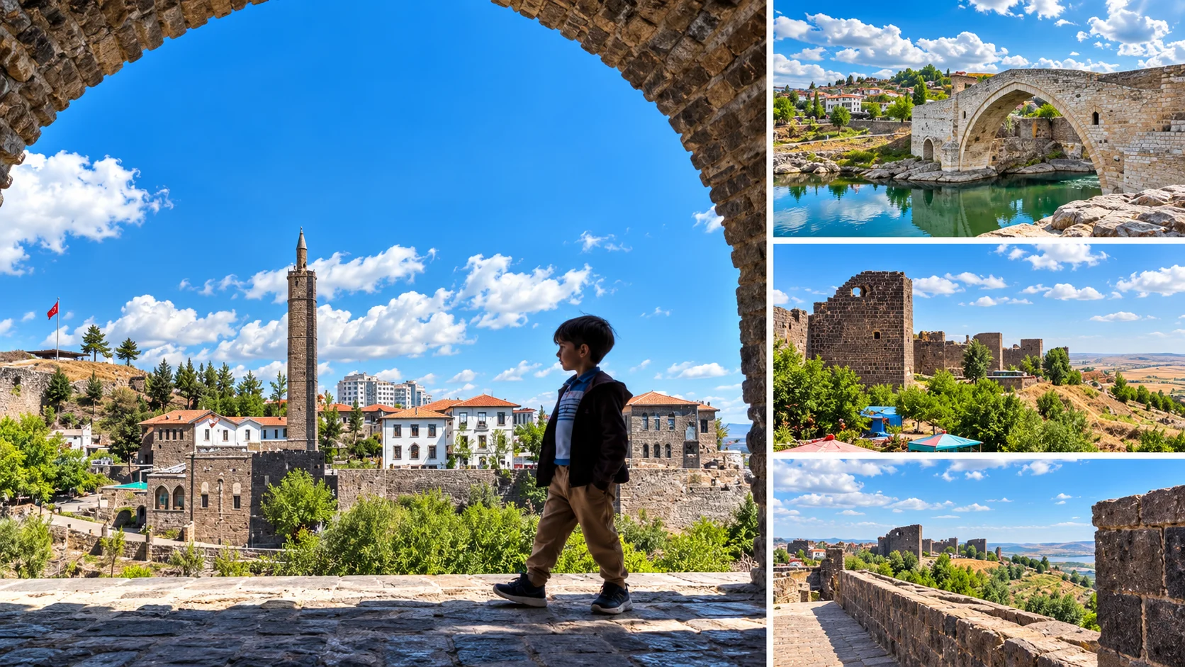
The Historic Core
Lanes, mosques, hans and house museums inside the walls are explored on foot.
Walls and Hevsel
Inscribed in 2015, the property covers the fortress and the gardens that link the city to the river.
Day Trips
Zerzevan, Çayönü, Malabadi, Eğil, Çermik and Birkleyn each need a separate day.
| Topic | Verified Detail |
|---|---|
| UNESCO property | Diyarbakır Fortress and Hevsel Gardens Cultural Landscape |
| Inscription year and criterion | 2015, criterion (iv). UNESCO reference 1488 |
| What it covers | The citadel and outer walls plus the Hevsel Gardens running down to the Tigris. UNESCO lists the property at about 521 hectares. It is not the whole of Suriçi, most of which falls in the buffer zone. |
| City walls length | About 5,800 metres (5,799 m appears too), of which about 5,200 m is the outer wall |
| Tower count | Sources give 101 towers (82 on the outer wall, 19 in the citadel), with 98 reported standing |
| Main gates | Dağ Kapı, Urfa Kapı, Mardin Kapı, Yeni Kapı |
| Main historic district | Sur district (Suriçi) |
| Major archaeology | Zerzevan (Çınar), Çayönü and Hilar (Ergani), Birkleyn (Lice) |
| Districts | 17: Bağlar, Bismil, Çermik, Çınar, Çüngüş, Dicle, Eğil, Ergani, Hani, Hazro, Kayapınar, Kocaköy, Kulp, Lice, Silvan, Sur and Yenişehir |
| Airport | Diyarbakır Airport, close to the city centre |
| Typical minimum stay | 1 day for Suriçi, at least 2 days if you add a district trip |
Diyarbakır the City Is Not Diyarbakır the Province
The urban area is made up of districts such as Bağlar, Kayapınar, Sur and Yenişehir. The historic city is only the Suriçi of Sur district. Zerzevan, Çayönü, Malabadi, Eğil, Çermik and Birkleyn lie far from the centre, in separate districts.
| Area | Main Sights | Why Go | Suggested Time | Transport Note |
|---|---|---|---|---|
| Sur / Suriçi | Great Mosque, Hasan Pasha Han, Four-Legged Minaret, madrasas, churches, house museums | The historic core of the city | 1 day | Explore on foot. Streets are narrow and paved with stone. |
| İçkale + Hevsel | İçkale, Diyarbakır Museum, Hevsel Gardens, Ten-Eyed Bridge | Citadel, museum and river landscape | Half day | A continuation of the Suriçi route. Hevsel is farmland. |
| Çınar | Zerzevan Castle and Mithraeum | A Roman frontier garrison with underground structures | Half to 1 day | About 13 km from Çınar town. A car is needed. |
| Ergani | Çayönü Mound, Hilar rock tombs | Neolithic archaeology and rock-cut tombs | Half to 1 day | A car is needed. Çayönü is an excavation site. |
| Silvan | Malabadi Bridge, Silvan town | An Artuqid bridge | Half day | The bridge is on the Batman River, near the Silvan-Batman line. |
| Eğil | Eğil Castle, Ziyaret Hill, reservoir | Faith tourism and a historic fortress | Half day | A car or transfer is needed. |
| Çermik | Thermal zone, Sinek Stream, Yabanardı-Şeyhandede Nature Park | Cool water and nature | Half to 1 day | Good for summer heat. |
| Lice | Birkleyn Caves | Assyrian reliefs and the Tigris tunnel | 1 day | About 92 km from the city. Needs experienced route knowledge and a guide. |
| Bismil | Körtik Tepe (historical context) | A Neolithic settlement, not a visitor stop | None | The site lies in the Ilısu reservoir area. |
How Many Days in Diyarbakır?
Suriçi alone fills a day. If you only have one day, stay with the walls, İçkale and the Tigris and Hevsel edge. A second day can go to a single far route such as Zerzevan. Days three and four add Ergani, Silvan, Eğil, Çermik and Birkleyn. Packing several remote districts into one day is not realistic.
- 1 day: walls, İçkale, the Tigris and Hevsel.
- 2 days: day two for Zerzevan and the Çınar area.
- 3 days: Ergani (Çayönü and Hilar) or Silvan (Malabadi).
- 4 days: Eğil, Çermik or Birkleyn, depending on season and access.
If you are extending a southeastern trip, our guides to Mardin and Hasankeyf cover nearby stops, Göbeklitepe covers another major Neolithic site, and the Türkiye travel guide adds wider context.
Video: a general look at things to do in Diyarbakır, in Turkish. Business and access details shown in it may be out of date.
"A 12,000-Year-Old City"? The Region's Past and the City's Past
The phrase "12,000 years old" often attached to Diyarbakır mixes two different things. The region's very early settlement history is not the same as the documented history of today's city.
The Region's Deep Past
Diyarbakır province holds traces of some of the earliest settled communities in human history. Çayönü in Ergani, with a Neolithic settlement going back roughly 10,000 to 12,000 years, and Körtik Tepe in Bismil are examples. Sources differ somewhat on dates. These sites are not an unbroken ancestor of today's Suriçi. They are much older settlements in the same landscape.
Amida and the City's Documented History
The city's own core is tied to the Amida Mound (Virankale) in İçkale, where the first settlement is reported. Early in the first millennium BCE it is said to have been the centre of a political unit called Bīt-Zamāni, known as Amedu or Amida. In Roman times it was the frontier city of Amida. The present wall line is tied largely to the 4th century CE and Emperor Constantius II (one source gives 349). Ammianus Marcellinus describes the siege of Amida in 359.
Accounts of a first wall around 3000 BCE in a "Hurrian-Mitanni" period are not firmly established either. So instead of a civilisation checklist, this guide tells the city's story in order: Amida and the Roman frontier, Late Antiquity, the Islamic period, the Marwanids, the Seljuks and principalities, the Artuqids, the Aq Qoyunlu, the Ottomans and the modern city.
UNESCO: Diyarbakır Fortress and Hevsel Gardens Cultural Landscape
The official name is "Diyarbakır Fortress and Hevsel Gardens Cultural Landscape". It was inscribed on the UNESCO World Heritage List in 2015, reference 1488, under criterion (iv). The walls and the Hevsel Gardens were inscribed together as one cultural landscape.
Reading that sentence correctly matters. What is inscribed is not the whole of Sur district. It is the İçkale and outer wall line and the Hevsel farmland below the walls running toward the Tigris. UNESCO lists the property at about 521 hectares. The mosques, hans and churches inside Suriçi have their own protection status, and most lie in the buffer zone. A sentence such as "the Great Mosque and Hasan Pasha Han are inside the World Heritage site" would therefore mislead.
Zerzevan Castle and Malabadi Bridge are not part of this inscription. Zerzevan is on UNESCO's Tentative List, which means it is not yet on the World Heritage List. Malabadi is also reported on the Tentative List, and that should be confirmed on UNESCO's own page.
Understanding Suriçi: Four Gates, One Walking Logic
Suriçi is the area inside the outer wall and forms the historic core of Sur district. Four main gates connect it to the outside. Inside, lanes are narrow, stone-paved and in many places closed to cars. Mosques, madrasas, hans, churches and house museums are within walking distance of each other, so the best way to see Suriçi is on foot, not by car. A detailed walking route appears later on this page.
The Diyarbakır City Walls
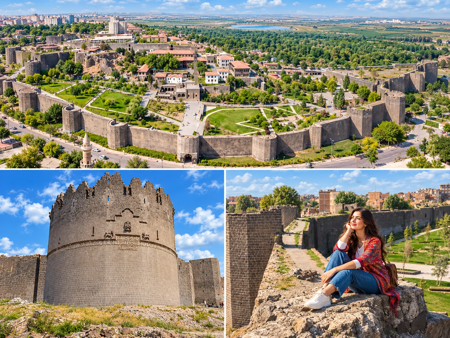
Length and towers. Sources give the total length as about 5,800 metres (some reports say 5,799 m). Roughly 5,200 metres of that is the outer wall and about 599 metres is the İçkale wall. Sources mention 101 towers: 82 on the outer wall and 19 in İçkale. Reportedly 98 still stand. The "5.5 km and 82 towers" in older guides is therefore only half right: 82 counts the outer wall alone.
Material. The walls are laid in the region's black basalt. Wall height and thickness vary along the line, so sources give different figures, and this page does not quote a single height.
Layers. The wall is not the work of one period. Its foundations are Roman (the present form largely 4th century CE), and it was repaired and extended under Byzantine, Seljuk, Artuqid, Aq Qoyunlu and Ottoman rule. That is why inscriptions from different periods and languages appear on it.
"The second longest wall in the world." This is a much repeated tourism line and no reliable comparative source supports it. We do not use it. A fairer description is that Diyarbakır's walls are among the most impressive and best preserved historic city defences in the world.
Inscriptions and Reliefs
The walls read like an open-air collection of inscriptions. Alongside texts from different periods, animal figures stand out. The Artuqids renovated Urfa Kapı and placed reliefs of an eagle and a lion-bull struggle in the gate niches. Nur Tower (also called the Malik Shah Tower) belongs to the Seljuk period and was built around 1089-1090 according to one source. It carries figures of lions, deer, horses, eagles and people. Yedi Kardeş Tower is decorated with lion and double-headed eagle reliefs. The Evli Beden (Ulu Beden) Tower is a round tower dated to 1208-1209 under the Artuqid ruler Malik Salih Mahmud and is known for its bands of inscriptions. We make no firm claim about the symbolic meaning of any single figure.
The Gates
| Gate | Older Name / Direction | Planning Note |
|---|---|---|
| Dağ Kapı | Harput Gate | The north gate. The usual starting point for entering Suriçi. |
| Urfa Kapı | Bâbürrûm (Rum Gate) | Known for the Artuqid eagle and lion-bull reliefs. |
| Mardin Kapı | Tell Gate | In the south, at the end of the Gazi Caddesi line. |
| Yeni Kapı | Tigris Gate | Opens toward the river and Hevsel. |
Current pedestrian and vehicle use of the gates can change, and some gates are closed to cars. Do not plan to drive into Suriçi.
Keçi Burcu and Other Notable Towers
Keçi Burcu (Goat Tower) is one of the best-known towers and older guides tell you to "watch the Tigris from it". We cannot say that for today. A June 2026 parliamentary question said restoration at Keçi Burcu has been unfinished for years, and we found no current opening announcement. Do not assume you can climb it. Ask the Diyarbakır Metropolitan Municipality or the Provincial Directorate of Culture and Tourism for the current status before you go.
Some wall sections and towers have been restored. A recent restoration of Yedi Kardeş Tower is reported as complete. Reports also say restoration of registered buildings inside the walls has slowed for a long time and that the Tek Kapı bastion is damaged. Towers and wall-top paths may therefore be open only in parts.
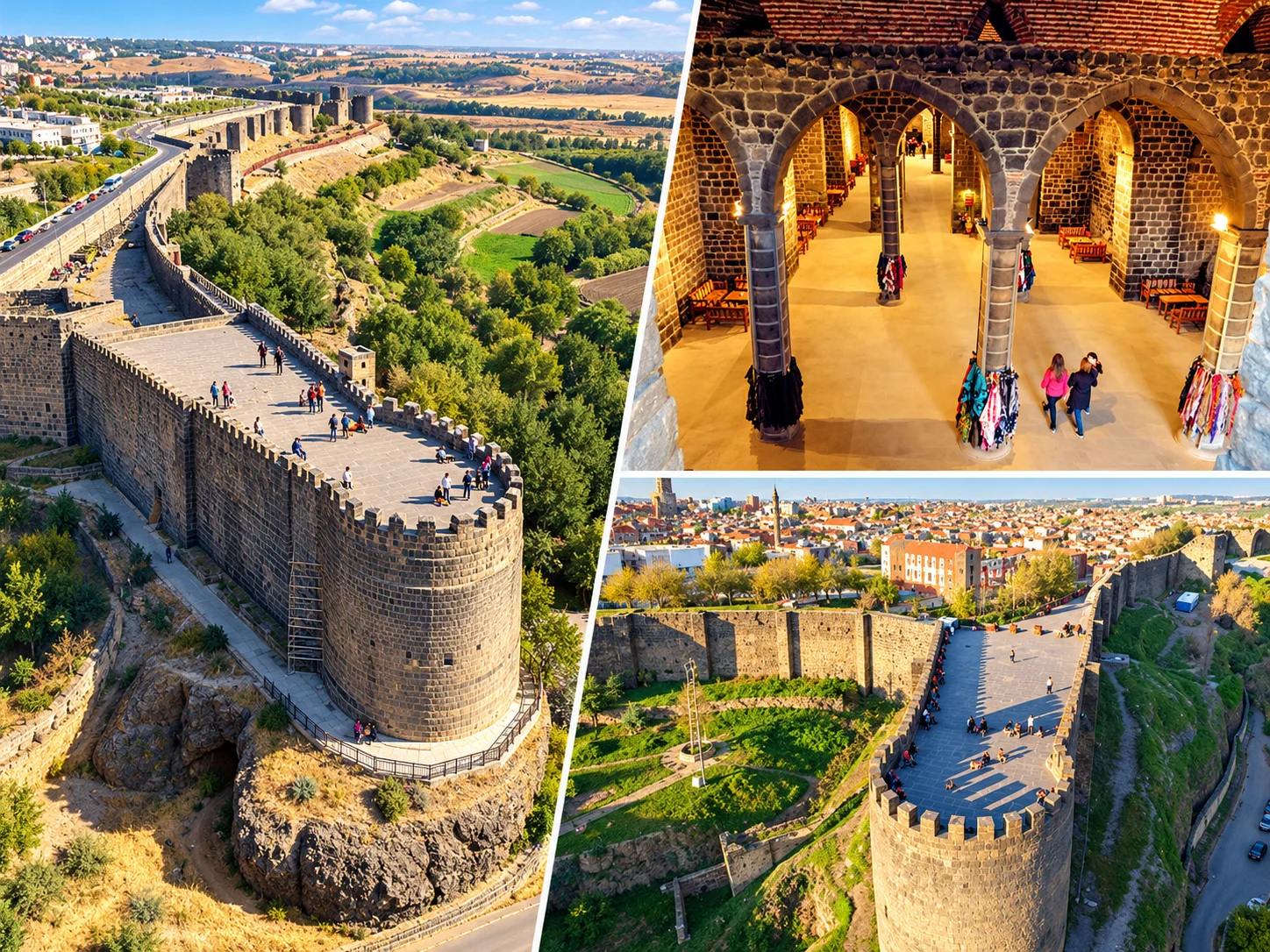
If you want to walk on the wall, use only officially open, railed sections. Steps and narrow passages are difficult for anyone with limited mobility.
İçkale and the Diyarbakır Museum
İçkale (the Inner Citadel) stands on the Amida Mound (Virankale), where the city's first settlement was found. It carries one of Diyarbakır's most important historic layers.
The complex. The İçkale Museum Complex holds 14 registered buildings, including the Amida Mound, the Aslanlı Fountain, the Church of Saint George (Aziz Corcis), the old prison, the governor's mansion and the old courthouse. The Ministry of Culture and Tourism's restoration began in 2005 and finished in 2014, and the complex opened in 2015.
The Diyarbakır Museum. The museum was founded in 1934, and sources say 1,615 works are on display. The Zinciriye Madrasa beside the Great Mosque served as the Diyarbakır Archaeology Museum in 1934, and today the museum operates within the İçkale complex. The Cahit Sıtkı Tarancı, Ziya Gökalp and Atatürk houses are described as affiliated units. Check the museum's official channels for hours and entry terms. This page gives no prices.
The Artuqid Palace and new finds. Excavations at the Amida Mound relate to the Artuqid Palace. According to December 2025 reports, a section of the İçkale walls that had been buried for about 100 years was uncovered. Which sections are open depends on the excavation and restoration schedule.
The Church of Saint George. This church is part of the museum complex. We could not confirm its current use (cultural events or worship), so ask before you go.
Hevsel Gardens: A Historic Farming Landscape
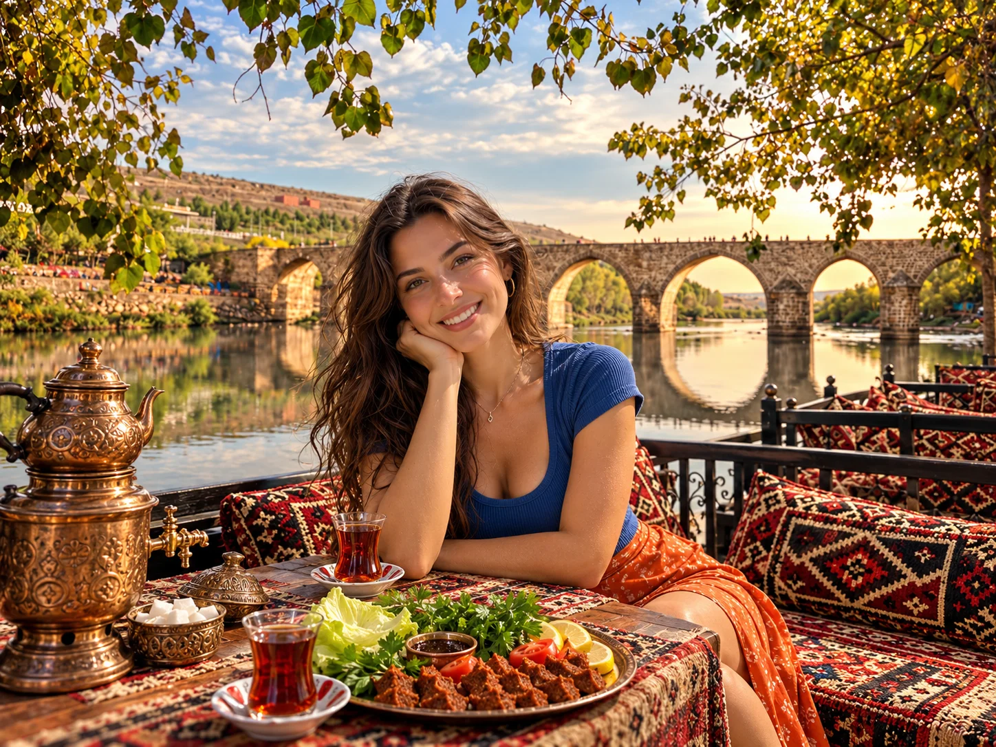
Hevsel is a belt of gardens and farmland of about 700 hectares between the walls and the Tigris. It is not a nature park or a city park. It is a cultural farming landscape that has fed the city for thousands of years, and UNESCO inscribed it with the walls as one cultural landscape. Sources say the area has been farmed since the Neolithic. Irrigation runs through channels and the Anzele spring.
These gardens are still working farmland. Not every part is a public trail, picnic area or birdwatching spot, and you should not enter fields without permission. Sources report more than 180 bird species can be seen in the area. That figure comes from a tourism source, so "many species" is the safer phrasing. Avoid anything that disturbs birds or their habitat.
The easiest way to see Hevsel is from the public areas along the Tigris and around the Ten-Eyed Bridge. The area is under pressure from dumping and illegal construction, and conservation problems are on the agenda.
The Tigris and the Ten-Eyed Bridge
The Tigris is the geographic skeleton of Diyarbakır. The walls sit on a rocky plateau above the river and the Hevsel gardens run down the slope to the water. Looking at the city from the river side makes it easier to understand why the walls stand where they do.
The Ten-Eyed Bridge. Known as the On Gözlü Köprü or Tigris Bridge, it spans the Tigris south of the city. Its inscription dates the bridge to the Marwanid period, about 1065-1067. It names Nizam al-Dawla Nasr, and it says the architect was Yusuf son of Ubayd. Some researchers argue the inscription is a repair inscription and that the bridge rests on an older structure, so the first build date is not certain. The bridge was also repaired in the 19th and 20th centuries. The municipality closed it to vehicles and restored it, and a new bridge was built nearby.
Gazi Köşkü. Atatürk was in Diyarbakır in 1916-1917 as commander of the 16th Army Corps. The mansion is the Semanoğlu (Samanoğlu) building, said to date from the 15th century, which the municipality bought in 1937 and gave to Atatürk. Sources conflict on its current state. One report says restoration after damage in the 6 February 2023 earthquakes has dragged on for years. Check whether it is open before you go.
The Great Mosque of Diyarbakır: How to Read Its History
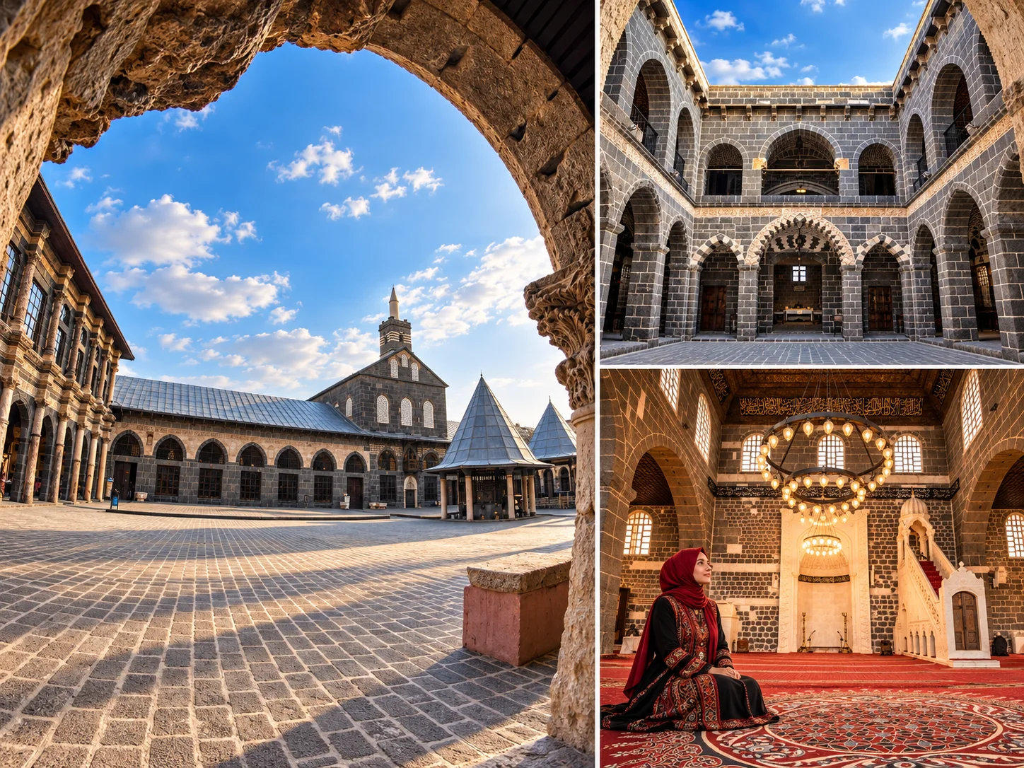
The year 639. The line "built in 639" in older guides is not correct for the present building. By tradition that date marks the conversion of the Mar Toma Church, then the city's largest church, into a mosque after the conquest under Caliph Umar. This is a tradition, not an independently documented fact. The first Islamic use and the construction and repair phases of today's building must be read apart.
The present building. The exact construction date is unknown. One of the clearest records is a major repair ordered by the Seljuk Sultan Malik Shah in 1091. Inaloğlu-era additions and repairs follow: the east maqsura is tied by inscription to 1163-1164, and the west maqsura was built between 1117 and 1124. Inscriptions and interventions from the Aq Qoyunlu, Ottoman, Nisanoğlu and Artuqid periods are also reported. The ablution fountain dates to 1849. Simplifications such as "an Artuqid mosque" or "built in one go" mislead.
"The oldest mosque"? Sources say "one of the oldest mosques in Anatolia". There is no basis for "the oldest". "The fifth Haram"? Describing it as the fifth sacred site after the Kaaba, the Prophet's Mosque, Al-Aqsa and the Umayyad Mosque of Damascus is a widespread view, not an official ruling.
Architecture. The rectangular mosque encloses a large inner courtyard. Likening its plan to the Umayyad Mosque of Damascus is an interpretation, not a documented fact. The courtyard has two-storey basalt arcades, a fountain in the middle and a sundial. The sundial is attributed to al-Jazari and was moved to its present spot in the early 20th century.
This is a working mosque. Prayer times and Fridays change how visits work. Dress modestly and follow footwear rules.
The Mesudiye and Zinciriye Madrasas
Both madrasas sit around the Great Mosque complex. The Mesudiye Madrasa is a two-storey cut-stone building on the north side of the courtyard and is now used as a manuscript library. The Zinciriye (Sincariye) Madrasa is on the west side, single-storey with two eyvans. It served as the Diyarbakır Archaeology Museum in 1934. Sources do not describe a direct architectural link between the two. We give no firm date or patron for either. Ask on site about opening and visiting terms.
Hasan Pasha Han, Sülüklü Han and Deliller Han
Hasan Pasha Han
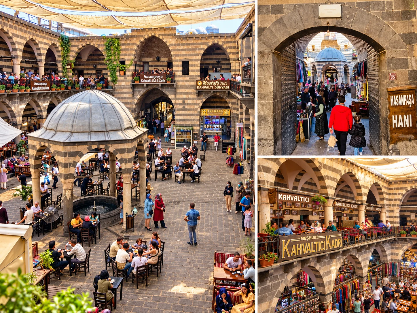
One source says the han was built between 1572 and 1575 by Hasan Pasha, son of Sokollu Mehmed Pasha, the third Ottoman governor of Diyarbakır after the conquest. The two-storey building is known for its alternating courses of basalt and white limestone and its courtyard with a central fountain pavilion. Today the courtyard and arcades hold eating places and shops. We do not rank individual businesses. It is a stop for breakfast, tea or shopping. Some write-ups give the year 1527 and Hüsrev Pasha as the builder. That belongs to Deliller Han, and the two have been mixed up.
Sülüklü Han
One source says it was built in 1683 by Hanilioğlu Mahmut Çelebi. Its name is said to come from leeches that came out of a well in its courtyard and were used for medical purposes. That is a local account and has not been confirmed by a scholarly source. After restoration finished around 2010, it opened to the public. It is described today as a café and public stop. Confirm on site that it is open.
Deliller Han
Also known popularly as Hüsrev Pasha Han. According to sources it was built by Deli Hüsrev Pasha, the second Ottoman governor of Diyarbakır, and is run today as a hotel. The han's historic role as lodging and its present commercial use are separate things. We could not confirm its current operation.
The Four-Legged Minaret and the Sheikh Mutahhar Mosque
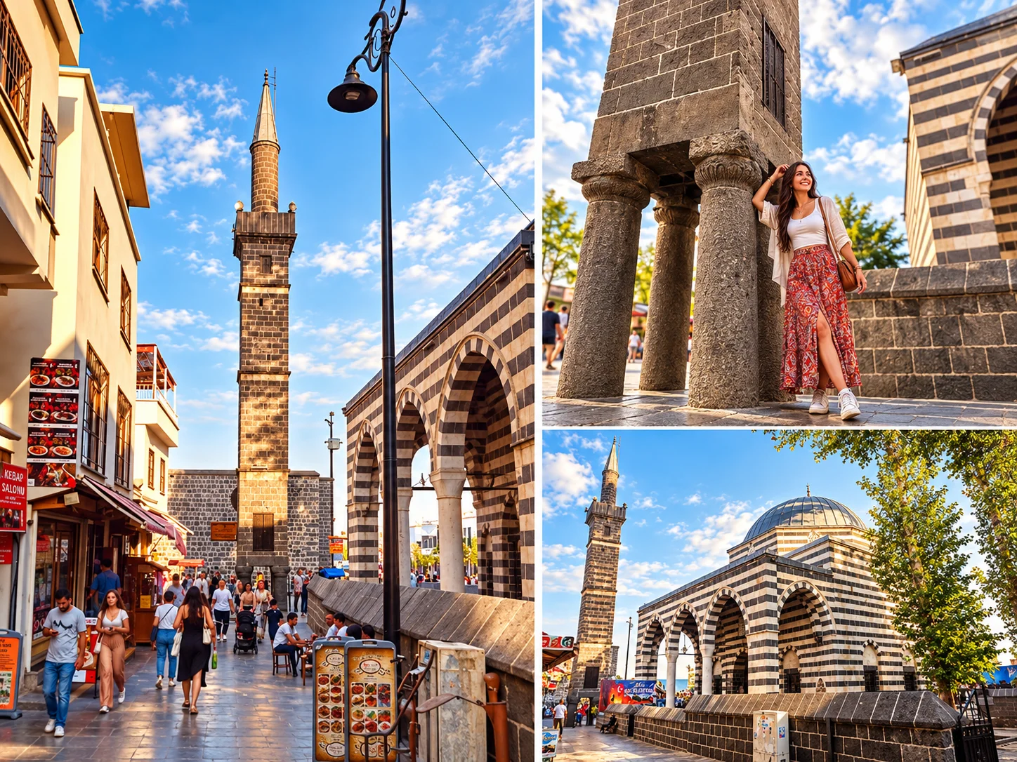
The minaret belongs to the Sheikh Mutahhar Mosque. According to the inscription on the minaret, the mosque was built in 1500 by Hajji Hüseyin son of Hajji Ömer, in the reign of the Aq Qoyunlu Sultan Kasım. Locally it is also called the Kasım Padişah Mosque. The minaret is a square tower on four columns topped by a shorter cylindrical shaft and a steep conical cap. The columns are basalt.
Do the four legs stand for the four Sunni schools? That is a popular tradition. The four columns are said to symbolise the Hanafi, Shafi'i, Hanbali and Maliki schools. No inscription or scholarly source supports it, so it is an interpretation.
Earthquake resistance. We found no structural study behind the older claim of "special earthquake-resistant engineering", so we do not use it. Sources say the mosque suffered light damage in the 6 February 2023 earthquake.
The wish tradition. People say that passing under the minaret and making a wish brings luck. That is a folk belief.
The minaret and mosque were damaged in the 2015 fighting around them and reopened after repairs.
Diyarbakır's Basalt Houses
The traditional houses of Suriçi are known for facades of alternating black basalt and white limestone. They are closed to the street and open inward around a courtyard. Around the courtyard are sections used in summer and winter, open eyvans and shaded sitting places. This layout answers a harsh continental climate of very hot summers and cold winters. The easiest houses to see are the ones turned into museums.
House Museums and Cultural Spaces
- Cahit Sıtkı Tarancı Museum: the traditional house where the poet was born, in Sur near the Great Mosque.
- Ziya Gökalp Museum: in the same area, close to the Great Mosque and the Cahit Sıtkı Tarancı Museum. Both are described as units of the Diyarbakır Museum.
- Ahmed Arif Literature Museum Library: opened in 2011 in a house on Pirinççi Sokak. The poet was not born here. Sources say he was born in a different neighbourhood.
Hours and entry terms can change. We could not confirm the current status of the Cemil Pasha Mansion as a city museum, so it is not included.
Syriac, Armenian and Chaldean Heritage: The Churches
Telling Diyarbakır only through mosques and hans would leave out a lot. The churches of Suriçi are still living religious heritage. Ask about service times and entry terms before visiting, and behave quietly and respectfully.
| Church | Community | What Is Known | Visiting Note |
|---|---|---|---|
| Meryem Ana (Virgin Mary) Church | Syriac Orthodox | Sources give dates from the 3rd to the 6th century. Restored in 2004-2005. | Still used for worship. The community is small, and services lapsed for a time without a priest. Ask whether it is open. |
| Surp Giragos | Armenian | Badly damaged in 2015. After restoration the first service in seven years took place in May 2022. | Ask the church for current visiting terms. |
| Mar Petyun | Chaldean | Reopened after restoration in October 2023, with a priest assigned for the first time in 108 years. | May open according to the service schedule. Ask. |
| Surp Sarkis | Armenian | The roughly 500-year-old church was reported at risk from looting and ruin, and the municipality signed a restoration protocol. | We could not confirm its current state. |
Sources give differing dates for these churches, and we do not hide that. Phrases like "one of the oldest churches" are replaced here by the dates as given.
A Walking Route Through Suriçi: One Full Day
| Order | Stop | Note |
|---|---|---|
| 1 | Dağ Kapı and the start of the wall | Start in the cool morning hours. |
| 2 | Great Mosque and the madrasas | Mind prayer times. |
| 3 | Cahit Sıtkı Tarancı and Ziya Gökalp house museums | In the same area, close to the Great Mosque. |
| 4 | Hasan Pasha Han | A good spot for breakfast or a tea break. |
| 5 | Four-Legged Minaret and Sheikh Mutahhar Mosque | On the bazaar line. |
| 6 | Churches (Meryem Ana, Surp Giragos, Mar Petyun) | According to service times. Ask first. |
| 7 | Sülüklü Han | A tea break. |
| 8 | Mardin Kapı | End the route here. |
The order follows walking logic. Check current lanes and closures on a map app. You do not have to see everything on a short day.
Zerzevan Castle: A Roman Frontier Garrison in Çınar
Zerzevan is in Çınar district, not in Silvan. It stands on a rocky hill about 124 metres high, roughly 13 km from Çınar town, near the Demirölçek neighbourhood.
What it is. Zerzevan is a military settlement founded in the Roman period. Sources say the main military settlement was built in the 3rd century CE under the Severans (198-235 CE). A broader dating runs from the 1st to the 6th century, and the settlement was used until the Muslim conquest in 639. It sits on Rome's eastern frontier, facing the Sasanian Empire. The garrison and its underground and above-ground settlement form one whole.
The structures. Excavations began in 2014 under Aytaç Coşkun of Dicle University. They have identified houses, water cisterns, an underground church, an underground shelter and a Mithraeum (a Mithras temple). The underground church is described as one of the early worship places identified after the shift from polytheism to Christianity in the Roman world.
What is a Mithraeum? Mithras is the god of Mithraism, a mystery cult widespread in the Roman army, especially among soldiers. A Mithraeum is the cult's place of worship and was usually built underground or partly underground. The one at Zerzevan matters as one of these buildings on Rome's eastern frontier. Sources also use claims such as "the best preserved in the world" or "the first". We do not repeat those without a reliable comparison.
UNESCO status. Zerzevan Castle and its Mithraeum were added to UNESCO's World Heritage Tentative List in 2020. They are not on the World Heritage List. It has been announced that a nomination dossier was submitted for evaluation in 2026. Until that result is confirmed, do not call it a World Heritage Site.
Visiting. The castle is partly open to tourism, and sources say about 400,000 visitors came in 2025. We could not confirm the entry fee, opening hours or the state of the visitor centre. Ask the Diyarbakır Museum Directorate or the Çınar District Governorate before you go. Excavation zones may be closed. The site is open and shade is limited. Avoid midday in summer, and carry water and sun protection.
Do not combine Zerzevan with another district on the same day. The roads between Çınar and Silvan, Eğil or Çermik are long.
Ergani: Çayönü Mound and the Hilar Rock Tombs
Çayönü. In Ergani district, near the village of Hilar (formerly Sesverenpınar), the mound is about 4.5 metres high. The settlement dates to roughly 10,000 years ago. Some reports say 10,000 to 12,000. Excavations began in 1964, paused in 1991 for security reasons, and resumed around 2015 under Aslı Erim Özdoğan. Since 2021, Bronze Age cist tombs have also been found.
Why it matters. Çayönü is not "the place where agriculture first began". That is an overstatement. It is one of the key archaeological sites for understanding the early history of farming, animal domestication and settled life, and it has to be read together with other early settlements in the region.
Can you visit? Çayönü is a registered archaeological site with active excavation. Archaeological importance does not mean an open tourist park. For entry terms, restrictions during the dig season and any fee, ask the Ergani District Governorate and the Provincial Directorate of Culture and Tourism.
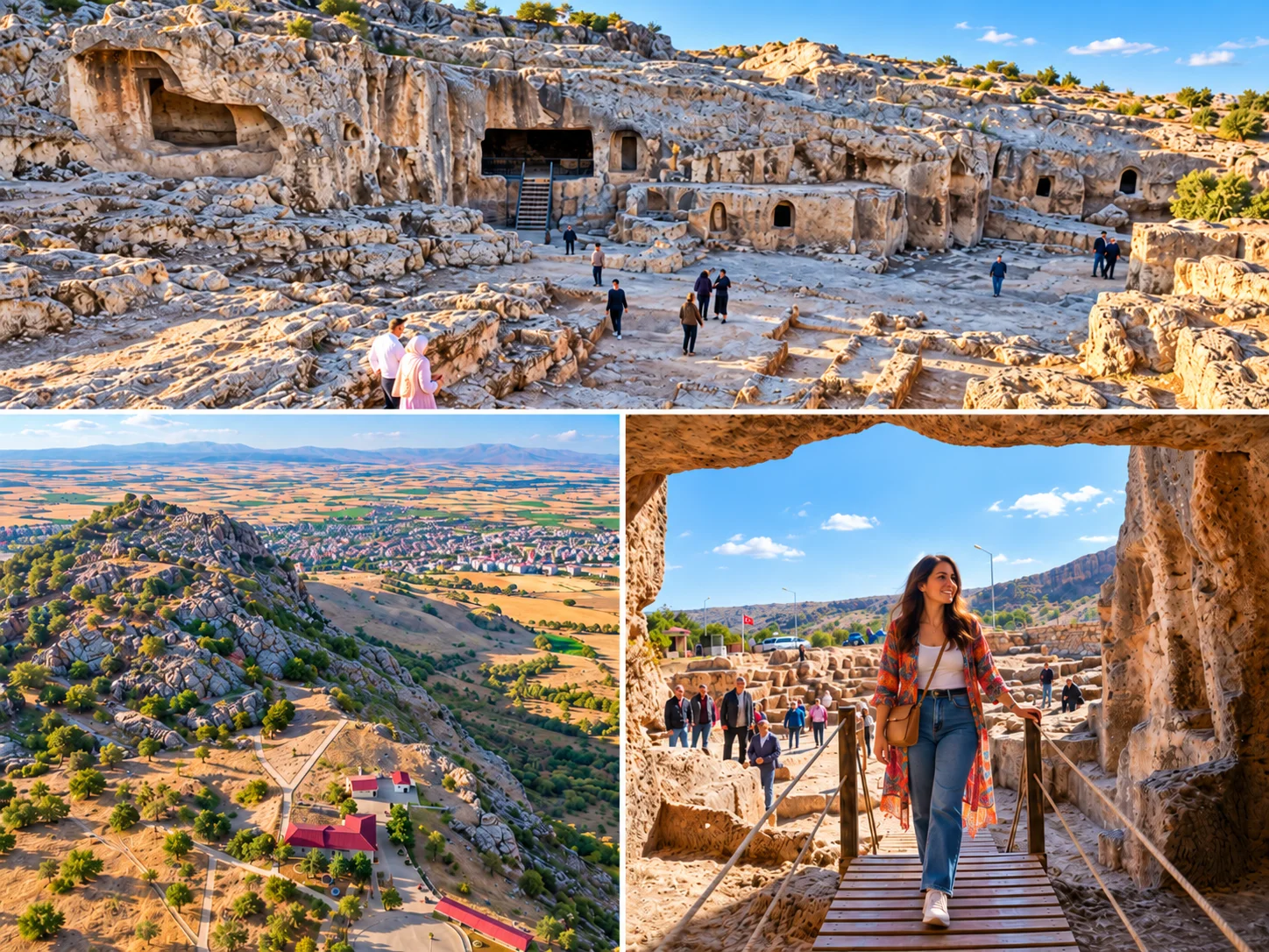
Hilar Rock Tombs (Hilar Caves). Hilar is in Ergani, not in Bismil. Sources give a distance of about 3-6 km from Ergani town (they differ), and it lies roughly 300 metres from Çayönü Mound in a straight line. The site is registered as an archaeological site under the name "Hilar Rock Tombs". It is reported to have one rock dwelling, 16 rock tombs and wall reliefs. These are rock-cut spaces, not natural caves. Traces of very early human presence are reported, and part of it is described as related to Çayönü.
We removed the "Sarıçiçek Plateau" of older guides because we found no reliable source placing it in Ergani.
Bismil: Körtik Tepe Is Context, Not a Stop
The Hilar site that older guides attach to Bismil is actually in Ergani. Bismil's own archaeological importance lies elsewhere, at Körtik Tepe. Sources describe it as a Neolithic settlement inhabited roughly between 10,400 and 9,250 BCE. It was excavated as a rescue dig ahead of flooding by the Ilısu Dam, and more than 30,000 finds were recovered. The site lies around the meeting of the Tigris and the Batman River, in the reservoir area, so it is not a place you can visit. We mention it only as historical context.
Silvan and the Malabadi Bridge
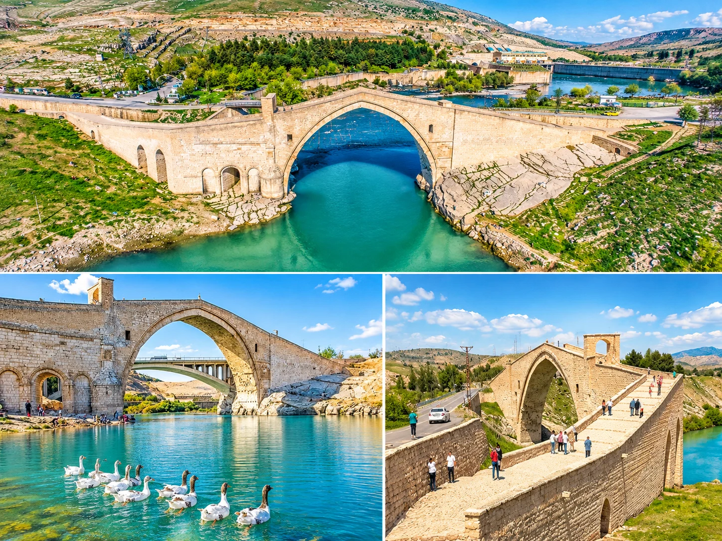
The river. The Malabadi Bridge crosses the Batman River, not the Tigris. The line "over the Tigris" in older guides is wrong. The bridge is in Silvan district, between Silvan and the Kozluk district of Batman.
History. Sources attribute it to the Artuqid ruler Hüsameddin Timurtaş and say it was built in 1147. One source gives 1154 as the completion year. The bridge is reported as about 150 metres long, about 7 metres wide and about 19 metres high from the water level to the top.
"The widest stone arch in the world." The main arch span is given as 38.60 m and 40.86 m in different sources. Sources describe it as the widest-span stone bridge of the region. We found no independent engineering source for "widest in the world", so we do not use that phrase. The bridge is reported as being on UNESCO's Tentative List. That does not make it a World Heritage Site, so confirm on UNESCO's own page.
Other Places in Silvan
Silvan is an ancient town known in Islamic sources as Mayyafariqin. A historic Great Mosque and wall and castle remains are mentioned there. We could not find a reliable visitor source on current access or dates for parts such as the one called Aslanlı Burç, or for the Hasuni caves. Ask the Provincial Directorate of Culture and Tourism before adding them to a plan.
Eğil: Castle, Faith Traditions and the Reservoir
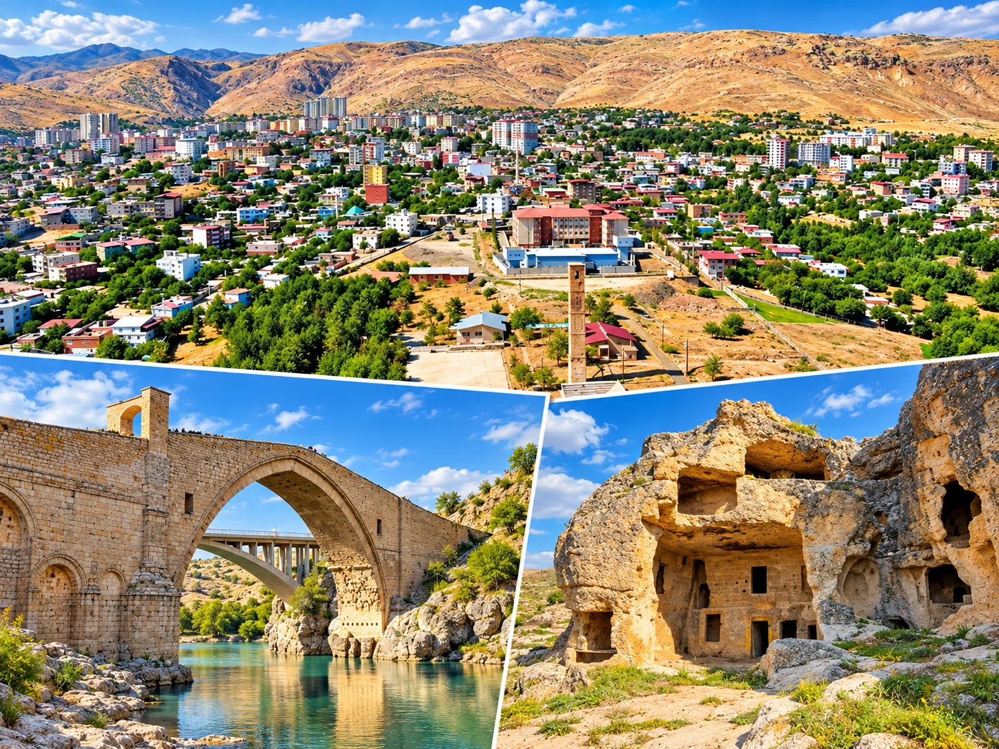
Eğil Castle. The castle stands on a hill overlooking the district, is described as carved out of a single rock mass, and is believed to date from the Assyrian period. Rock tombs are part of the setting. We found no source for the "Assyrian reliefs" mentioned in older guides, so we do not use the claim.
The prophets' tombs: tradition and history. Eğil is called the "city of prophets" by locals and in religious tradition. It is believed that Dhul-Kifl and Elisha are buried here. Other sources also list shrines such as Nebi Harun and Nebi Hallak, and one report says nine prophets are believed to be buried here. These are not graves confirmed by history. They are shrines and tombs attributed to these figures in local and religious tradition. For visitors they are revered places of visit. Ziyaret Hill was redeveloped in 2012 with a mosque, an ablution area and rest spots.
The reservoir. Water sports and boat tours are reported on the dam lake in the district, and the lakeside has bungalows, restaurants and picnic areas. We could not confirm whether the boat tours run in 2026. Ask the operator or the municipality before you go, and use a life jacket.
Birkleyn Caves: The Tigris Tunnel and Assyrian Reliefs in Lice
Location. Birkleyn is in Lice district, not in Dicle district. It lies about 92 km northeast of Diyarbakır city and about 25 km from Lice town. The "Dicle district" in older guides is wrong.
What it is. It is the point where water emerges from underground through a natural tunnel. In ancient times it was seen as a source of the Tigris and so considered sacred. Locally it is called "Birkleyn" or the "Tigris Tunnel". The area is marked by late Assyrian reliefs and inscriptions.
Assyrian kings. According to Columbia University records, of the two main reliefs the lower is attributed to the Assyrian king Tiglath-pileser I (around the early 11th century BCE) and the upper to Shalmaneser III (mid 9th century BCE). The "8,000-year-old inscription" story does not fit the academic dating and should not be used.
Protection and access. The area was registered as a first-degree archaeological site in 2003. A court stayed mining and quarry projects in a lawsuit against them. This route is not a developed tourist facility. Water, rock and rough ground mean you need experienced route knowledge, suitable footwear and, ideally, a local guide. Seasonal water levels and the weather affect safety. Give it a separate day, and check the season and access first.
Çermik: the Thermal Zone, Sinek Stream and Yabanardı-Şeyhandede Nature Park
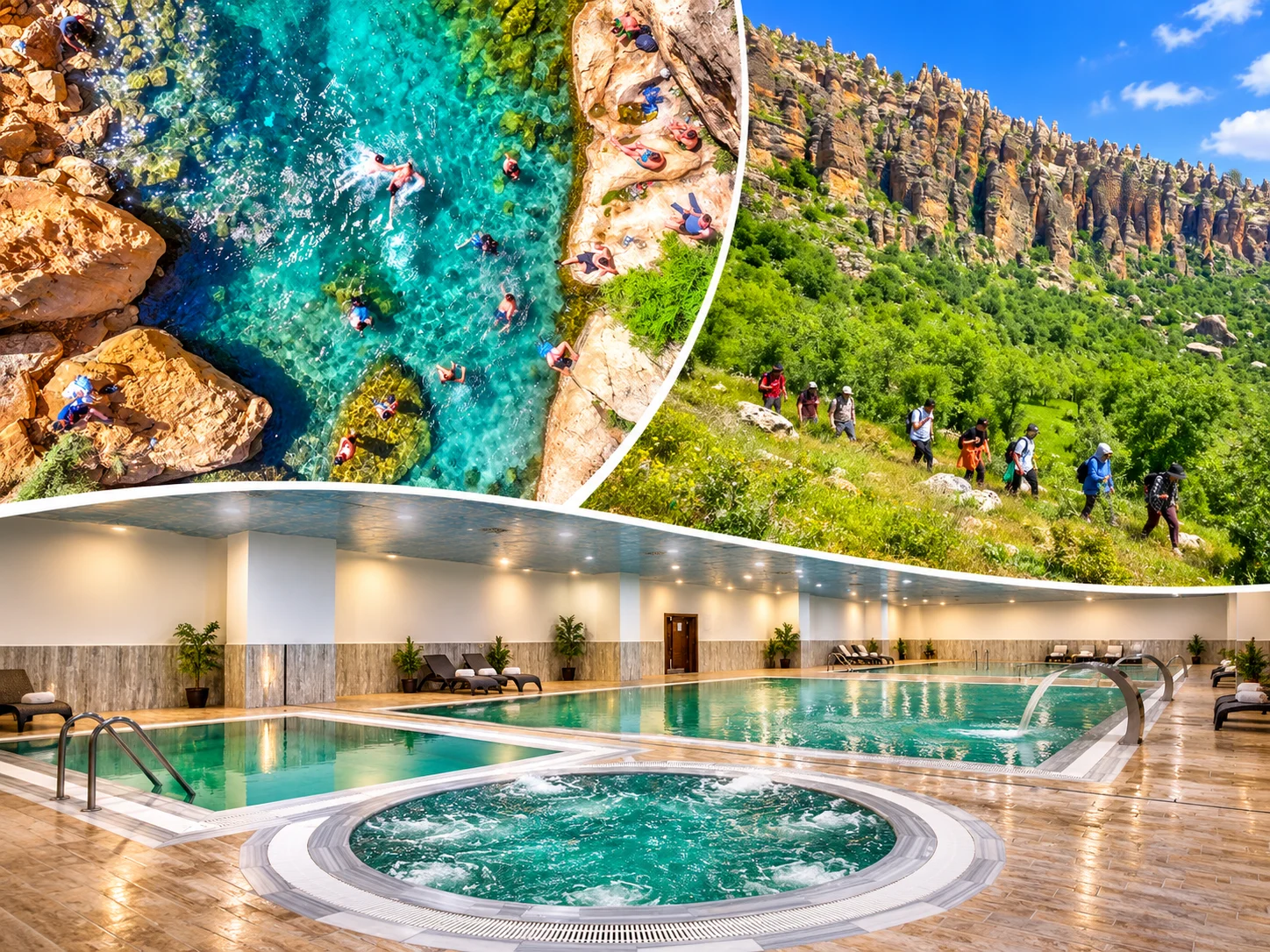
The thermal zone. The Çermik springs are grouped in an area about 3 km from the district centre, and most facilities there run as thermal hotels. In some hotels thermal water is available only in shared pools, so ask when booking if you want it in your room. This page gives no figure for water temperature or chemistry, which would need an official hydrogeological source. We make no health claims.
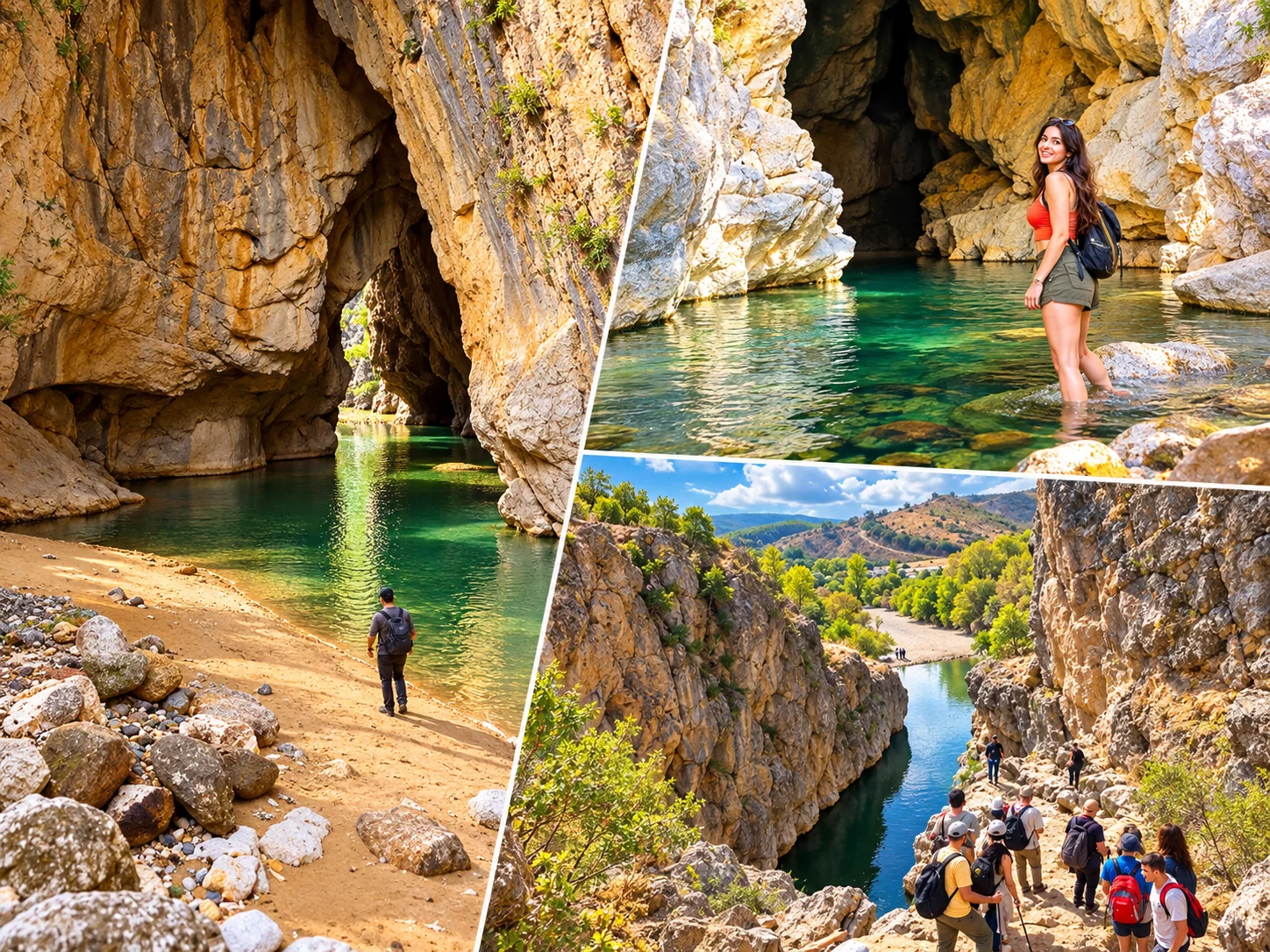
Sinek Stream. With its cold, shaded water it is a summer spot for people seeking coolness. On its banks are picnic areas, restaurants and cafés. We found no official permit or safety information for walking or swimming in the canyon, so we do not call it "ideal for trekking".
Yabanardı-Şeyhandede Nature Park. This area in Çermik district was declared a nature park in 2021. The Şeyhandede Waterfall drops about 32 metres over basalt columns. For the Twin Waterfalls at Yabanardı, a walking path of about one kilometre between the two falls is mentioned. Water flow rises in wet periods. These waterfalls are in Çermik, not in Çüngüş. We found no reliable source for the "Çınar Waterfall" of older guides and do not use it.
We found no reliable source on the Haburman Bridge, so it is not included.
Kulp and the Other Remote Districts
For Kulp, Hani, Hazro, Çüngüş, Kocaköy and Dicle, among Diyarbakır's 17 districts, we found no verifiable visitor attraction strong enough to anchor a trip. Their mountainous terrain, villages and local food may appeal to some travellers, but for a detailed route ask the district governorates and the Provincial Directorate of Culture and Tourism. The "Şeyhandede Waterfall in Çüngüş" of older guides was also attached to the wrong district.
We do not pad the page to cover every district. The vague earlier mentions of highland plateaus were removed because they could not be verified.
Commonly Repeated Claims About Diyarbakır, Checked
| Common Claim | What Research Shows |
|---|---|
| "Diyarbakır is a 12,000-year-old city" | The region has very early settlements such as Çayönü, but they are not the unbroken past of today's city. The city's own core is the Amida Mound. |
| "The walls are the second longest in the world after the Great Wall of China" | No reliable comparative source supports it. An unproven popular claim. |
| "The walls are 5.5 km long with 82 towers" | The total is about 5,800 m. The 82 towers are on the outer wall alone, and 101 are mentioned with İçkale. |
| "The Great Mosque was built in 639" | 639 is a tradition about the conversion of the Mar Toma Church. Later phases of today's building follow, such as the 1091 repair. |
| "The Great Mosque is the oldest mosque in Anatolia" | Sources say "one of the oldest". There is no basis for "the oldest". |
| "The four legs stand for the four schools" | A widespread tradition not backed by an inscription. |
| "The Four-Legged Minaret has special earthquake-resistant engineering" | We found no structural source for it. |
| "Malabadi spans the Tigris" | It spans the Batman River. |
| "Malabadi is the widest stone-arch bridge in the world" | Described as the widest-span stone bridge of the region. The world claim is unproven. |
| "Zerzevan is in Silvan" | It is in Çınar district. |
| "The Hilar Caves are in Bismil" | They are in Ergani and are rock-cut tombs and dwellings. |
| "Birkleyn is in Dicle district" | It is in Lice district. |
| "Çayönü is where agriculture began" | One of the key sites for the early history of farming, animal domestication and settled life. "The first" is an overstatement. |
| "The Çermik springs cure illnesses" | This guide makes no health claims. |
What to Eat in Diyarbakır
Many Diyarbakır dishes carry geographical indication records. Recipes vary by household and cook, so we do not claim one "traditional formula" below. There are no health claims either.
Ciğer Kebabı (Liver Kebab)
Diyarbakır Ciğer Kebabı is named in official bulletins and among registered local dishes. Sources do not say clearly which liver is used (lamb, mutton or beef), so we do not state it. Locally, liver is also said to be eaten in the morning. Not every business serves it then, so check opening hours.
Kaburga Dolması (Stuffed Lamb Ribs)
As the name says, it is a meat dish in which ribs are stuffed. It appears in an official bulletin as an application. We could not confirm its registration status. The filling and the cooking vary with the cook.
Meftune
A family of meat and vegetable dishes. TÜRKPATENT bulletins record Diyarbakır Kenger Meftunesi, and Kabak (squash) and Patlıcan (aubergine) Meftunesi are also mentioned. We do not present any one recipe as the formula.
Duvaklı Pilav
The recipe in older guides, "meat and rice wrapped in yufka and baked", is wrong. It has been confused with Siirt's perde pilavı. According to the Culture Portal description, in Diyarbakır's Duvaklı Pilav the pilaf is placed on the serving plate and the top is completely covered with an almond and meat filling (the "veil", duvak). The ingredients listed are minced or diced meat, almonds, rice, butter, and spices such as allspice, black pepper and cinnamon. It is named as a wedding dish. The sources do not explain the origin of the name.
Other Local Dishes
Ayvalı kavurma, patlıcan dizme, nardan aşı and mahlepli çörek appear in local food writing, but we could not verify them for recipe, ingredients or GI status. TÜRKPATENT records exist for Şırdanlı Bastırma, Şehriye and Tirit Yemeği. We found no geographical indication record for burma kadayıf. We found no reliable Diyarbakır-specific source for mumbar dolması, so we do not feature it.
| What You Want | Where to Look | Note |
|---|---|---|
| Liver and kebab | Around Suriçi and Dağ Kapı, and in Yenişehir | Ask the business about its opening hours. |
| Breakfast | Around Hasan Pasha Han, in Suriçi | The han's courtyard has eating places. |
| A tea break | The hans and the Tigris bank | Places such as Sülüklü Han and the Hevsel edge. |
| Local products | Suriçi bazaars | Ask about geographical-indication products. |
Diyarbakır Watermelon
Diyarbakır Karpuzu is registered in the TÜRKPATENT record as a designation of origin (no. 111), applied for by the Diyarbakır Chamber of Commerce and Industry. Sources give the registration year as both 2008 and 2009, so we give no year. The melons are grown mainly in villages and districts along the Tigris. We found no source linking them directly to Hevsel. Prize-winning giant melons at festivals do not represent the normal product, so we do not use "giant" claims. The season is summer, and they are sold in local markets.
We do not name individual restaurants. The current status of the restaurants and bakeries listed in older guides could not be verified. Map reviews and local advice are more reliable.
Where to Stay in Diyarbakır
| Area | Advantage | Watch For |
|---|---|---|
| Sur / Suriçi | Historic atmosphere, with house museums and hans on foot | Stone-paved, narrow lanes and limited car access. Allow for walking with luggage. |
| Yenişehir / Ofis | A central, modern location with plenty of places to eat | You need a short ride into Suriçi. |
| Kayapınar | Modern hotels, and good airport and road links | Far from Suriçi, so plan transport. |
International chain hotels such as Radisson Blu and Mövenpick are listed in Kayapınar on booking platforms, Novotel and Wyndham Garden in Yenişehir, and boutique properties in Sur. These names are not a ranking or a recommendation. They only show the typical lodging character of each area. We could not verify some names from older guides for Diyarbakır, for example Hilton Garden Inn. International brand names change often, so check each property's own page for the current brand and facilities (spa, pool, parking and so on). We give no prices.
How to Get to Diyarbakır and Around the City
| Topic | Information | What to Watch |
|---|---|---|
| Airport | Diyarbakır Airport is close to the city centre. Sources give the distance as anywhere from 7 to 13 km. | Check current routes and times with airlines and DHMİ. |
| Airport link | City buses, Havaş shuttles and taxis are mentioned. | Check the municipality and Havaş for current lines and fares. |
| Suriçi | On foot | Do not plan to drive through stone lanes. |
| Districts | A private car or transfer | Public transport is limited. Zerzevan, Çayönü, Eğil, Çermik and Birkleyn need a vehicle. |
Accessibility
In Suriçi the paving stones are uneven and lanes are narrow and sloped. Towers and wall-top passages involve steps. Access varies from one museum or historic building to the next. We do not use a blanket "fully accessible". If mobility is limited, ask about each building before you go.
Cars and Parking
Parking and car access in Suriçi are limited. Do not try to drive through the narrow historic lanes. Leave the car outside the walls and walk.
When to Visit Diyarbakır
| Season | What to Expect | Planning |
|---|---|---|
| Spring | Mild and green, good for outdoor days | One of the most comfortable periods for Zerzevan and other open archaeological sites. |
| Summer | Very hot and dry. In meteorological data, July and August average highs are about 38-39 °C. | Stay out of the midday sun. For shadeless places like Zerzevan, go early or late. The cool water edges at Çermik are an alternative. |
| Autumn | Milder days | A comfortable period for walking Suriçi. |
| Winter | Cold. The January average is around 2 °C. Snow can fall between December and February. | Museums and indoor places. Check road conditions in the mountain districts. |
Spring and autumn are usually the most comfortable seasons, though that is not a guarantee. Summer can be very hot. Think of the thermal zone and summer heat separately: Çermik's cool water edges for relief, and the thermal facilities in winter and spring.
1, 2, 3 and 4 Day Itineraries for Diyarbakır
Each day uses one area. Remote districts are never combined in a single day. Check roads, opening times and excavation status in advance.
| Plan | Day | Route | Note |
|---|---|---|---|
| 1 day | Day 1 | Dağ Kapı → Great Mosque → house museums → Hasan Pasha Han → Four-Legged Minaret → İçkale → the Tigris and Hevsel edge | Suriçi and the river, no districts. End the day with tea by Hevsel. |
| 2 days | Day 1 | Suriçi, İçkale, the Tigris and Hevsel | The same as the one-day route. |
| Day 2 | Zerzevan Castle (Çınar) | Early morning or afternoon. Shade is limited in summer. | |
| 3 days | Day 1 | Suriçi, İçkale, the Tigris and Hevsel | The same. |
| Day 2 | Zerzevan Castle | The same. | |
| Day 3 | Option A: Ergani (Çayönü, Hilar). Option B: Silvan (Malabadi) | Do not do both. Ask about excavation limits at Çayönü and current access at Malabadi. | |
| 4 days | Day 1 | Suriçi, İçkale, the Tigris and Hevsel | The same. |
| Day 2 | Zerzevan Castle | The same. | |
| Day 3 | Ergani or Silvan | The same. | |
| Day 4 | Eğil, Çermik or Birkleyn (Lice) | Choose by season and access. Birkleyn is a separate, long day. |
Day Trips
- İçkale + Hevsel: İçkale and the Diyarbakır Museum, open points on the wall, the Ten-Eyed Bridge and the Hevsel landscape. Public, safe areas only.
- Zerzevan: half a day or a full day. In summer heat, carry water and sun protection and avoid midday.
- Ergani: Çayönü and Hilar, if access allows.
- Silvan: the town centre and the Malabadi Bridge.
- Eğil: the castle, the tombs known by religious tradition and, if boat tours run, the reservoir.
Do not squeeze them together. Combining Çermik, Silvan, Lice, Eğil and Zerzevan in one day is not realistic because of road lengths and differing access.
A Note on Independent Private Transport
Public transport to the districts is limited, so some routes are easier by car. Cab Istanbul is an independent private transport provider based in Istanbul. Our drivers are chauffeurs, not licensed tour guides. Whether a Diyarbakır route can be served is confirmed separately, along with the price. For intercity transport, see our intercity car with driver service or the car with driver page.
Frequently Asked Questions About Diyarbakır
What are the must-see places in Diyarbakır?
The walls and Dağ Kapı, the Great Mosque, Hasan Pasha Han, the Four-Legged Minaret, İçkale with the Diyarbakır Museum, and Hevsel and the Tigris edge are the core of Suriçi. Of the districts, Zerzevan, Çayönü, Malabadi and Birkleyn stand out.
How many days do you need in Diyarbakır?
One day for Suriçi, two with a district route, three with a second, and four with the farthest routes. Remote districts are not squeezed into one day.
Are the Diyarbakır walls a UNESCO World Heritage Site?
Yes, but not on their own. The property officially called "Diyarbakır Fortress and Hevsel Gardens Cultural Landscape" was inscribed in 2015 (ref. 1488, criterion iv). The whole of Suriçi is not part of it.
Why are the Hevsel Gardens on the UNESCO list?
The historic farming landscape below the walls, running to the Tigris, was inscribed together with the walls as one cultural landscape. Hevsel is farmland that feeds the city, not a nature park.
Are the walls really the second longest in the world after the Great Wall of China?
We found no reliable comparative source for that claim. It is fairer to say the walls are among the best preserved historic city defences in the world.
How long are the walls, and how many towers do they have?
About 5,800 metres in total (roughly 5,200 m of outer wall). Sources mention 101 towers: 82 on the outer wall and 19 in İçkale. Reportedly 98 still stand.
Is Keçi Burcu open in 2026?
We could not confirm that it is. A June 2026 parliamentary question said restoration at the tower has long been unfinished. Ask the municipality for the current status.
Was the Great Mosque really built in 639?
No, not the present building. 639 ties to a tradition about converting the Mar Toma Church after the conquest. The clearest documented repair is the one ordered by Malik Shah in 1091.
Is the Great Mosque the oldest mosque in Anatolia?
Sources say "one of the oldest mosques in Anatolia". There is no basis for "the oldest". Calling it the "fifth Haram" is a widespread view, not an official ruling.
What is in İçkale?
The İçkale Museum Complex has 14 registered buildings, among them the Amida Mound, the Aslanlı Fountain, the Church of Saint George, the old prison, the governor's mansion and the old courthouse. It opened in 2015, and the Diyarbakır Museum is here.
Where is the Diyarbakır Archaeology Museum?
The Diyarbakır Museum was founded in 1934 and today operates within the İçkale Museum Complex. Check its official channels for hours and current entry terms.
When was the Ten-Eyed Bridge built?
Its inscription dates it to the Marwanid period, about 1065-1067. Some researchers argue it is a repair inscription and that the bridge is older.
When was Hasan Pasha Han built?
One source says between 1572 and 1575, by Hasan Pasha, son of Sokollu Mehmed Pasha. The date 1527 and Hüsrev Pasha belong to Deliller Han.
Which period does the Four-Legged Minaret belong to?
It is the minaret of the Sheikh Mutahhar Mosque. By its inscription the mosque was built in 1500, in the reign of the Aq Qoyunlu Sultan Kasım.
Do the four legs of the minaret stand for the four Sunni schools?
That is a widespread tradition, not backed by an inscription. We also could not confirm the older claim of special earthquake-resistant engineering.
How did Sülüklü Han get its name?
The name is said to come from leeches that came out of a well in its courtyard and were used medically. This is a local account, not confirmed by a scholarly source.
Is the Surp Giragos Church open in 2026?
After damage in 2015, the church held its first service in seven years in May 2022 following restoration. Ask the church for current visiting terms.
Can you visit the Meryem Ana Church?
It is a place of worship of the Syriac Orthodox community and is still in use. The community is small. Ask in advance whether it is open, and be respectful.
Which district is Zerzevan Castle in?
Çınar district, about 13 km from Çınar town, near the Demirölçek neighbourhood. It is not in Silvan.
Is Zerzevan Castle a UNESCO World Heritage Site?
No. It has been on UNESCO's Tentative List since 2020. A nomination dossier is reported to have been submitted for evaluation in 2026.
What is the Mithras temple at Zerzevan?
It is a place of worship of Mithraism, a mystery cult widespread among Roman soldiers. The Zerzevan Mithraeum is one of these buildings on Rome's eastern frontier.
Why is Çayönü Mound important?
Its Neolithic settlement, going back roughly 10,000 to 12,000 years, is one of the key sites for understanding early farming, animal domestication and settled life. "Where agriculture first began" is an overstatement.
Can you visit Çayönü?
It is a registered archaeological site with active excavation. We could not confirm current entry terms. Ask the Ergani District Governorate and the Provincial Directorate of Culture and Tourism.
Which district are the Hilar Caves in?
Ergani, near Çayönü Mound, not Bismil. They are rock-cut tombs and dwellings more than natural caves.
Which district is the Malabadi Bridge in, and which river does it cross?
Silvan district, over the Batman River, not the Tigris. It is attributed to the Artuqid ruler Timurtaş and said to have been built in 1147.
Is the Malabadi Bridge the widest stone-arch bridge in the world?
It is described as the widest-span stone bridge of the region. Its main arch span is given as 38.60 m and as 40.86 m in different sources. We could not verify the "widest in the world" claim.
What is there to see in Silvan besides Malabadi?
Silvan is the old town of Mayyafariqin. A Great Mosque and wall and castle remains are mentioned. We found no reliable visitor source on their current access, so ask the directorate.
Are the prophets' tombs in Eğil historically certain?
No. The belief that Dhul-Kifl, Elisha and others are buried there rests on local and religious tradition. They should not be presented as historically confirmed graves.
Are there boat tours at Eğil?
Water sports and boat tours are reported on the dam lake. We could not confirm that they run in 2026, so ask the operator before you go.
Which district are the Birkleyn Caves in?
Lice district, about 92 km northeast of Diyarbakır city and about 25 km from Lice town. It is not in Dicle district.
Are there Assyrian inscriptions at Birkleyn?
Yes. Late Assyrian reliefs and inscriptions are reported, and academic records tie the lower relief to Tiglath-pileser I and the upper to Shalmaneser III. The "8,000-year-old inscription" story does not fit the academic dating.
Where are the Çermik thermal springs?
In an area about 3 km from Çermik town. Most facilities there run as thermal hotels. We make no health claims.
What should you eat in Diyarbakır?
Liver kebab, stuffed lamb ribs (kaburga dolması), meftune dishes and duvaklı pilav stand out. Diyarbakır watermelon is sought in the summer season.
What is duvaklı pilav?
A Diyarbakır dish in which the pilaf is covered on the plate with an almond and meat filling (the "veil"). The dish wrapped in yufka and baked is Siirt's perde pilavı, not duvaklı pilav.
Where should you stay in Diyarbakır, in Sur or in Kayapınar?
Sur gives historic atmosphere and walking distance, though its lanes are narrow and stone-paved. Kayapınar offers modern hotels and the airport road but is far from Suriçi. Yenişehir is a central option in between.
How do you get to Diyarbakır by plane, and do you need a rental car?
Diyarbakır Airport is close to the city centre. You do not need a car in Suriçi. District routes (Zerzevan, Çayönü, Eğil, Çermik, Birkleyn) need a private car or transfer.
What is the best season to visit Diyarbakır?
Spring and autumn are usually the most comfortable. Summer is very hot and winter is cold. That is editorial advice, not a guarantee.