
Kars: A Border Stone City, a Medieval Capital and a Winter Landscape
A trip to Kars has four layers. The first is the Kars River corridor below the castle: Kumbet Mosque, the Stone Bridge, old bathhouses and the grid-plan stone town that Russian administrators built between 1878 and 1918. The second is the Ani archaeological site on the Türkiye-Armenia border, looking over the Arpaçay (Akhurian) gorge. The third is Sarıkamış, a ski base in winter and a pine-forest area in summer. The fourth is the lake and waterfall line around Çıldır, Kuyucuk and Susuz.
Every place here is tied to its correct district and season. Several claims that circulate in older guides were left out because we could not verify them: that Lake Çıldır belongs only to Kars, that Sarıkamış has "crystal snow found only in the Alps and here", flat statements about Ani, and a pair of dubious legends. Information was compiled in October 2026. For opening hours, fees and access, which change, we point you to official sources rather than quoting figures.
Kars at a Glance
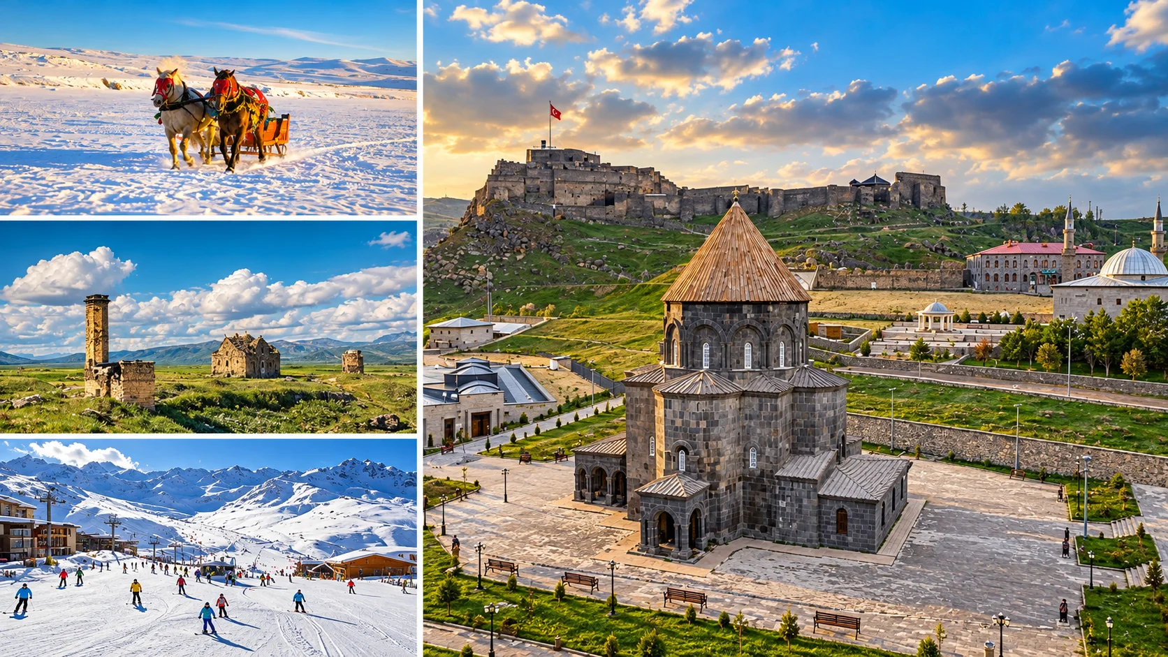
Castle, Stone Bridge and Russian-Era Streets
Most of the centre is walkable. The castle, Kumbet Mosque and bridge sit close together along the river.
Ani Archaeological Site
On the World Heritage List since 2016. It spreads across an open plateau and deserves its own day.
Sarıkamış, Çıldır, Kuyucuk, Susuz
Winter and summer routes differ. Season, road conditions and ice safety decide the plan.
How Many Days in Kars?
Kars's main sights are not close to one another. Ani, Sarıkamış, Çıldır and Susuz lie in different directions, so the number of days shapes the route.
| Time | Realistic Scope | Note |
|---|---|---|
| 1 day | Kars centre (castle, Kumbet Mosque, Stone Bridge, Fethiye Mosque, museums) or Ani alone | Squeezing both into one day rushes Ani. |
| 2 days | Kars centre plus Ani | If you want a third direction, pick Sarıkamış or Susuz by season. |
| 3 days | Centre, Ani, then Sarıkamış in winter or the lake line in summer | Plan Çıldır separately for winter and summer. |
| 4 days | The three-day plan plus a second nature day and Boğatepe or Digor | Remote districts need a vehicle and good seasonal conditions. |
Winter days are short and roads can ice over. Choosing one direction per day is safer than combining two far-apart ones.
Kars by Region and Season
| Area | Main Highlights | Best For | Suggested Time | Seasonal Note |
|---|---|---|---|---|
| Kars Centre | Kars Castle, Kumbet Mosque, Stone Bridge, Fethiye Mosque, Kars Museum, Kanlı Tabya | History and city architecture | Half day to 1 day | Open all year. Pavements ice up in winter. |
| Ani (Ocaklı) | Cathedral, Tigran Honents, Menuçehr Mosque, walls | Archaeology, photography | Half day to 1 day | Wind and ice on an open plateau. Winter visits are possible, access depends on weather. |
| Sarıkamış | Ski centre, Scots pine forest, Allahuekber Mountains National Park, Katerina Lodge (from outside) | Winter sports, history | 1 day or overnight | Busiest in winter. Forest walks in summer. |
| Lake Çıldır | Lake views, horse sleigh in winter, shore villages | Scenery, winter experience | Half day | Most of the lake is on the Ardahan side. Ice safety depends on the local operator. |
| Kuyucuk / Arpaçay | Kuyucuk Lake wetland | Birdwatching | 1 to 2 hours | Water levels have varied a lot. Ask about current conditions first. |
| Susuz | Susuz Waterfall | A short nature stop | 1 hour | Strongest flow in spring and early summer. It freezes partly in winter. |
| Kağızman | Aras valley views, Kağızman long apple | Rural route | Half day | Harvest season in autumn. |
| Digor | Kilittaşı (Bagaran) village, Beşkilise | Medieval ruin enthusiasts | Half day | Ask about access and the condition of the buildings beforehand. |
Calling Lake Çıldır "in Kars" is only half right. One shore belongs to Çıldır district in Ardahan, while the other side faces Arpaçay district in Kars. If you are planning wider eastern Türkiye, see our Türkiye travel guide for general routes.
Where to Go in Kars by Goal
| Goal | Suggestion | Why |
|---|---|---|
| First-time visitor | Kars centre and Ani | You see both the city and the medieval heritage. |
| Archaeological site | Ani | It is Kars's only UNESCO-listed site. |
| City walk | From Fethiye Mosque up to Kars Castle | Russian-era stone buildings and the river corridor are close together. |
| Winter experience | Sarıkamış, and Çıldır with a controlled operator | Skiing and sleigh rides anchor the winter route. |
| Nature and birds | Kuyucuk, Susuz | A wetland and a waterfall make short stops. Conditions change with the season. |
| Food | Goose, gruyère, kaşar, hangel | Boğatepe and Kars's market show the cheese culture. |
| Architecture | Kumbet Mosque, Fethiye Mosque, Ani Cathedral | Bagratid, Seljuk and Russian layers can be seen side by side. |
| Photography | Ani, Kars Castle, Çıldır in winter | Depends on light and season. Follow the photography rules in the border zone. |
This table is editorial guidance, not a ranking or a "best of" list.
Kars Centre: The Castle, Stone Buildings and the Russian-Era Town
The centre of Kars is not one monument but two towns laid over each other. Around the castle and the Kars River sits the older settlement with medieval and Ottoman layers. On the flat ground to the south, a grid plan with streets crossing at right angles was laid out after 1878. The cut-basalt and tuff civic buildings inside that plan give Kars the look it has today.
A centre visit runs through Kars Castle, Kumbet Mosque, the Stone Bridge and the old baths beside it, Fethiye Mosque, the Kars Museum and the Caucasian Front War History Museum at Kanlı Tabya. Most stops are within walking distance, but icy pavements slow you down in winter.
If you are combining Kars with other cities in the east, our Türkiye travel guide is a starting point for wider routes.
Video: a general look at what to see in Kars. Hours, fees and business details in the video may be out of date.
How Kars Changed Between 1878 and 1918
Kars took on much of its present look under Russian imperial rule. This section is about how the urban fabric formed, not a timeline of wars.
Context. After the 1877-78 Russo-Ottoman War, Kars, Ardahan and the surrounding area passed to Russia. The region was administered as the Kars Oblast and stayed under that status for roughly forty years. A leading archive-based source is Candan Badem's book on Tsarist rule in Kars, Ardahan and Artvin, 1878-1918.
The town plan. According to academic studies, the Russians left the old settlement under the castle as it was and built a new grid-plan town on the flat ground south of it. Military, commercial and civic buildings there were built from cut basalt, and houses were lined up along the streets.
Today's identity. Wide streets, stone facades of similar height and courtyard houses set Kars apart from other eastern cities. Some of these buildings now serve as public offices, hotels or shops. Because the current use of each building can change, this guide does not give street addresses.
"Baltic Architecture" in Kars: What the Label Means
In Turkish, the usual label for Kars's Russian-period buildings is "Baltık mimarisi", Baltic architecture. It works more as a local label than as a settled architectural-history term. One study on file at Atılım University notes that the Russian buildings in Kars are commonly called Baltic architecture, while describing them as built in the eclectic Russian style that was common in Russia at the time. A thesis at Uludağ University looks at the facade features of civic buildings built in 1878-1918.
For that reason, this guide keeps three things apart. "Baltic" is the local label, eclectic Russian civil architecture is the stylistic description, and basalt and tuff are the regional materials. For Fethiye Mosque, sources mention Neo-Renaissance and Empire-style facade decoration. It would be wrong to call any building purely "Baltic" or flatly "neoclassical", and not every stone building in Kars belongs to one style.
In local talk, "Baltic" often just means "a Russian-period stone building". In architectural literature, the style is described as eclectic.
Kars Castle: First Build, Destruction and the Ottoman Rebuilding
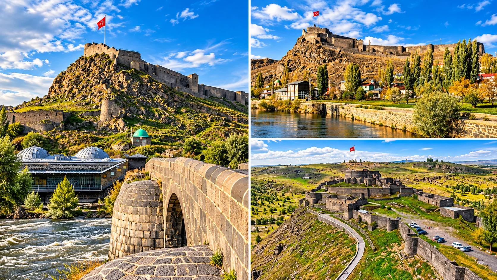
The Saltukid Period
Sources say the vizier Firuz Akay built the castle for a Saltukid ruler in the mid-12th century, in 1152 or 1153 depending on the source. Some accounts add that an earlier Bagratid fortification may have stood on the site.
1386 and 1579
Most sources say Timur destroyed the castle in 1386. Under Ottoman rule, Lala Mustafa Pasha rebuilt it in 1579 on the orders of Sultan Murad III. The castle standing today rests mainly on that Ottoman phase.
Repairs
Sources say Shah Abbas damaged it in 1606 and that it was repaired in 1616 and 1636. Russian occupation after 1877-78 caused further damage.
Was it "built by the Saltukids in the 12th century"? For the first castle, most sources support that, but it is not accurate for the castle you see today. The first foundation and the Ottoman rebuilding that stands now should be read as two separate phases. Sources also disagree on the exact year, so "mid-12th century" is safer than a single date.
Visiting. The castle dominates the centre and gives a panorama of the city and the Kars River. Check official sources for current entry terms, hours, lighting and the winter state of the stairs and paths. In winter, take care on slippery ground, on the rocky slope and along wall edges, and keep away from unrailed edges.
Kumbet Mosque, Fethiye Mosque and the Stone Bridge
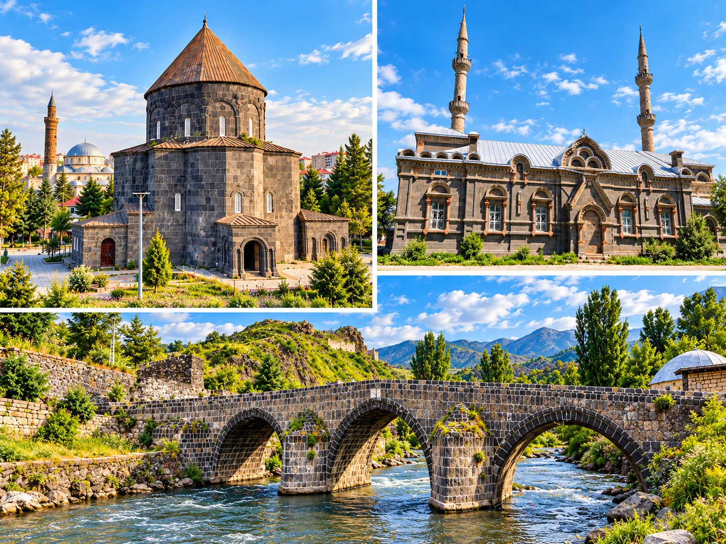
Kumbet Mosque (the Church of the Holy Apostles)
The building was put up as the Church of the Twelve Apostles by the Bagratid King Abas I between 932 and 937. It has a four-lobed, clover-like plan, with four columns and arches carrying a central dome. The material is dressed basalt. Figural reliefs representing the Twelve Apostles appear on the dome drum, and sources describe them as rare survivals from the church period.
Sources give different dates for its later use. Turkish sources say it became a mosque in 1064 after the Seljuk conquest, while others place the start of mosque use at 1579. Both accounts agree that it served again as a church under Russian rule, became a museum in 1964 and returned to mosque use in 1993. The Directorate General of Foundations carried out a major restoration in 2007. So the line that "the Ottomans converted it in the 19th century" is wrong. In the 19th century it was in use as a church under Russian rule.
Fethiye Mosque
Fethiye Mosque was built in the late 19th century as a Russian Orthodox church and is known as the Alexander Nevsky church. Sources do not agree on the construction date or the architect, so this page does not carry the "1898" and "1918" dates from the old text. Sources also give different times for the conversion to a mosque: one encyclopedia says 1985, while another account says the building was used by public bodies for a long time first. The twin minarets were added in the Republican period.
The facades show Neo-Renaissance and Empire-style influences. We could not verify the label "Neo-Gothic", so we do not use it. Do not confuse the building with the Cathedral of Ani, which is a separate medieval structure.
The Stone Bridge
The three-arched basalt bridge over the Kars River was, according to most sources, built in 1579 during Lala Mustafa Pasha's rebuilding programme. One researcher argues it could go back to the 10th century, so the date of the first bridge is disputed. Sources report flood damage around 1715 and rebuilding in 1719 by Hacı Ebubekir Karahanoğlu (some records say 1725). It was restored by the highways authority in 2013.
The Baths and the Kars River Corridor
Historic baths stand on both banks of the Kars River near the bridge. Mazlum Ağa Bath is one of them and is described as 18th-century Ottoman bath architecture. News of its restoration is inconsistent. One source says the repairs were completed in 2021, while a parliamentary document says the doors are still kept shut. Do not assume you can go inside, and plan to see it from outside.
A suggested order is the castle foot, Kumbet Mosque, the Stone Bridge and the baths, a walk along the river, then the Russian-era streets on the flat ground and Fethiye Mosque. In practice it takes around half a day, depending on your stops.
Kars Museum and the Caucasian Front War History Museum
These are two separate institutions. Do not mix up their collections or visiting details.
| Museum | What You See | What Is Known | Visiting Note |
|---|---|---|---|
| Kars Archaeology and Ethnography Museum (Kars Museum) | Palaeolithic stone tools, Early Bronze Age metalwork, Urartian, Roman, Byzantine, Seljuk and Ottoman works, Ani excavation finds, an ethnography hall | The new building went up in 1978 and opened in 1981. About 9,000 registered items are reported. The building is not Russian-era. | Check official sources for hours and fees. Older guides list free entry and 08:00 to 17:00, which may be out of date. |
| Caucasian Front War History Museum (Kanlı Tabya) | Exhibits on the Caucasian Front and the bastion's architecture | Kanlı Tabya was converted into a museum in 2018. The Directorate General of Cultural Heritage and Museums restored it, and it operates under the Kars Archaeology Museum. | Hours and fees differ between sources. Confirm with the museum's official channel before going. |
Kanlı Tabya belongs to the defensive line of Kars in the context of the Ottoman-Russian wars. This history is sensitive. For casualty figures, rely only on what the museum and academic sources state.
A One-Day City Walk in Kars
| Order | Stop | Note |
|---|---|---|
| 1 | Fethiye Mosque | Russian-era street fabric and the building's architecture. It is a working mosque, so mind prayer times. |
| 2 | Russian-era stone streets | Look from outside. The use of buildings can change. |
| 3 | Kars Museum | Confirm hours and days. |
| 4 | Kanlı Tabya (Caucasian Front War History Museum) | A separate museum, so set time aside for it. |
| 5 | Stone Bridge and the baths | A short break on the river bank. |
| 6 | Kumbet Mosque | The interior can be seen outside prayer times. |
| 7 | Kars Castle | The hours near sunset suit the view. Ask about current entry terms. |
The order follows walking logic. Check a map app for current street closures. You do not have to see everything on a short day.
The Ani Archaeological Site: A Medieval Capital on the Border
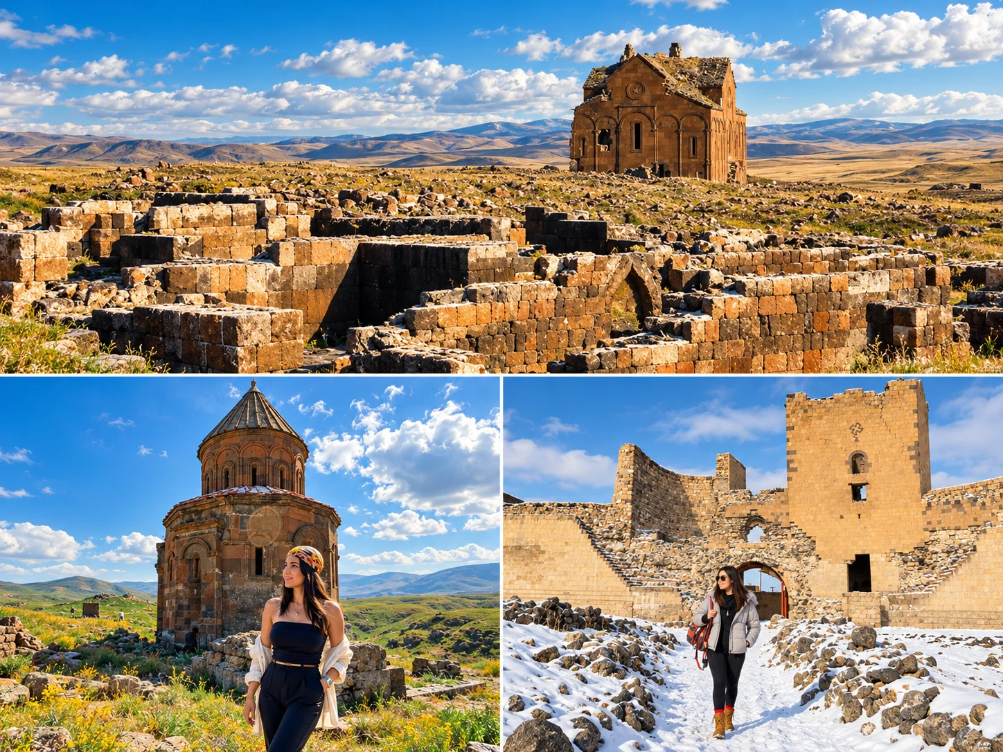
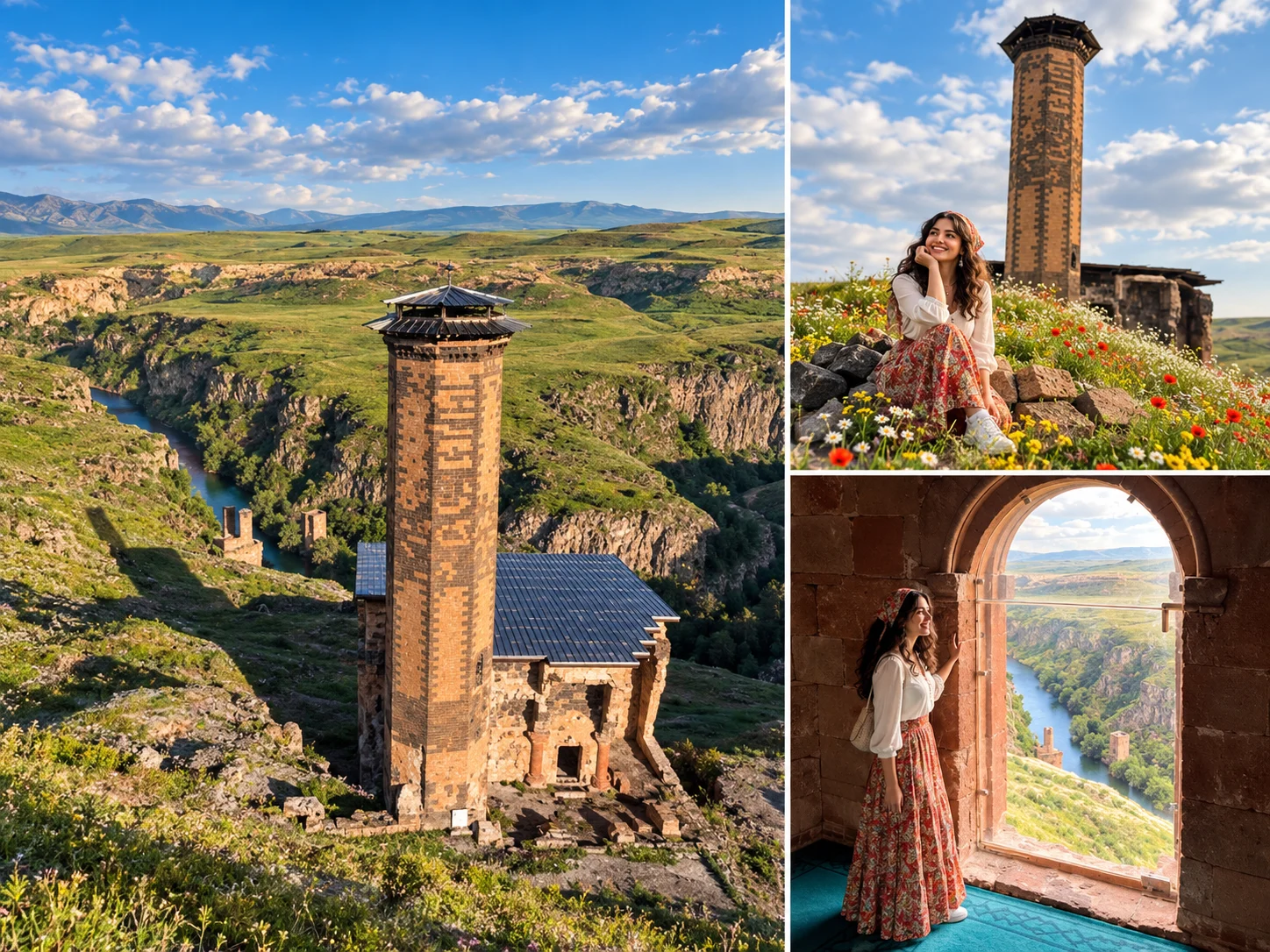
The site's official Turkish name is Ani Ören Yeri, the Ani Archaeological Site, and it is also searched for as "Ani Harabeleri", the Ani ruins. In the Middle Ages it was the capital of the Armenian Bagratid kingdom and an important city linked to Silk Road routes. Today it lies near Ocaklı village in Kars's central district, on a plateau overlooking the Arpaçay valley (called the Akhurian in Armenian and international sources). The far bank is in Armenia, and the border runs along the river.
Ani is not a border crossing. It is an archaeological site, and there is no passenger crossing between Türkiye and Armenia here. Because the site is in a border zone, follow the military restricted-area signs and the directions of staff. Do not approach the border line without permission.
"City of 1,001 churches" is a popular phrase, not a real count. Just know that Ani is called that in popular retelling and in older history writing.
Ani's UNESCO Status
UNESCO lists it as the "Archaeological Site of Ani", reference 1518. The World Heritage Committee inscribed it in 2016 at its 40th session under criteria (ii), (iii) and (iv). UNESCO documents give the property area as about 250.7 hectares, or about 683 hectares with the buffer zone. UNESCO's assessment says the site conveys its value through its monuments, underground passages and caves. At inscription it also flagged risks such as the lack of a conservation master plan, inappropriate grazing and cave use in the valleys, and no seismic monitoring plan.
Ani Quick Facts
| Topic | Detail |
|---|---|
| UNESCO | Archaeological Site of Ani, 2016, reference 1518, criteria (ii), (iii), (iv) |
| Main period | 10th and 11th century Bagratid capital, followed by Seljuk, Georgian and Mongol phases |
| Location | Kars central district, near Ocaklı village. About 45 km from Kars city (confirm on a map service) |
| Typical visit | The site is large. Half a day to a full day is comfortable. This is an estimate, not a guarantee, and depends on your pace. |
| Main monuments | Cathedral, Tigran Honents Church, Menuçehr Mosque, the remains of the Gagik (Gagkashen) church, the walls |
| Border setting | The site sits on the Armenian border. Restricted-area and photography rules apply. |
| Winter | Wind, snow and ice on an open plateau. Winter visits happen, but access and walking conditions depend on the weather. |
| Hours | The muze.gov.tr page shows 08:00 to 17:00 for winter, with the ticket desk closing at 16:30. Summer hours differ. Confirm on the official page. |
| Ticket and Museum Pass | The ministry's fee list shows entry with the Museum Pass. This page gives no current lira price. See the official source for amounts. |
Ani's History: From Capital to Abandonment
| Period | What Happened | Note |
|---|---|---|
| 10th century | Rises as capital of the Bagratid kingdom. The capital moves to Ani under Ashot III. | Sources give 964, 977 and 1064 for phases of the wall construction. |
| 989-1001 | Construction of the cathedral. The architect Trdat is commissioned by Smbat II. | Work stops when Smbat II dies in 989, and the building is finished under Katranide, wife of Gagik. Sources give completion dates between 1001 and 1010. |
| 1045 | Byzantine rule begins. | Bagratid rule lasts until 1045. |
| 1064 | Sultan Alp Arslan takes Ani. | The Kufic inscription at the Lion Gate is linked to this conquest. |
| 11th-12th century | The Shaddadid emirate and the Menuçehr Mosque. | Shaddadid rule often overlaps with Georgian control. See academic sources for detail. |
| 12th-13th century | Georgian and Zakarid influence. Tigran Honents Church is completed in 1215. | A wealthy merchant commissioned the church in the Zakarid period. |
| 13th century onward | Mongol period, earthquakes, shifting trade routes. | Dates such as 1236 vary by source. The earthquake of 1319 did great damage but was not the only cause. |
| 17th-18th century | The small settlement inside the walls gradually empties. | Some sources say the last monks left in 1735. Abandonment was gradual, not a single date. |
That is why the old claims "abandoned completely in the 17th century" and "the 1319 earthquake ended Ani" are simplified here. The city's decline came from earthquakes, war and shifts in trade routes together.
The Walls and Gates of Ani
Sources put the wall length at 4.5 to 5 km. "Double wall" is not true for the whole circuit. According to the excavation director, the double-layered construction appears on the northern stretches facing the plain, while the wall is single-layered where it faces the Arpaçay, Mığmığ and Bostanlar streams. There are seven gates in the walls. The best known is the Lion Gate (Aslanlı Kapı), which opens toward Kars. West of it are the Çiftebeden and Uğurun (Hidden) gates, and to the east are the Satrançlı (Hıdırellez), Mığmığ Stream, Bağ Sekisi and Divin gates. The Divin Gate sits at the zero point of the Armenian border and is named for the Seljuk-period town of Divin that it opened onto. That gate and its surroundings may count as a restricted area.
Ani's Main Buildings: the Cathedral, Tigran Honents and the Gagik Church
| Building | Verified Detail | Caution |
|---|---|---|
| Cathedral of Ani | The architect was Trdat. Construction began in 989 and finished around 1001. The inscription on the south facade names Katranide and Gagik. | It has nothing to do with Fethiye Mosque in Kars city. This is a medieval building, while Fethiye Mosque is a 19th-century Russian structure. |
| Tigran Honents (St Gregory) Church | Completed in 1215 and commissioned by the wealthy merchant Tigran Honents during the Zakarid period. It is counted among Ani's best-preserved buildings. | Do not treat details about the frescoes and inscription languages as settled unless explained on site. |
| Gagik (Gagkashen) Church | Said to be dedicated to St Gregory and built in imitation of the Zvartnots Cathedral. Historians also attribute it to Trdat. | It is largely in ruins today. Do not expect a standing building. |
Other buildings such as the Church of the Redeemer and Abughamrents Church can be seen at Ani. This page gives no detail about them because we could not verify their dates in the sources we found. While walking the site, use the information boards and what the excavation team publishes.
Menuçehr Mosque: Is It "the First Turkish Mosque in Anatolia"?
The mosque is associated with the Shaddadid emir Abu'l-Muammer (Abu Shuja) Menuçehr. The TDV Encyclopedia of Islam says it was built between 1072 and 1086, while statements attributed to the excavation director use a range of 1072 to 1092 and argue the inscription belongs to the reign of Malik Shah.
Is "the first Turkish mosque in Anatolia" right? The phrase is very common in official and popular accounts. In the academic literature, the building's original function and date are still debated. Some researchers argue it was a mosque from the start, built soon after the Turks took Ani. Others hold that it was a Bagratid-period palace later converted into a mosque. A third view says that, even if built as a mosque, its architectural style could place it in the 12th or 13th century. The minaret may also be older than the main building. For this reason, this page uses "one of the most important examples of early Turkish-Islamic architecture in Anatolia" instead of a flat verdict.
The mosque stands on a high edge overlooking the Arpaçay valley. Look at the valley only from safe, permitted points.
How to Visit Ani in 2026
- Getting there: Ani is about 45 km from Kars centre. We found no current official information on regular public transport from Kars to Ani. Plan on a private car, a taxi or an organised tour, and ask beforehand whether any service runs in winter.
- Time: Walking distances are long. Allow at least a few hours to see several monuments, and half a day to a full day for the whole site.
- Winter: The plateau is open and the wind is hard. Dress warmly, choose non-slip footwear and start early because days are short.
- Caves and passages: Ani has cave settlements and rock-cut spaces. Do not be drawn by "secret passage" stories into closed or restricted places. Stay in open, marked areas.
- Photography and drones: Border-zone and heritage-protection rules apply. Ask about current restrictions at the ticket desk or the Kars Museum Directorate. Assume a drone needs permission.
- Facilities: We found no current official information on toilets, cafés or accessibility. Consider bringing water and food.
Sarıkamış: Skiing, Scots Pine Forests and War History
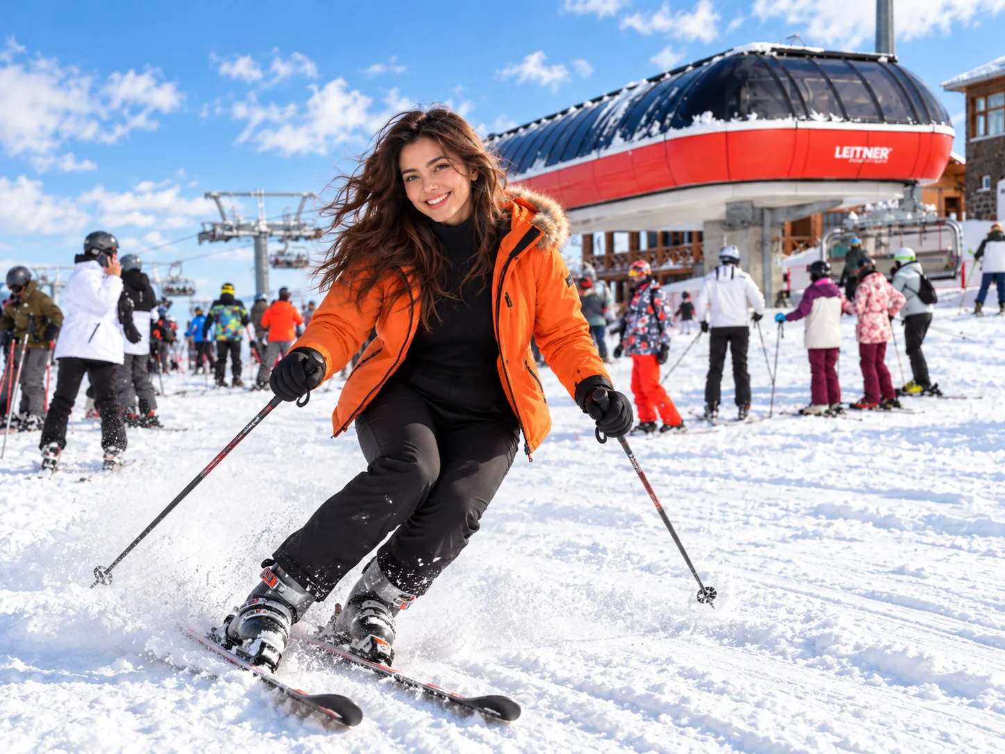
Sarıkamış is a district about 50 km south-west of Kars city, toward Erzurum. In winter it is known for skiing, in summer for Scots pine forest, and all year for the memory of the 1914-15 Sarıkamış Campaign. For the ski area this page uses the name Sarıkamış Ski Centre. The same place is also called Cıbıltepe, and news reports say "Sarıkamış Cıbıltepe". The official name or operator can change, so check the operator's announcements.
Current infrastructure figures are inconsistent in the sources. The summit elevation is most often given as 2,634 metres in news reports, and the ski area is also described as running from about 2,100 to 2,634 metres. Older reports speak of 8 slalom runs and 25 to 30 km, newer ones of 10 runs and about 33 km. The number of chairlifts is given as 4 or 5. So this page gives no exact run or lift counts. For prices and the season, see the operator's official announcements.
The "crystal snow" claim. We found no scientific source for the promotional line that "crystal snow exists only in the Alps and Sarıkamış". A more careful description is that the area is known for dry, low-moisture snow conditions. Snow depth and the season change each year. Season dates are not guaranteed, so check current piste conditions before you go.
Whether snowboarding, sledding and snowmobile activities are offered depends on the season and the operator. This page makes no blanket "everything is available" claim.
Pine Forests and Allahuekber Mountains National Park
The area around Sarıkamış is known for Scots pine (Pinus sylvestris) forests. The Sarıkamış-Allahuekber Mountains National Park was declared on 19 October 2004, lies on the Kars and Erzurum provincial border and is managed under the Ministry of Agriculture and Forestry. Sources give its area as roughly 22,500 to 23,000 hectares. The park was declared both to protect the alpine environment and to commemorate the 1914 Sarıkamış Campaign. Sources give very different figures for the number of people who died in the campaign. This page gives no definite figure and approaches the subject with respect.
On wildlife, the old page listed "bear, wolf, fox". Because we did not verify species against an official biodiversity source, this page gives no species list. Do not set out to meet wild animals, and stay on marked paths in the forest.
Soğuksu Nature Park
The old text said "Soğuksu Nature Park near Kars city centre". That is not accurate. In the sources, the nature park of that name lies about 3 km from Sarıkamış, was established in 2011 and covers around 11 hectares. Its distance from Kars centre is given as about 53 km. This rests on a single encyclopedic source, so confirm it against official General Directorate of Nature Conservation and National Parks records. Do not mix it up with Soğuksu National Park near Ankara.
Katerina Hunting Lodge: Name and Documented History
According to most sources, the lodge is a hunting lodge built by Nicholas II in 1896 (some sources say 1887 and 1897). It is made of wood and is described as built without nails. It served military purposes until 1994 and is a registered cultural property. Locals call it "Katerina", but one source says that name is wrong. We found no documented link to Empress Catherine II, so we do not present the name as historical fact. Plans to restore it as a hotel have appeared in the news, but we found no current source saying works began. Do not assume it can be visited, and ask before you go.
In winter, ice and snow can close the Kars-Sarıkamış road. Winter tyres, chains and current road information matter.
Lake Çıldır: Kars or Ardahan?
"Where is Lake Çıldır" and "which province" are heavily searched questions. The answer is the border between two provinces. The lake lies between Ardahan and Kars. One shore is in Çıldır district in Ardahan, and the other side faces Arpaçay district in Kars. Its area is given as about 123 km². Sources give different altitudes (roughly 1,960 m to 2,100 m) and depths of 30 to 42 m, so this page does not claim a single figure.
When you come from Kars, find out beforehand which shore the service points are on and whether the road is open, since the places that offer horse sleighs and similar services can change. That is why describing Çıldır as "Kars's lake" is only half right, and this page treats it as a body of water shared by two provinces.
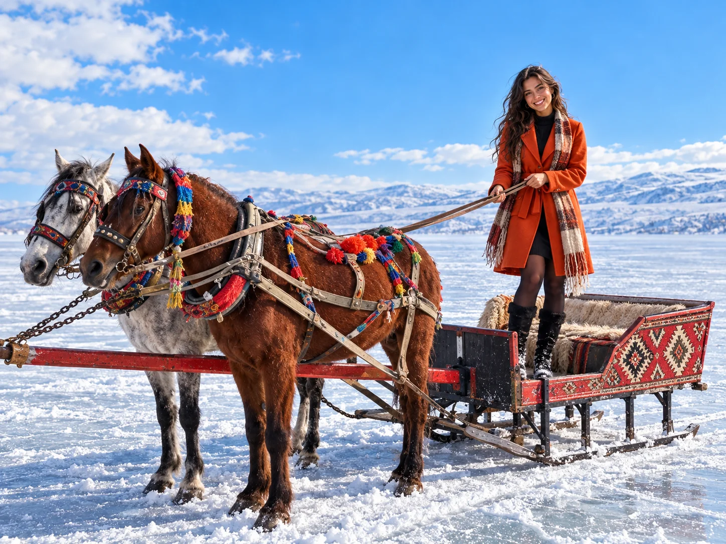
Winter freezing. "It freezes completely every winter" is not true every year. In hard winters a large part of the surface can freeze. News reports say the ice reaches 30 to 50 cm in places, but in some years the lake did not freeze at all. Timing and thickness differ each year.
Horse sleighs and ice fishing. Horse-sleigh tours and fishing through holes in the ice are traditional activities in the area. For safety, know that ice is not safe everywhere. Join activities only in areas that a local operator and the local authorities control. We found no official safe-thickness threshold. Do not go onto the ice on your own, do not drive onto it, and do not leave children unsupervised. Ask organisers to confirm prices.
Çıldır in summer. In summer you see the lake, fishing and village life around it. We could not confirm whether boat tours or other services are offered, so this page does not present them as available.
Lake Kuyucuk and Susuz Waterfall
Lake Kuyucuk: Ramsar Site and Current Condition
Lake Kuyucuk is in Arpaçay district. An encyclopedic entry says the site was designated a Ramsar site in 2009 and that the Ramsar area covers about 416 hectares, and news reports call it Türkiye's 13th Ramsar site. For the date and ranking, check the Ramsar Secretariat's official site.
The old "182 bird species" figure is out of date. Different sources give more than 230, 232 and 233, and these are historical record totals. This page makes no claim about a current species count. What matters more is the lake's recent condition. It is reported to have shrunk from 2018 because of drought and water use, and in 2020 the news reported it as "completely dried up". Later reports say snow and rain brought hope, and that under the governorate's lead the General Directorate of Nature Conservation and National Parks and the State Hydraulic Works are working to revive the lake. We found no current data on the 2025-2026 water level.
So instead of selling Kuyucuk as a "bird paradise", we treat it as a sensitive wetland that depends on water levels. Look at the local authorities or current news before you go. For birdwatching, use only public observation points, keep away from nesting areas and stay quiet.
Susuz Waterfall
Susuz Waterfall (locally also called "flying water") is on the Kars-Ardahan road, and sources put it about 23 km from Kars centre and about 5.6 km from Susuz town. Most sources give its height as about 75 metres, while a single old news item says 15 metres. We report the 75 m figure as "about, according to sources", because we found no official measurement. The flow strengthens in spring with rain and snowmelt and partly freezes in winter. The area has been landscaped under the Kars Governorate, Susuz District Governorate and the Serhat Development Agency. Take care on edges and rocky surfaces, and keep away from unrailed spots.
Kağızman, Digor, Arpaçay, Akyaka and Selim
Instead of giving each district equal space, we cover only places with a verifiable value for visitors.
| District | Verified Value | Note |
|---|---|---|
| Kağızman | Canyon views around the Aras River, seen from the Kağızman and Tuzluca roads. The Kağızman long apple is registered in the TÜRKPATENT record as a designation of origin dated 25.12.2017. | Geographical-indication work for Kağızman apricot appears in the news, but we could not verify its registration. |
| Digor | Two churches from the Bagratid period and old settlement remains at Kilittaşı (Bagaran) village. Beşkilise is the district's best-known historic building. | A parliamentary question refers to claims of threats to Beşkilise. Find out its current condition before you go. |
| Arpaçay | Lake Kuyucuk and the Kars side of Lake Çıldır. | We did not verify a separate historic building. |
| Akyaka | We found no verified standalone stop. | Kept short. |
| Selim | We found no verified standalone stop. | Kept short. |
General lines such as "quiet village life and hospitable people" were removed because they carry no place-specific verification.
When to Visit Kars
| Season | Best Experiences | Main Limitations | Planning Note |
|---|---|---|---|
| Winter | Skiing at Sarıkamış, snowy Kars and Ani, horse sleighs at Çıldır in controlled areas | Short days, icy roads, hard wind at Ani, ice safety | Winter tyres and current road information. Not every lake freezes every year. |
| Spring | Bird migration, strong flow at Susuz Waterfall | Snowmelt, mud, closed upland roads | Ask about Kuyucuk's water situation in advance. |
| Summer | Ani, rural routes, Sarıkamış forest, lake shores | Shadeless heat and sun at Ani, short showers | Visit early in the morning or late in the afternoon. |
| Autumn | City and heritage visits, harvest season, bird movement | Rapidly cooling air, early snow | From late October, allow for winter conditions. |
What to Do in Kars in Winter
Winter is Kars's best-known season. The snow-covered town and Ani photograph well, Sarıkamış has skiing, and horse sleighs run at Çıldır in controlled areas. Days are short, though, so putting Sarıkamış and Çıldır on the same day is often inefficient. Daylight, road conditions and ice checks argue for splitting the two routes over separate days.
What to Do in Kars in Summer
In summer, Ani, Susuz, Kuyucuk, the lake shores and the Sarıkamış forest come to the fore. At Çıldır, winter activities give way to village life and lake scenery. On a summer route, Ani offers very little shade in the hot hours. For other seasonal ideas in winter-sports country, you can also see our guide to the best ski resorts in Türkiye.
How to Get to Kars: the Eastern Express, the Airport and the Road
The Eastern Express and the Touristic Eastern Express Are Not the Same Train
| Feature | Eastern Express (Doğu Ekspresi) | Touristic Eastern Express (Turistik Doğu Ekspresi) |
|---|---|---|
| What it is | A regular regional train service | A touristic train with a limited calendar |
| Carriages | Pullman seats and couchettes | Sleeping and dining cars |
| Departures | Reported in the news as a daily service in both directions | 70 departures (35 each way) announced for the 2026-2027 winter season |
| Fare | Lower | Noticeably higher |
| Sales | TCDD Taşımacılık official channels | Individual sales announced to open on 26 October 2026. Buy through the official channel. |
According to news reports, the Touristic Eastern Express will run Ankara-Kars departures between 21 December 2026 and 10 March 2027, and Kars-Ankara departures between 23 December 2026 and 12 March 2027. Sightseeing stops are planned at Erzincan and Erzurum on the Ankara-Kars leg and at İliç, Divriği and Sivas on the way back. The ministry has warned about unauthorised agencies selling Eastern Express tickets as Touristic Eastern Express ones. For fares and times, trust only TCDD Taşımacılık's official channels. This page gives no ticket price.
The Airport and Getting Around the City
The airport is Kars Harakani Airport and is run by DHMİ (it was renamed in this form in 2015). Its distance from the city centre is given as 6 to 7 km in sources. Municipal buses run between the airport and the centre to match flight times, and taxis wait outside the terminal. A Turkish Airlines and SunExpress ground shuttle links the airport and Ardahan. For current times and fares, see Kars Municipality and DHMİ announcements.
Vehicles in and Around Kars
The centre of Kars is walkable, but Ani, Sarıkamış, Çıldır, Kuyucuk and Susuz call for a vehicle. We found no current official information on regular public transport between Kars and Ani or Sarıkamış. In winter, snow and ice can close roads, so winter tyres and a weather check matter. A private car or an organised tour is a practical option for remote sites.
What to Eat in Kars: Goose, Cheese and Dough Dishes
Kars Goose
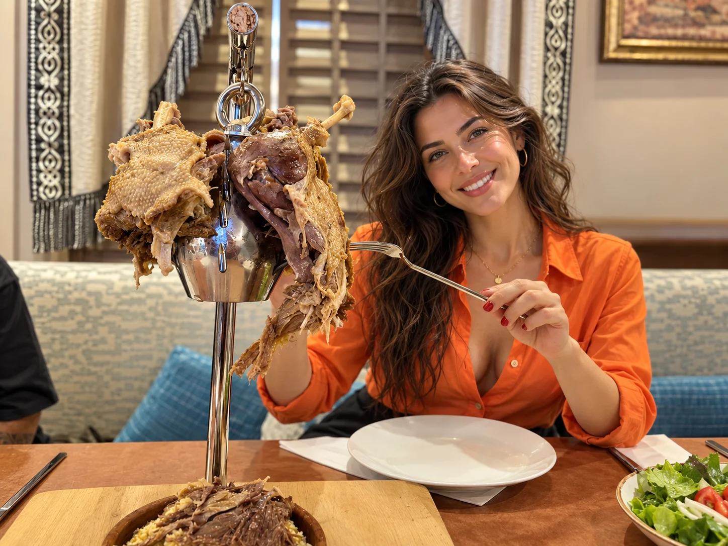
Kars goose is a winter dish. According to the methods described, slaughter generally happens in November after the first snow. By the method reported as the official geographical-indication description, the carcass is pressed whole, salted and dried in the open air for 5 to 10 days. News reports also give drying times of 10 to 30 days. Before cooking, the meat is boiled to draw out the salt. In Kars, goose is usually served with bulgur pilaf cooked in the goose's own fat.
The old page's nutrition and health-related line was removed. A document of the provincial agriculture and forestry directorate exists for Kars goose's geographical indication, so confirm its registration status with TÜRKPATENT.

Hangel, Kete and Feselli
- Hangel (also hingel, hengel): A dough dish from Caucasian cuisine that is common around Kars, Ardahan and Erzurum. Pieces of dough are boiled and dressed with garlic yoghurt and a buttery sauce. Some recipes make it as a filled dough. Recipes vary by area and family.
- Kete: One of Kars's known pastries. We could not verify the old page's "walnut or tahini" detail for Kars kete. News items mention a 2023 geographical indication, but the source is of low reliability, so we do not describe it as GI-registered.
- Feselli: Described as a griddle-cooked morning dish among Kars's flavours. We found no reliable detailed recipe. We did not carry over the old page's "thin dough brushed with butter and folded" description because we could not confirm it.
- Piti, umaç halva, sour meat stew: We found no reliable source that these are specific to Kars, so we give no detail. They may also be common in the wider Caucasian and eastern Anatolian kitchen.
Kars Cheese Culture and Boğatepe
Kars's cheese culture is told around two products: kaşar and gravyer. Gravyer is technically a Gruyère-style hard cheese, not an Emmental. The old "Emmental-style" wording is therefore corrected here. Gravyer is tied to the story of the Swiss cheesemaker David Moser coming to Boğatepe in 1878. That is the date most often repeated, but it is not settled, and one source says 1882.
In Boğatepe village (formerly called Büyük Zavot), an old dairy said to date from 1880 was restored by villagers and turned into a cheese museum by the Boğatepe Environment and Life Association. The association says it founded Türkiye's first eco cheese museum in 2010, and the museum has been in active use since 2011. Villagers show visitors the village, the museum and the dairies, and some households serve breakfast. For current visiting terms, contact the local authority or the association.
| Product | Geographical Indication Status | Note |
|---|---|---|
| Kars Kaşarı | Reported in the news as registered in 2018 | An EU registration process is under way. Read production details from the registration document. |
| Kars Gravyeri | TÜRKPATENT registration, following an application by the Kars Chamber of Commerce, was reported in the news | The registration date is inconsistent across sources, so we give no year. |
| Kars Honey | Appears with kaşar in 2018 reports, single source | The old page's purity and health-related phrases were removed. |
| Kağızman Long Apple | TÜRKPATENT record, 25.12.2017, designation of origin | Kars province, Kağızman district. |
| Kars Goose | A provincial directorate document exists | Confirm registration status with TÜRKPATENT. |
We did not repeat the old claims "made only from the milk of cows grazing in summer" and "matured in natural stone cellars" because we could not verify them against a product specification. We also do not give the old "6 to 12 months" maturation range without a source.
If you want to buy local products, look for ones with a geographical indication marking on the label. Sales terms in Kars's market and in Boğatepe depend on the business.
Where to Stay in Kars: Centre or Sarıkamış?
The old page's hotel list was removed from this page. We could not verify the current name and operating status of most of the listed businesses, and we do not rank any hotel. Choose accommodation by area.
Kars Centre. Suits history and city sightseeing, food, a base for Ani and train access. The castle, Kumbet Mosque and museums are grouped in the centre. Staying close by makes sightseeing on foot easier.
Sarıkamış. Suits a ski holiday. A ski hotel near the slopes brings easier access to the ski area and equipment. Outside a ski trip, staying in Kars is more sensible for a sightseeing visit.
Around Çıldır. Accommodation is limited and mostly on the Ardahan side. This page gives no list.
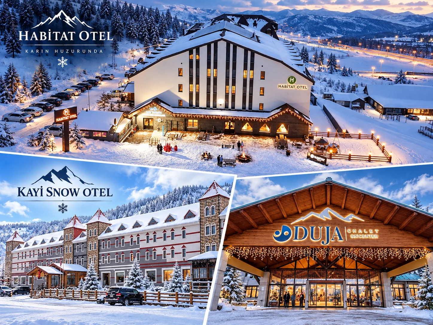
The image is a collage of the signs of three hotels around the Sarıkamış ski centre. Facilities such as a spa, pool, transfers or slope access are not claimed on this page, and no prices are given. For current facilities, prices and any name or brand changes, see each property's official page.
1, 2, 3 and 4 Day Itineraries for Kars
| Time | Winter Route | Summer Route |
|---|---|---|
| 1 day | A walk through Kars centre, or Ani alone. Do not squeeze both into one day. | Kars centre and a short afternoon visit to Ani, or Ani alone. |
| 2 days | Day 1 Kars centre. Day 2 Ani (start early, days are short). | Day 1 Kars centre. Day 2 Ani, with Susuz Waterfall toward evening. |
| 3 days | Day 1 centre. Day 2 Ani. Day 3 Sarıkamış (skiing) or controlled Çıldır, keeping the two apart. | Day 1 centre. Day 2 Ani. Day 3 Susuz, Kuyucuk and the lake line. |
| 4 days | The 3-day plan plus a second Sarıkamış or Çıldır day. | The 3-day plan plus the Boğatepe cheese village or a Digor and Kağızman route. |
Do not pack remote points into one day. The distance between Sarıkamış and Çıldır and the shortness of winter days make combining them hard. Combining Kuyucuk, Çıldır and Ani in a single day is not realistic either.
A Note on Kars Culture and Legends
The old page had two legends tied to Ani: "the cloud dragon that winters in Ani's well" and "Shahmaran". We could not support these with a reliable folklore source specific to Kars or Ani. The Shahmaran belongs to a wide Anatolian and Mesopotamian storytelling tradition. For that reason both stories were removed from the page.
Kars's cultural layers can be documented, though. In the region you see Turkish, Kurdish, Azerbaijani-origin and Armenian communities, traces of the Russian period and the effect of Caucasian migrations. Present-day identities need to be treated respectfully and without generalising. The ashik minstrel tradition is an important cultural topic for Kars, but because we found no verified information about current ashik cafés or events, we give no detail.
About Independent Private Transport
Cab Istanbul is an independent private transport provider. Our drivers work as chauffeurs and are not licensed tourist guides. We have no tie to Kars's tourism authorities, to Ani, to the Sarıkamış ski operator or to TCDD, and this page does not speak for them. For intercity transport within Türkiye, see our intercity car with driver service and our chauffeur-driven car page. We do not claim to provide a local service in Kars, so first confirm your transport details from official sources when you plan.
Frequently Asked Questions About Visiting Kars
What are the must-see places in Kars?
Ani, the Kars Castle and Kumbet Mosque and Stone Bridge line, and Fethiye Mosque with the Russian-era streets lead the list. Depending on season, add Sarıkamış, Çıldır, Kuyucuk and Susuz.
How many days do you need in Kars?
Two days cover the centre and Ani. For Sarıkamış or the lake line, three to four days are more comfortable.
When is the best time to visit Kars?
Winter suits skiing and snow views, and summer suits Ani and nature routes. Winter asks for more careful planning because of roads and ice. This is a suggestion, not a guarantee.
Can you walk around Kars city centre?
Yes. The area around the castle, Kumbet Mosque, Stone Bridge and Fethiye Mosque is mostly walkable. Pavements can be icy in winter.
When was Kars Castle built?
Sources say the first castle dates to the mid-12th century, around 1152 or 1153. The castle you see now rests mainly on the Ottoman rebuilding of 1579.
Did the Saltukids build Kars Castle?
For the first castle, most sources name a Saltukid ruler and the vizier Firuz Akay. The castle visible today is Lala Mustafa Pasha's rebuilding of 1579. The two phases should be read separately.
Was Kumbet Mosque once a church?
Yes. It was built as the Church of the Twelve Apostles under the Bagratid King Abas I between 932 and 937. It later served as a mosque, a church, a museum and a mosque again.
When was the Church of the Holy Apostles turned into a mosque?
Sources give different dates, such as 1064 or 1579. In the 19th century it was used as a church again under Russian rule, and it became a mosque again in 1993.
Was Fethiye Mosque a Russian church?
Yes. It was built in the late 19th century as a Russian Orthodox church known as the Alexander Nevsky church. Sources give different dates for its conversion to a mosque.
What is "Baltic architecture" in Kars?
It is a local label for Russian-period stone buildings. Academic work describes these buildings as eclectic Russian civil architecture, in regional basalt and tuff.
Is the Kars Museum open in 2026?
Check official sources for current hours and fees. Older guides list free entry and 08:00 to 17:00, which may be out of date.
Where is the Caucasian Front War History Museum?
It is in Kanlı Tabya, a bastion converted into a museum in 2018. It is a separate institution from the Kars Museum.
Is Ani a UNESCO World Heritage Site?
Yes. It was inscribed in 2016 as the "Archaeological Site of Ani" under criteria (ii), (iii) and (iv), reference 1518.
Why is Ani called the "city of 1,001 churches"?
It is a popular phrase, not a literal count. It stresses that Ani had many churches.
Which district is Ani in?
It is near Ocaklı village in Kars's central district.
How long does it take to see Ani?
The site is large. A short visit takes a few hours, and a relaxed one half a day to a full day. This is an estimate that depends on your pace.
How do you get to Ani from Kars?
Ani is about 45 km from Kars centre. We found no current official information on regular public transport, so plan on a private car, a taxi or a tour.
Can you visit Ani in winter?
Yes, winter visits take place. Expect wind and ice on the open plateau, with access depending on the weather. muze.gov.tr shows winter hours of 08:00 to 17:00, so confirm them.
Can you cross from Ani into Armenia?
No. Ani is an archaeological site, not a border gate. Do not approach the border line.
Who built the Cathedral of Ani?
The architect was Trdat. Work began in 989 under Smbat II and was completed around 1001 in the time of Katranide and Gagik. It has no connection with Fethiye Mosque in Kars city.
Is Menuçehr Mosque the first Turkish mosque in Anatolia?
It is often called that in popular accounts. Scholars still debate its original function and date, so "an important example of early Turkish-Islamic architecture" is the safer wording.
Why is Tigran Honents Church important?
Completed in 1215, it is counted among Ani's best-preserved buildings and is linked to a merchant patron of the Zakarid period.
Can you enter the caves at Ani?
Visit only open, marked areas. Do not enter closed or restricted spaces.
What is the official name of the Sarıkamış ski resort?
It is called Sarıkamış Ski Centre, and the name Cıbıltepe is also used. The operator or name can change, so check the current announcement.
Is Sarıkamış's "crystal snow" really found only in the Alps?
We found no scientific source for that claim. The area is known for dry, low-moisture snow.
When is the Sarıkamış ski season?
Season dates are not guaranteed and depend on snowfall. Check current piste conditions before you go.
Is the Katerina Lodge really tied to Empress Catherine?
No documented link was found. Sources say Nicholas II had it built in 1896. "Katerina" is a local name.
Is Lake Çıldır in Kars or in Ardahan?
It sits on the border of both. One shore is in Çıldır district in Ardahan, and the other side faces Arpaçay district in Kars.
Does Lake Çıldır freeze completely every winter?
No. In hard winters a large part of the surface can freeze, but in some years the lake did not freeze at all.
Are horse sleigh rides on Lake Çıldır safe?
Join only in areas controlled by local operators. Ice is not safe everywhere.
Is Lake Kuyucuk a Ramsar site?
Yes. Sources say it was designated in 2009. Its water level has fallen sharply in recent years because of drought, so check conditions before you go.
How tall is Susuz Waterfall?
Most sources say about 75 metres. We report it as approximate, because we found no official measurement.
Is there really a Soğuksu Nature Park in Kars?
Sources place a Soğuksu Nature Park near Sarıkamış, established in 2011, not in Kars city centre. Confirm it with official records.
What is the difference between Kars gravyer and Kars kaşar?
Gravyer is a Gruyère-style hard cheese. Kaşar is a different cheese product. Both are mentioned under geographical indications.
Why is Boğatepe famous for cheese?
It is tied to the start of gravyer production, and the village has an eco cheese museum.
Are the Eastern Express and the Touristic Eastern Express the same train?
No. The Eastern Express is a regular regional train. The Touristic Eastern Express has a limited calendar and sleeping and dining cars.
What is the official name of Kars airport?
It is Kars Harakani Airport, run by DHMİ, about 6 to 7 km from the city centre.
Should I stay in Kars centre or Sarıkamış?
The centre suits history and city sightseeing, and Sarıkamış suits a ski holiday.
Do I need to rent a car in Kars?
Not for the centre. Ani, Sarıkamış, Çıldır and Susuz need a vehicle or a tour. In winter, check road conditions for snow and ice.
Can Kars and Lake Çıldır be seen on the same day?
It is possible but rushed. With short winter days, plan Çıldır as its own half day.