
Siirt Works Best When You Plan It by District
Siirt is a province in southeastern Türkiye, in the upper Tigris basin, near Diyarbakır, Batman and Bitlis. Most of what is worth seeing is not in the city itself. It is spread across the surrounding districts and along the Botan Valley. This guide is organised around those seven districts: the city centre, Tillo, Baykan, Kurtalan, Eruh, Şirvan and Pervari.
The information here was compiled in October 2026. Some claims that circulate in older guides, such as places attached to the wrong district, dates with no source and health claims, could not be verified and have been left out.
What Siirt Offers, at a Glance
Use this table to decide which area deserves your time. Durations are approximate time on site and do not include the drive.
| Experience | Area | Main Highlight | Suggested Time | Planning Note |
|---|---|---|---|---|
| History and architecture | Siirt centre | Great Mosque and clock tower area | 2-3 hours | Walkable on foot. |
| Faith heritage | Baykan | Veysel Karani complex (Ziyaret town) | 1-2 hours | On the Diyarbakır road. Busiest in mid-May. |
| Science and history | Tillo | İsmail Fakirullah Tomb and the sun event | Half day | The event happens only at equinox sunrise. |
| Panorama | Tillo | Glass viewing terrace over Botan Valley | 1-2 hours | Weather dependent. Ask about current entry conditions. |
| National park | Centre, Tillo, Eruh, Pervari | Botan Valley National Park | Half day to 1 day | A car is needed. Activities are seasonal. |
| Railway | Kurtalan | End of the line for the Güney Kurtalan Express | Journey time | The train does not reach Siirt city centre. |
| Archaeology | Kurtalan | Arzen (Erzen) ruins | 1 hour | No visitor facilities. Little is visible. |
| Local food | Siirt centre | Büryan, perde pilavı, kitel, gebole | One meal to one day | Büryan is a morning dish. |
| Local crafts | Siirt centre | Siirt blanket, Bıttım soap | 1 hour | Ask about geographical indication status when buying. |
| Remote nature | Pervari | Çemikari Plateau | 1 day | Depends on road and weather. Best in summer. |
Siirt the Province Is Not Siirt the City
Siirt province has seven districts: the central district plus Baykan, Eruh, Kurtalan, Pervari, Şirvan and Tillo. Tillo became a district in 1990 under the name Aydınlar and was officially renamed Tillo in the Official Gazette on 7 November 2013. You will still see Aydınlar on older maps and in older guides.
In practice this means that "going to Siirt" usually means basing yourself in the city and making day trips outward. The city sits at roughly 930 metres, while the centre of Tillo is at about 1,417 metres. The train station at Kurtalan is in the Kurtalan district town, not in the city of Siirt. And Botan Valley belongs to no single district. It runs through several.
| District / Area | Main Sights | Why Visit | Suggested Time | Access Note |
|---|---|---|---|---|
| Siirt centre | Great Mosque, clock tower, Taşbaşı and Delikli Taş | Historic and administrative heart, and where local food and products are gathered | Half day to 1 day | Your base. The airport and bus links are close by. |
| Tillo | İsmail Fakirullah Tomb, sun event, glass terrace | Where science, faith and Botan views meet | Half day to 1 day | Mountain road. A car or transfer is advised. |
| Baykan | Veysel Karani complex, Derzin (Adakale) Castle | Faith tourism and rural history | Half day | On the Diyarbakır-Siirt road. The shrine is about 40 km from the city. |
| Kurtalan | Güney Kurtalan Express terminus, Arzen ruins | Arrival by rail and traces of an ancient and medieval city | Half day | The train ends here. Continue to Siirt by road. |
| Eruh | Billoris (Sağlarca) hot spring, Botan River road | Thermal water and a valley drive | Half day | On the Siirt-Eruh road. Facilities are limited. |
| Şirvan | Kormas (İncekaya) Castle, Zivzik pomegranate area | Rural scenery and local produce | Half day to 1 day | Rural roads. A car is needed. |
| Pervari | Çemikari Plateau, Pervari honey | Highland scenery and honey production | 1 day | High altitude. Check road and weather first. |
| Botan Valley | Botan Valley National Park, Botan River | Canyon views and outdoor activities | Half day to 1 day | Covers parts of the centre, Tillo, Eruh and Pervari. |
How Many Days Do You Need in Siirt?
Short answer: two days covers the essentials, three days is comfortable, and four days lets you reach the remote districts. Distances look short on a map, but mountain roads are slow, so avoid packing several far-apart districts into one day.
- 1 day: the city centre and Tillo. The most efficient short visit.
- 2 days: centre, Tillo and Botan on day one. Baykan and Kurtalan on day two.
- 3 days: add Eruh or Şirvan.
- 4 days: add Pervari and Çemikari Plateau, only if roads and weather allow.
Detailed day-by-day plans are near the end of the page. If you are building a longer southeastern trip, our guides to Hasankeyf and Mardin cover nearby stops, and the Türkiye travel guide gives wider context.
Video: a general look at things to do in Siirt, in Turkish. Business and event details shown in it may be out of date.
| If You Want | Go To | Why |
|---|---|---|
| A first-time overview | Siirt centre + Tillo | City fabric, the science and faith story, and valley views in one day. |
| A historic monument | Siirt Great Mosque | A complex dated to 1129 with a well-documented restoration history. |
| A wide panorama | Tillo glass terrace | A high view over Botan Valley. |
| Faith and tradition | Veysel Karani complex | One of the most visited religious sites in the region. |
| A science-history story | Tillo sun event | An 18th-century light mechanism and the scholars behind it. |
| A railway experience | Güney Kurtalan Express | A long-distance journey from Ankara to Kurtalan. |
| Nature | Botan Valley National Park | A deep canyon declared a national park in 2019. |
| Local food | Büryan and perde pilavı | Both carry geographical indication status. |
The City Centre: Great Mosque and Old Town Fabric
The centre is compact and walkable. Its core is the Great Mosque and the streets around it. The city is also where you will find local products and dishes in one place.
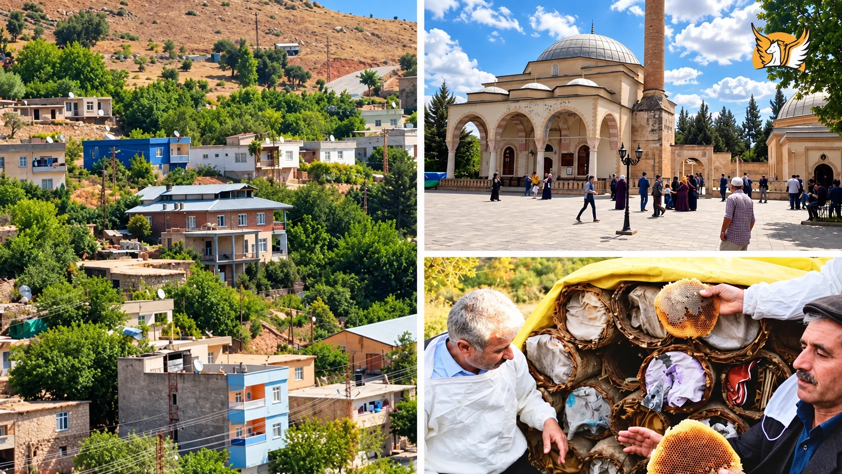
Great Mosque
A Great Seljuk-era complex dated by most sources to 1129. Details below.
Clock Tower
The present tower dates from the 1970s. Its historic clock came from the Great Mosque.
Taşbaşı and Delikli Taş
About 4 km from the city: a natural rock arch and viewpoint over the Botan River.
Siirt Great Mosque: History, Architecture and the Minbar
When and by whom? Most sources date the mosque to 523 AH / 1129 CE and say it was built on the order of the Iraq Seljuk ruler Mughith al-Din Mahmud b. Muhammad Tapar. The exact construction date is not known, so this is an accepted date based on inscriptions and historical records. The "built by the Artuqids" statement found in older guides does not match these sources. The patron named is a ruler of the Great Seljuk line.
Later periods. The mosque was repaired in 1260 (658 AH) by al-Mujahid Ishaq, a judge of Cizre and Seljuk atabeg, and extended into a complex. In the Ottoman period the madrasa cells on the east side were removed and replaced by a two-aisled prayer room, and a clock tower was added in 1905. The General Directorate of Foundations carried out restorations between 1957 and 1980. The leaning minaret was taken down and rebuilt in 1974-1975.
Architecture. The plan follows the Great Seljuk mosque tradition: a dome in front of the mihrab joined to an eyvan, with barrel-vaulted aisles on either side. The central dome is larger than the others and rests on squinches. The exterior is cut stone and the interior is rubble masonry. The minaret has a square base, a cylindrical shaft and three bands of glazed brick. The mosque sits about 3.5 metres below the surrounding ground level, and a wide staircase leads down to its courtyard.
Where is the historic minbar? According to the sources, the walnut minbar dated 611 AH (1214-1215), made with kündekâri joinery, is no longer in the mosque. It is displayed at the Ankara Ethnography Museum. So a line like "greets visitors with its wooden minbar" would be wrong today. Do not expect to see it on site. If you want to see it, check the museum's current display first.
Visiting note: this is a working mosque. Prayer times and Fridays can change access. Dress modestly and follow footwear rules.
Clock Tower, Museum Status and What Else Is in the Centre
The clock tower. A first tower was added to the east side of the Great Mosque in 1905. That tower was lost over time. The present tower was built in 1974-1975 on Hükümet Caddesi, near the old governorate building, and the clock moved there from the mosque. Sources disagree on whether the build year is 1974 or 1975. Older summaries that say "built in 1905, renewed in 1975" treat the two towers as one structure.
Museums. We could not confirm a state museum currently operating in Siirt. Past reports mention finds from local digs being shown in other provinces' museums and a museum being planned for the province. If a museum visit matters to you, ask the Siirt Provincial Directorate of Culture and Tourism for current information.
Old town fabric. Cas, a local plaster-mortar, was used in traditional houses and in the earlier Veysel Karani tomb. Historic cas houses are counted as part of the province's architectural heritage. We could not find a current source on which streets hold them or whether they are open to visitors. A local guide or the culture directorate is the safest route.
Taşbaşı and Delikli Taş. About 4 km from the city centre, this is a rock formation overlooking the Botan River valley. It includes a natural arch formed by erosion, the Taşbaşı Cave beside it, and caves used for shelter nearby. Some sources give its height above the river as roughly 350 metres. The area has been landscaped as a recreation spot with the Siirt Governorship and the Dicle Development Agency. Stay back from cliff edges and keep to landscaped, railed areas.
Older guides describe a "12th-century Cumhuriyet Mosque, formerly Hıdrü'l Ahdar". We could not verify this with a reliable source, so it is not included here.
Tillo: Science, Faith and the Botan View
Tillo is the most distinctive stop in Siirt. It offers more than a viewing platform: an 18th-century madrasa tradition, the story of two scholars, and a mechanism that works with sunlight.
Name and location. The district began as a sub-district in 1953, was renamed Aydınlar in 1964, became a district in 1990 under Law 3647 and was renamed Tillo in the Official Gazette on 7 November 2013. The district centre is about 1,417 metres above sea level and borders Eruh, Şirvan and the central district of Siirt. It covers about 138 km² and had roughly 4,200 residents in 2020.
Madrasa tradition. Tillo has long been associated with madrasa education. İsmail Fakirullah and Erzurumlu İbrahim Hakkı are the best known names from this milieu. The district also holds the tomb of a scholar called Gavsü'l-Memduh. Older guides that say "Sultan Memduh" are wrong: the person named was a scholar, not a sultan.
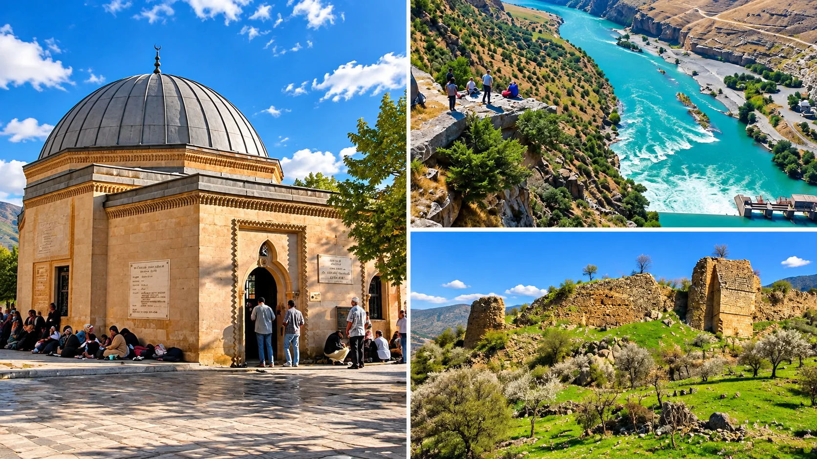
İsmail Fakirullah Tomb
The tomb where the sun event takes place. The mechanism is explained below.
Glass Viewing Terrace
A high view over Botan Valley. Ask about current entry conditions first.
Botan Valley
A canyon system that begins near Tillo and runs through several districts.
İsmail Fakirullah and İbrahim Hakkı
İsmail Fakirullah (1656-1734)
A Sufi and scholar who lived in the 17th and 18th centuries and was one of the leading figures of Tillo's madrasa and lodge tradition. His tomb is in Tillo. He is revered in local belief, and the stories told about him should be kept apart from documented history.
Erzurumlu İbrahim Hakkı (1703-1780)
Born in 1703 in Hasankale, Erzurum, İbrahim Hakkı came to Tillo with his father, became İsmail Fakirullah's student and later his son-in-law, and died in 1780. Sources differ slightly on his place of death, but it is widely reported that he lived in Tillo and that his tomb is there.
The Marifetname. This is the encyclopedic work İbrahim Hakkı completed in 1757. Sources describe it as written in plain Turkish, opening with the existence and unity of God and then covering bodies, minerals, plants and human beings. It presents the solar system in the "new astronomy" (hey'et-i cedide), which makes it notable for its time. Calling him a modern scientist would be anachronistic. He is better described as an Ottoman scholar whose religious learning also took in astronomy and geography.
What Is the Tillo Sun Event?
The sun, or light, event happens twice a year at the equinoxes. The first light of the morning passes through a window in a stone wall and reaches the sarcophagus of İsmail Fakirullah inside the tomb. Poetic phrases about light "dancing" explain little. The mechanism is more interesting.
The wall and window
About 2.5 to 4 km east of the tomb stands a dry-laid stone wall known as Kal'atül Üstad. It has a window of about 40 x 50 cm.
The reflecting tower
Beside the tomb is an eight-sided tower about 10 metres high. Light from the window strikes this tower.
Inside the tomb
Redirected from the tower, the light enters the tomb and illuminates the head of the sarcophagus for about five minutes.
The equinox
Tradition gives 21 March and 23 September. The real astronomical equinox can shift by a day or two from year to year.
Who built it? By tradition, İbrahim Hakkı had the tomb, the tower and the wall built after his teacher İsmail Fakirullah died in 1734. According to sources the mechanism worked until the 1960s. During a restoration in those years the window's position was changed and the event could no longer be seen. In 2011 scientists from TÜBİTAK and universities restored it. The phenomenon has been on UNESCO's World Heritage Tentative List since 2015.
Kal'atül Üstad is not the same as "Tillo Castle". Kal'atül Üstad is the windowed wall that sends light to the tomb, several kilometres away. The place where the glass terrace stands is called "Tillo Castle" in tourism language. Do not mix the two up.
When can you see it? The event is organised under the Siirt Governorship and the Tillo District Governorship. At the September 2026 equinox the programme was held in the district square after dawn prayer, lasted about five minutes at sunrise, and viewers followed it on a screen. If the sky is overcast the event may not occur. Check Governorship announcements for dates and attendance rules. The next equinox is in March 2027, but a programme may not yet have been announced.
In local faith tradition the event is spoken of with reverence. Scientifically, it is an optical mechanism. Both views mean something to visitors. Here, local belief and documented history are kept separate.
Tillo Glass Terrace: What Do You See?
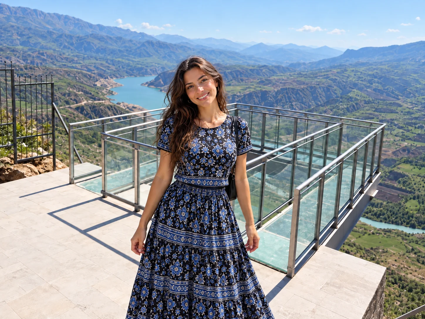
The glass terrace stands at the castle ruin site in Tillo and looks over Botan Valley. Below you see the Botan River running through the canyon and the rocky slopes around it. Some older guides mention a view of a strait. That is wrong: there is no strait at Tillo. The view is entirely of a valley and a river.
Tourism sites say the terrace opened in 2016 with support from the Dicle Development Agency and measures about 7 x 5 metres. The "1,100 metres" figure on the same sites is unclear: it may be elevation or height above the valley floor. The district centre is already about 1,417 metres above sea level and the Botan River runs far below that, so we do not use this number. We could not find an official source for the opening year, opening hours or entry fee. Ask the Tillo District Governorship or the Siirt Provincial Directorate of Culture and Tourism before you go.
When taking photos, follow railing and platform rules and do not lean over the edge.
We could not verify the official protected-area status of the valley lookouts sometimes called "Tillo Nature Park", so this guide relies only on the status of Botan Valley National Park. Some structures mentioned in older guides, such as a "Zemzemil Hassa Hatun place of worship", could not be confirmed with a reliable source and are not included.
Botan Valley National Park and the Botan River
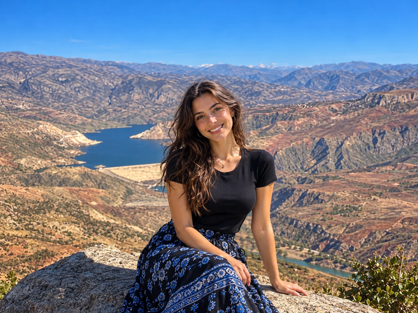
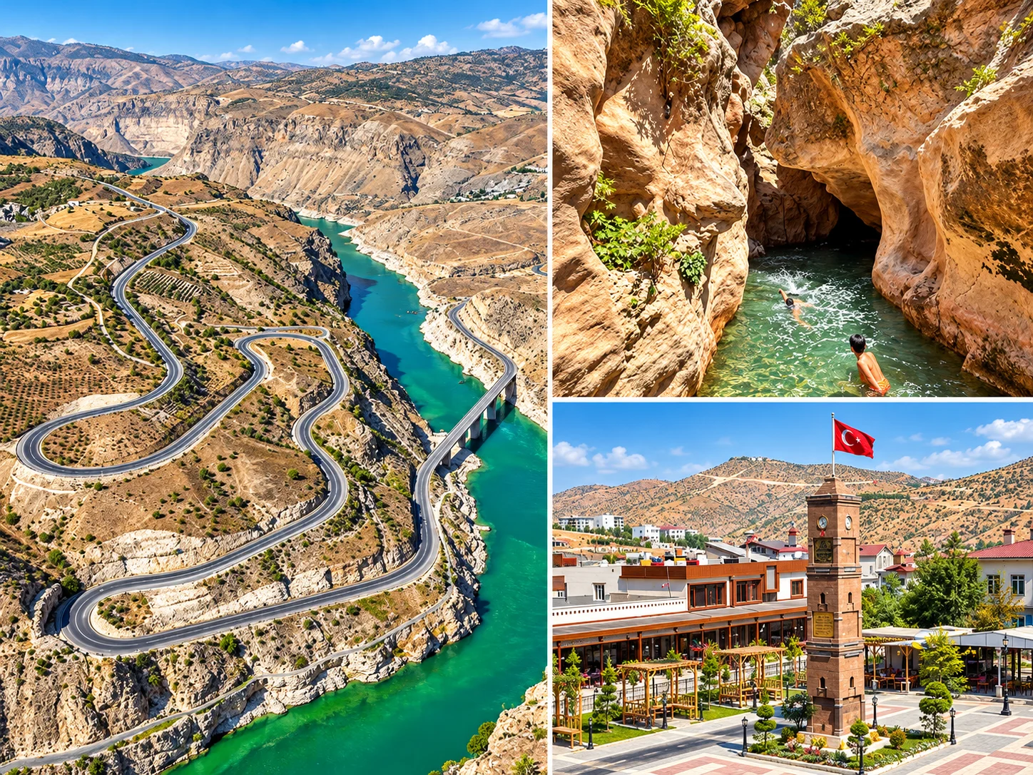
Botan Valley was declared a national park on 15 August 2019 by Presidential Decree No. 1421. The area is about 11,384 hectares. Sources say the park covers parts of the central district, Tillo, Eruh and Pervari. The valley route is about 29 km long, and canyon walls reach roughly 1,000 metres in places. The Botan River runs the full length and opens into the Tigris valley. The park lies between 3 and 19 km from the city centre and can be reached by four different roads.
Sources report more than 800 plant species, with oak, juniper, wild almond and mastic tree given as examples. Fauna listed includes wild goat, caracal, red fox, hawk and golden eagle. We do not give figures for species lists without comparing them against official park records.
What Can You Do?
Sources list walking, marked trails, photography, mountain biking, paragliding and rafting between April and June. Confirm that any activity runs through an authorised operator with current permits. Do not go alone to canyon edges, caves or unauthorised areas.
Can You Camp?
In national parks, camping is allowed only in permitted, designated areas. We could not confirm a current camping permit or camping area for Botan Valley, so we do not offer a general "hiking and camping" recommendation. Ask the park administration and the Siirt Nature Conservation and National Parks branch for current rules.
Where Are the "Botan Caves"?
Older guides present "Botan Caves" as a single visitor site in Şirvan. We could not find such an official site in reliable sources. The name looks like a general label for rock shelters and caves around the Botan River. The closest example to the city is the Taşbaşı Cave and Delikli Taş (Siirt centre). For other caves, visitor facilities and safety are uncertain.
Baykan and Veysel Karani
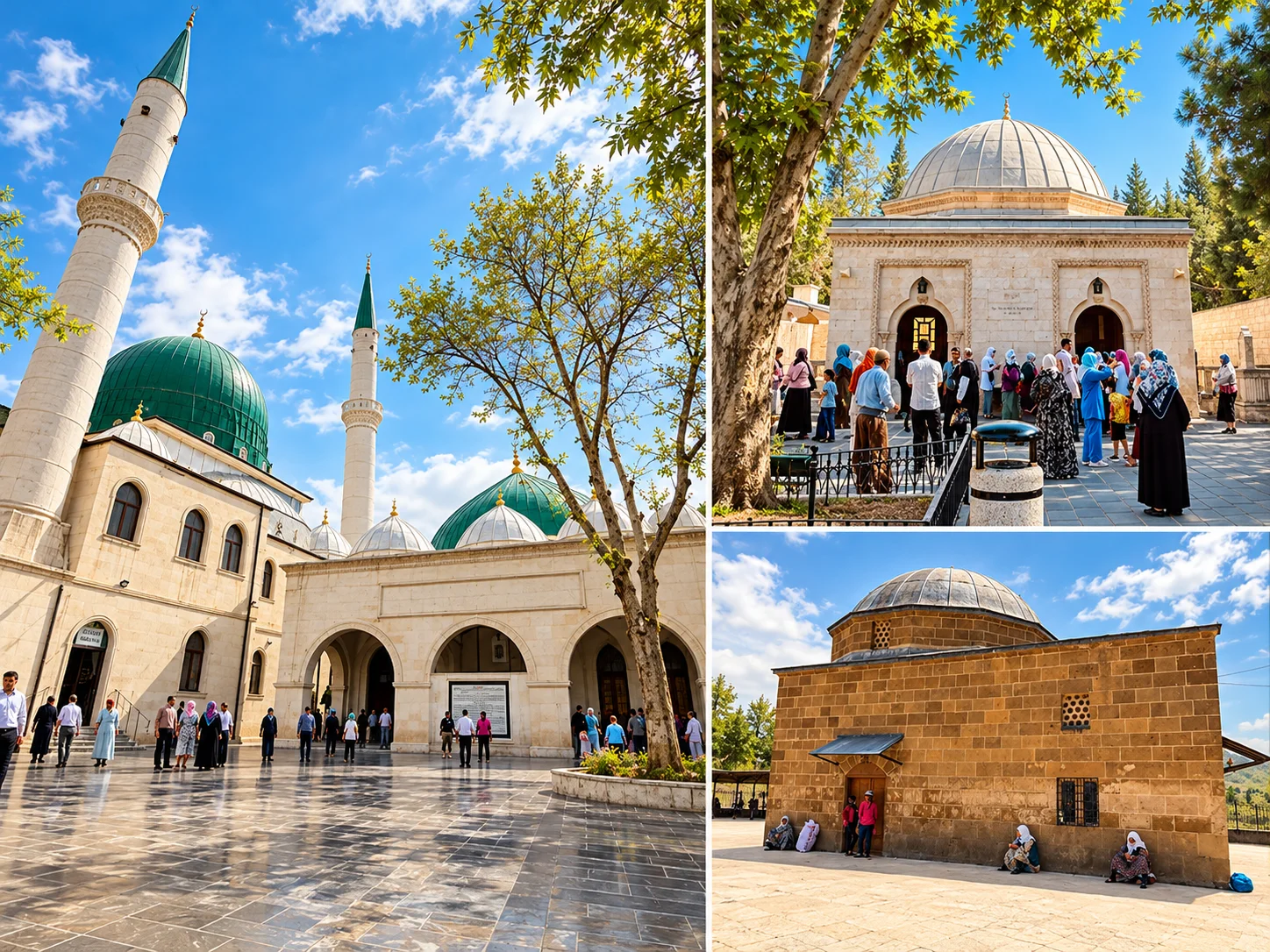
Baykan's best-known site is the Veysel Karani complex in the town of Ziyaret. It includes a mosque, a tomb, an ablution fountain and guest buildings. It lies on the Diyarbakır-Siirt highway, about 40 km from the city and about 8 km from Baykan town. Sources report that no entry fee is charged.
History. The date of the first buildings is unknown. The 10th-century geographers al-Maqdisi and Nasir Khusraw mention a mosque in the area. Evliya Çelebi calls the place "Mescid-i Üveys-i Karanî". Matrakçı Nasuh's 1534 miniature of the Irakeyn campaign shows an octagonal tomb and a two-part domed mosque. The old tomb, built in 1901 with cas mortar and partly rubble stone, was judged unsafe because of damp and demolished in 1967, and a new one was built to the old dimensions. Inside is a wooden sarcophagus attributed to Veysel Karani. The complex has been maintained under the General Directorate of Foundations since 1974, and the interior and surroundings of the tomb were reworked between 1998 and 2001.
Veysel Karani: Read History and Tradition Separately
Uways al-Qarani was a Yemeni figure who lived in the time of the Prophet Muhammad, never met him in person, and is remembered for his devotion to him. Most sources say he was killed at the Battle of Siffin (657) fighting alongside Ali. Some give Raqqa as the place of death. In other words, accounts of where and when he died conflict. For that reason it is more accurate to understand the Baykan tomb as an important pilgrimage site attributed to him in local tradition than to present it as his certain grave. The number of visitors shows how alive that tradition is.
Commemoration days. Commemoration days for Veysel Karani are held each year on 16-17 May, and the complex is at its busiest in spring, especially May. We have not separately confirmed the exact 2026 programme. Expect crowds on those days.
Visiting note. The complex is a working place of worship and pilgrimage. Dress respectfully and keep quiet. Ask about local visiting rules at the entrance.
Derzin (Adakale) Castle
This historic fortress stands on a steep rock in the village of Adakale (Derzin), about 8 km east of Baykan town. It is attributed to the Byzantine period, but that is a belief rather than a certainty. An academic article describes a hilltop complex in the village with a castle, madrasa, mosque, tombs and many gravestones, and links it to the Zirki principality. A car and local knowledge are needed. Research the roads and the state of the structure beforehand.
We could not find a reliable date or location source for the Çarpıran Bridge that older guides place in Baykan. Sources do mention the Dört Ulular Bridge among Baykan's historic bridges. Treat any bridge as an opportunity on the road rather than a planned stop.
Video: scenes from around Baykan, in Turkish. Business and event details shown in it may be out of date.
Kurtalan: The Train and the Arzen Ruins
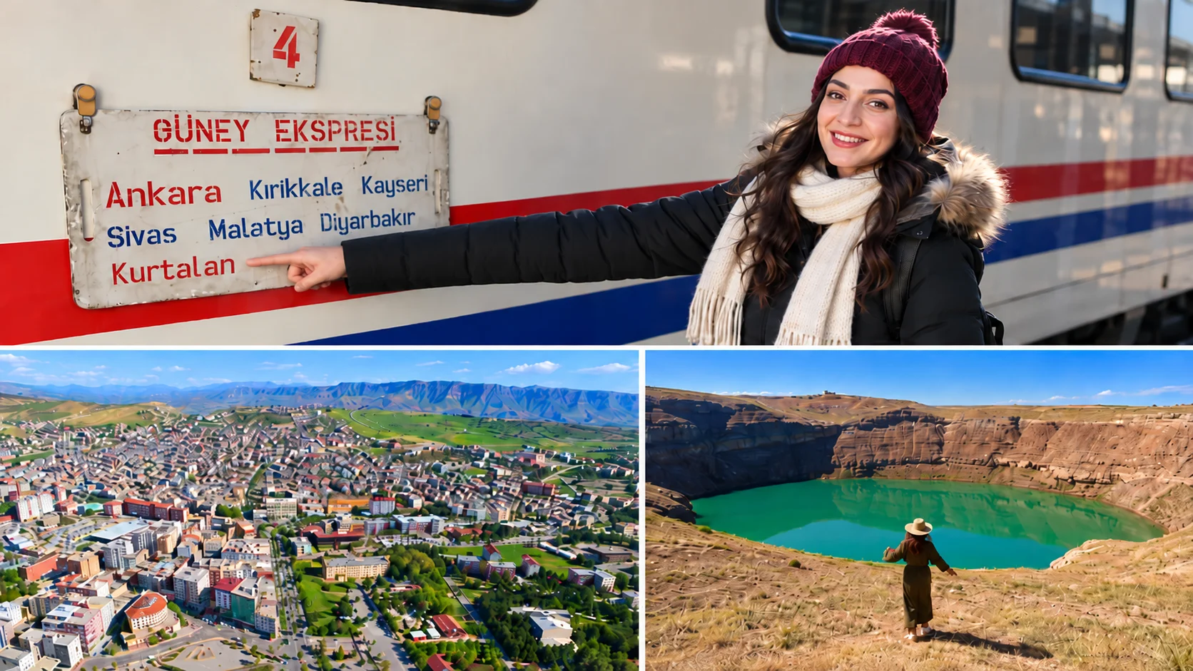
Güney Kurtalan Express
A regular long-distance passenger train from Ankara to Kurtalan.
Arzen (Erzen)
Traces of an ancient and medieval city on the Garzan River. Little is visible.
Onward to Siirt
From Kurtalan station, continue to Siirt city by road.
Is the Güney Kurtalan Express Running in 2026?
Yes, according to sources that list the current timetable, but we could not reach the official TCDD Taşımacılık timetable directly, so confirm days and times yourself. According to secondary timetable sources, the train leaves Ankara at 11:20 on Monday, Wednesday, Thursday, Friday and Saturday and arrives in Kurtalan at 14:10 the next day. The return leaves Kurtalan at about 09:20. The total journey is close to 27 hours. The route runs via Kırıkkale, Kayseri, Sivas, Malatya, Diyarbakır and Batman. The train is made up of pullman, closed couchette, sleeper and dining cars.
It is not a tourist train. The Güney Kurtalan Express is a regular long-distance passenger train. The Touristic Diyarbakır Express, which began in 2025 between Ankara and Diyarbakır, is a separate product and does not go to Kurtalan. Do not confuse the two. For fares and availability use TCDD Taşımacılık's official channels. We do not print a fare here.
The train does not reach Siirt city centre. Kurtalan station is the easternmost railway station in Siirt province and is not in the city. If you take the train you continue from Kurtalan to Siirt by road (roughly 35 km; confirm on a map app). A new Siirt-Kurtalan railway line has been planned but cannot be considered complete, so "the train goes to Siirt" would be wrong.
Arzen (Erzen) Ruins
Arzen is an ancient and medieval city on the Garzan River in Kurtalan district, around the villages of Bozhöyük and Gökdoğan. It does not belong to a single period. In antiquity it was the capital of the Arzanene region. Around 410 it was a Syriac bishopric, and it surrendered to Muslim armies in 640. In the 9th and 10th centuries it was held by local Muslim dynasties and the Hamdanids, and in 942 it was sacked by the Byzantines. By the 12th-13th century the geographer Yaqut al-Hamawi describes it as deserted and in ruins. Today little remains on the surface, the land is largely farmed, and the site is recorded in the cultural inventory.
It would therefore be wrong to call Erzen a "Byzantine site". Know that there is no landscaped archaeological park or museum. If you go, expect an archaeological landscape, go with local help, and treat it as a short stop.
Eruh: Billoris (Sağlarca) Hot Spring and the Botan River Road
The hot spring in the village of Sağlarca, Eruh district, is called "Sağlarca Kaplıcası" by locals and "Billoris" or "Biloris" in sources. It lies on the bank of the Botan River on the Siirt-Eruh road, and sources give a distance of about 15-17 km from the city. The spring water is reported at 30-36 °C. The thermal water has been made usable by enlarging and arranging a natural cave beside the river.
Sources describe the facilities as simple, with no accommodation. That may have changed. Ask before you go whether it is open, what it costs and what the usage rules are. This page makes no statement about health effects. For health-related use, consult a doctor.
Visitor infrastructure in Eruh is limited. Because the district is one of those the Botan Valley passes through, the scenic valley roads are of interest. We found no other verified tourist structure there, so we suggest Eruh as a half-day trip built around the hot spring and the valley route.
Finik Castle is often linked with Eruh, but according to sources it lies in Cizre district of Şırnak, in the Kasrik Valley on the Tigris. It is not part of a Siirt trip. The "Assyrian and Guti reliefs" claim in older guides could not be verified either.
Şirvan: Kormas Castle and the Zivzik Pomegranate
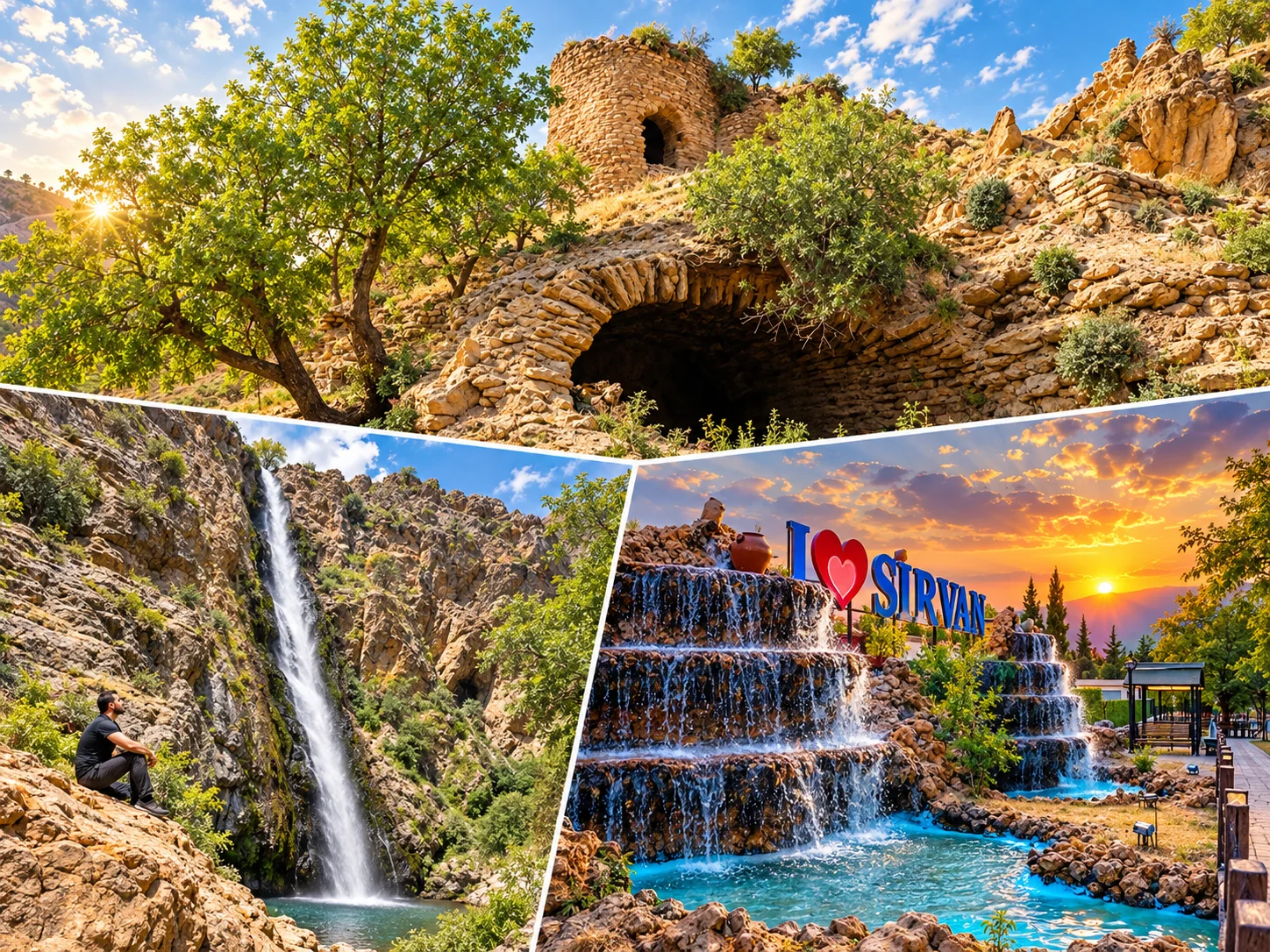
Kormas (İncekaya) Castle. About 10 km from Şirvan town, in the village of İncekaya (Kormas), this hilltop castle commands the village. It has no inscription, so it is believed to be Byzantine. It is said to have been taken later by the Seljuks and used as a refuge for local lords in the Ottoman period. It is often described as château-like. It sits on a rural road, so do not expect visitor facilities.
Mountains. The main mountains of Şirvan include Hasteri, Bardak, Bacavan and Kaş Dağı.
The Zivzik pomegranate. Named after the village of Zivzik (Dişlinar) in Şirvan, the pomegranate received geographical indication status as a designation of origin on 20 May 2026 (registration no. 1861, applicant Siirt Provincial Directorate of Agriculture and Forestry). The protected area is the districts of Şirvan and Pervari. The registered description calls it large-grained, very juicy, sweet and thin-skinned, with low acidity. Harvest runs from late autumn to early winter, and under suitable conditions the fruit keeps for months. We make no health claims.
Older guides mention a "Sason Plateau within Şirvan". We could not verify this. Sason is a district of Batman, and the Sason plateaus belong to Batman. Because we found no plateau of that name in Şirvan, we removed it. The question of the "Botan Caves" is covered in the Botan Valley section.
Pervari: Çemikari Plateau and Pervari Honey
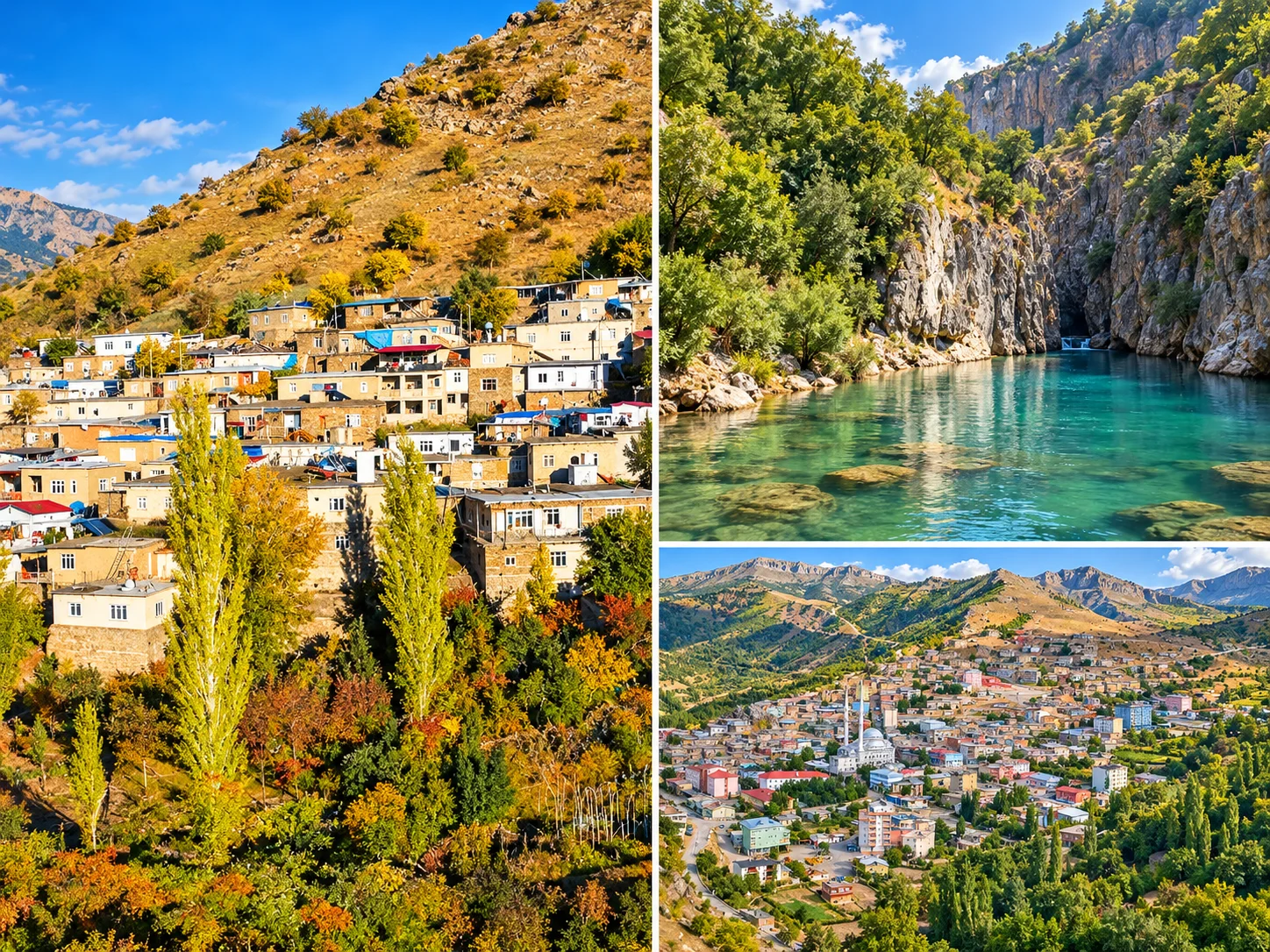
Çemikari Plateau. In Pervari district, on the slopes of Mount Herekol, this plateau is reported in the news at about 2,047 metres. Road works on the Pervari-Kubik-Çemikari-Doğan route have made the news. Road conditions change with the season, so we do not give a fixed drive time such as "1.5 hours". Check road and weather before you set out, and expect cooler air at altitude than in the city. News reports mention honey harvest ceremonies on the plateau. We could not confirm a regular "honey festival".
Pervari honey. Pervari honey is described as a registered product made by the black-hive (kara kovan) method at high altitude. For registration details, see the TÜRKPATENT geographical indications portal. We make no health claims about honey. Its taste and the culture of its production are enough.
In remote mountain districts, access and security restrictions can apply in some areas. Stay on public, marked roads and follow official announcements.
What to Buy in Siirt: Local Products and Geographical Indications
Some of the products below hold geographical indication status. When buying, ask the producer or seller whether the item is registered. We make no health claims for any of them.
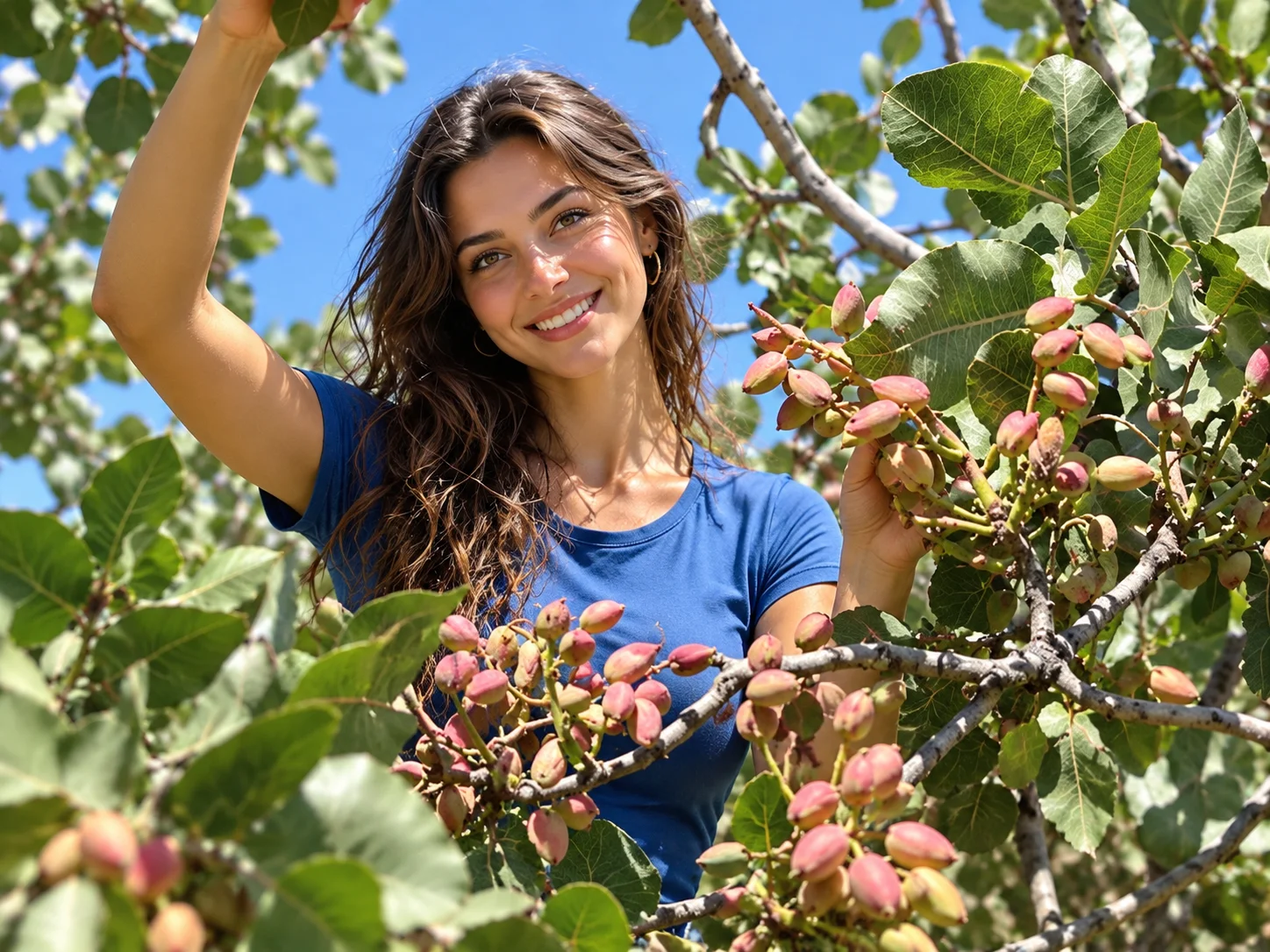
Siirt pistachio. Registered on 4 September 2025 as a designation of provenance (no. 1770). The protected area covers Siirt, Batman, Şanlıurfa, Şırnak, Diyarbakır and Mardin provinces. Locally it is nicknamed "green gold", which is a marketing image.
Siirt blanket. Registered on 15 July 2004 as a designation of provenance (no. 57, applicant Siirt Special Provincial Administration). The official name is "Siirt Battaniyesi", and locally it is also called a "tiftik" (mohair-type goat hair) blanket. For raw material and weaving details, consult the registration document.
Bıttım soap. Registered on 20 May 2025 (no. 1741). According to the registered description, it is made from the oil of the fruit of the wild, ungrafted pistachio tree (bıttım, menengiç or çitlembik), well salt and ash, boiled over a wood fire, and the soaps are left to rest. We treat it as a traditional product. It carries no treatment or care claim, and nothing here suggests an "organic" certificate.
Pervari honey and Zivzik pomegranate. Covered in the district sections above. Prices vary by season, and we do not give prices on this page.
What to Eat in Siirt
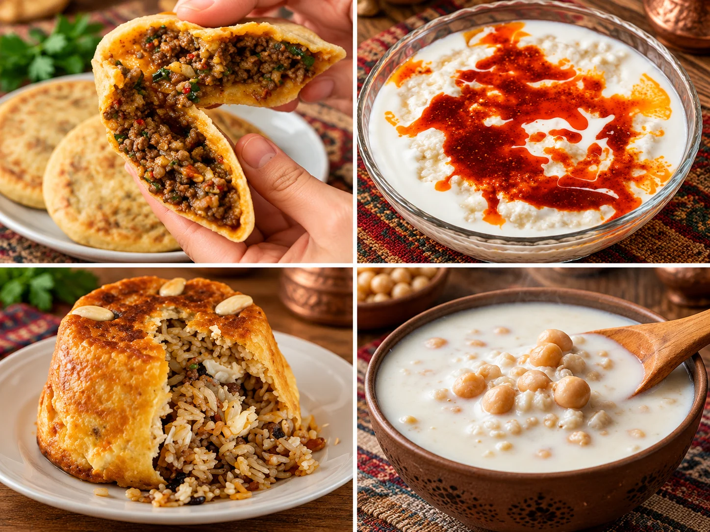
Siirt cooking is broad and still largely rooted in home kitchens. A study at Batman University identified 81 traditional Siirt dishes through interviews. The dishes below are the ones named most often. Methods vary by household and cook, so we do not claim a single "traditional formula" for any of them.
Büryan
Büryan is slow-cooked lamb steamed in a deep pit oven. Siirt büryan kebabı received geographical indication status on 27 July 2003 on the application of the Siirt Special Provincial Administration. Sources say it is made from lamb, steamed in a pit oven (tandır), and that Siirt uses weaned lamb grazed in the highlands. It is usually served early in the morning. Bitlis büryan has its own geographical indication, and the Bitlis side says it is made from goat meat and prepared with rock salt. The two provinces disagree about its origin. We do not state pit depth, diameter or a spice blend without a source.
Perde Pilavı
Perde pilavı ("curtain pilaf") was registered on 15 July 2004 as a designation of provenance (no. 58). It contains rice, chicken (in some accounts partridge), almonds and currants, wrapped in a thin pastry shell and baked in a mould. It is known for being served at weddings and special invitations. The mix can differ from home to home.
Kitel (Stuffed Bulgur Köfte)
Listed among geographical-indication products as "Siirt İçli Köftesi/Kiteli". Its spelling varies in sources: Kitel, Kiftel, Kitelk. It belongs to the içli köfte (stuffed köfte) family. Ask a local cook about the recipe details and the sauce.
Mehir (Mihr) Soup
Counted among Siirt's local soups, spelled Mihr or Mehir. Sources do not give a clear ingredient list, so we do not write one. If you want to try it, ask at a local restaurant.
Gebole
According to local news, Siirt Gebole Tatlısı is among Siirt's geographical-indication products. It is a dessert. We give no details of its composition.
Other Local Dishes
Local sources also list aside (a sweet), bumbar (mumbar) stuffing, Arap dolması, İsmeket köfte, Zerfer, Kiftel Leben, Pırtike soup, İmçerket and Varakkaak. Geographical-indication information is also reported for Tillo Heriresi and Siirt Kuru Ekmeği (dry bread). For details of these dishes, a regional source or a local cook is the most reliable.
| What You Want | Where to Look | Note |
|---|---|---|
| Büryan | Siirt city centre | In the morning. Check that the place is open. |
| Perde pilavı | Local restaurants, weddings and invitations | You may need to order ahead. |
| Kitel and soups | Local restaurants | Ask whether it is on the menu. |
| Desserts | Sweet shops in the centre | Ask a local sweet shop about gebole and aside. |
| Shopping for products | Market streets in the centre | Pistachios, honey, soap and blankets. |
We do not name individual restaurants. The current status of businesses listed in older guides could not be verified, and some turned out to be in a different city. Map reviews and local advice are more reliable for finding a current place.
Where to Stay in Siirt
| Location | Best For | Note |
|---|---|---|
| Siirt centre | The main base for most visitors | Most hotel options are here. Tillo, Botan, Baykan and Kurtalan work as day trips. |
| Kurtalan | Early or late train times | Consider a short stay tied to a train arrival or departure. Choices are limited. |
| Tillo | The sun-event morning | If you plan to attend at a very early hour, research lodging in advance. |
| Other districts | Pervari, Eruh, Şirvan | Lodging supply is limited. Most visitors day-trip from the city. |
We could not verify the hotel lists and facility claims (spa, parking, meeting rooms and the like) in older guides against current official sources, so they have not been carried over. For current prices, availability and features, use booking sites and each property's own channels. Admission rules at public guesthouses such as the teachers' lodge can change, so call ahead.
How to Get to Siirt
| Mode | How It Works | What to Watch |
|---|---|---|
| Air | Siirt Airport was temporarily closed to flights for renovation. The Transport Minister announced its reopening. According to a report dated 12 September 2026, the first passenger flight was Turkish Airlines from Istanbul Airport. | The terminal grew from 1,062 m² to 3,135 m² and annual capacity from 100,000 to 250,000 passengers. Check other routes and times with the airline. Flight lists go stale quickly. |
| Train | The Güney Kurtalan Express runs from Ankara to Kurtalan. | Kurtalan station is not in the city of Siirt. You continue to Siirt by road. |
| Road | The Diyarbakır-Siirt highway passes near Baykan and the Veysel Karani complex. | A sensible approach if you are coming from Diyarbakır or Batman. Check winter conditions. |
| Within the province | In the centre, walking and short taxi rides are enough. | Public transport to the districts is limited. A car or transfer is advised. |
In remote districts, road conditions, the season and access restrictions in some areas can change. In mountain districts such as Pervari and Eruh, do not rely on the weather in the city. If you need intercity transport covering Siirt and its surroundings, see our intercity car with driver service, where the route and price are confirmed in advance. Cab Istanbul is an independent private transport provider based in Istanbul. Our drivers are chauffeurs, not licensed tour guides. Whether a Siirt route can be served is confirmed separately, along with the price. You can also see our car with driver page.
When to Visit Siirt
| Season | What to Expect | Highlights |
|---|---|---|
| Spring | Mild weather and green valley scenery | The April-June rafting period on the Botan, the March equinox, the Veysel Karani commemoration in mid-May |
| Summer | Very hot at low altitude. Climate data put the August average daytime high at about 38 °C. | Early mornings and evenings, cooler plateaus, Pervari and Çemikari |
| Autumn | Milder days and cool evenings | The September equinox and the sun event, the Zivzik pomegranate harvest in early winter |
| Winter | Average January night temperatures in the city are near zero. Colder in the mountain districts, with snow and ice possible. | City and indoor visits. Check road conditions for mountain routes. |
General advice: spring and autumn are the most balanced seasons. That is editorial advice rather than a guarantee. Summer heat can be tiring at low altitude, and conditions in the high districts are not the same as in the city.
1, 2, 3 and 4 Day Itineraries for Siirt
These routes follow the geography: Tillo and Botan share a day, while Baykan and Kurtalan fall on another. Far-apart districts are never squeezed into one day. Check roads and opening status on a map app and with the relevant authorities before you go.
| Plan | Day | Route | Note |
|---|---|---|---|
| 1 day | Day 1 | Morning in Siirt centre (Great Mosque, clock tower) → afternoon in Tillo (tomb area, glass terrace) → Botan Valley view | A full day. If you only want the valley view and Tillo, shorten the centre. |
| 2 days | Day 1 | Siirt centre → Taşbaşı and Delikli Taş → Tillo → Botan Valley | Tillo and Botan can share a day. Plan half or a full day. |
| Day 2 | Baykan (Veysel Karani complex, and Derzin Castle if you wish) → Kurtalan | Depending on train times, Arzen can be a short stop in Kurtalan. | |
| 3 days | Day 1 | Siirt centre + Tillo + Botan | The same as the two-day plan. |
| Day 2 | Baykan + Kurtalan | The same as the two-day plan. | |
| Day 3 | Option A: Eruh (Billoris hot spring, Botan River road). Option B: Şirvan (Kormas Castle, Zivzik in season) | Do not do both. Choose by interest. | |
| 4 days | Day 1 | Siirt centre + Tillo + Botan | The same. |
| Day 2 | Baykan + Kurtalan | The same. | |
| Day 3 | Eruh or Şirvan | The same. | |
| Day 4 | Pervari and Çemikari Plateau | Only if the road is open and the weather suits. Otherwise make it a rest and shopping day. |
Tillo and Botan on the same day. They are close, so this makes a sensible half or full day. Use only landscaped, railed viewpoints.
Baykan and Kurtalan on the same day. Both lie in the western part of Siirt toward Diyarbakır and Batman, so they usually fit into one day. Confirm exact times on a map app. Arzen needs no separate block of time, and a short stop is enough.
Do not combine remote districts in one day. Putting Pervari, Eruh, Şirvan, Baykan and Tillo into a single day is unrealistic because of the mountain roads.
Frequently Asked Questions About Siirt
What are the must-see places in Siirt?
The Siirt Great Mosque, the İsmail Fakirullah Tomb in Tillo where the sun event takes place, the glass terrace in Tillo, Botan Valley National Park and the Veysel Karani complex in Baykan are the core stops. Depending on your interests, add the train journey to Kurtalan and the local food.
How many days do you need in Siirt?
Two days covers the essentials, three is comfortable, and four also reaches remote districts such as Pervari. A single day is limited to the centre and Tillo.
How many districts does Siirt have?
Seven, counting the central district: Siirt centre, Baykan, Eruh, Kurtalan, Pervari, Şirvan and Tillo.
When was the Siirt Great Mosque built?
Most sources date it to 1129 and say it was built on the order of the Iraq Seljuk ruler Mughith al-Din Mahmud b. Muhammad Tapar. The exact construction date is unknown, and the date rests on inscriptions and records. It was repaired in 1260 and extended into a complex.
Where is the Siirt Great Mosque's historic minbar?
According to the sources, the walnut minbar dated 611 AH (1214-1215) is displayed at the Ankara Ethnography Museum, not in the mosque. Check the museum for its current display status.
Is Tillo close to Siirt city centre?
Tillo borders the central district and can be done as a day trip. The road is mountainous and times vary with the weather. Check the current journey time on a map app.
Was Tillo formerly called Aydınlar?
Yes. The sub-district was named Aydınlar in 1964, became a district in 1990 and was renamed Tillo in the Official Gazette on 7 November 2013.
What does the Tillo glass terrace overlook?
It overlooks Botan Valley and the Botan River running through it. Some older guides mention a view of a strait, which is wrong: there is no strait at Tillo.
How high is the Tillo glass terrace?
Tourism sites give "1,100 metres", but it is unclear whether that is elevation or height above the valley floor. The district centre is already at about 1,417 metres. We could not verify an official figure, so we do not give one.
What is the Tillo sun (light) event?
At equinox sunrise the first sunlight passes through a window in a wall called Kal'atül Üstad, is redirected by a tower beside the tomb, and lights the sarcophagus of İsmail Fakirullah for about five minutes. The mechanism is attributed to İbrahim Hakkı.
On what date can the sun event be seen?
Tradition gives 21 March and 23 September. The real equinox can shift by a few days, and the Governorship announces the programme. In September 2026 it was held in the district square after dawn prayer. If it is cloudy, the event may not be visible.
Who was İbrahim Hakkı?
An Ottoman scholar born in 1703 in Hasankale, Erzurum, who became the student and son-in-law of İsmail Fakirullah in Tillo. He is known for the encyclopedic Marifetname, completed in 1757, and died in 1780.
Who was İsmail Fakirullah?
A Sufi and scholar who lived from 1656 to 1734 and was a leading figure in Tillo's madrasa and lodge tradition. His tomb is in Tillo, and the sun event is watched there.
Where is Botan Valley National Park, and when was it declared?
It covers parts of the central district, Tillo, Eruh and Pervari and was declared a national park on 15 August 2019. The area is about 11,384 hectares.
Can you camp in Botan Valley?
We could not confirm a current camping permit or area. In national parks, camping is allowed only in permitted, designated areas. Ask the park administration for current rules.
Where are the Botan Caves?
"Botan Caves" looks like a general label for caves and rock shelters around the Botan River rather than a single official site. We could not confirm the older claim that places them in Şirvan. The closest example to the city is Taşbaşı Cave and Delikli Taş in the central district.
Where is the Veysel Karani Tomb?
In the town of Ziyaret in Baykan district, on the Diyarbakır-Siirt highway, about 40 km from the city and about 8 km from Baykan town.
Is Veysel Karani's actual grave in Siirt?
Sources give conflicting accounts of where and when he died, and most mention the Battle of Siffin (657). The Baykan tomb is an important pilgrimage site attributed to him in local tradition. We do not claim it as a certain grave.
When are the Veysel Karani commemorations held?
Sources say commemoration days are held each year on 16-17 May. We have not separately confirmed the 2026 programme, so check current announcements.
Is the Kurtalan Express running in 2026?
According to current timetable sources the Güney Kurtalan Express is running, leaving Ankara at 11:20 on Monday, Wednesday, Thursday, Friday and Saturday. We could not reach the official TCDD Taşımacılık timetable directly, so check days and times when you buy a ticket.
Does the Kurtalan Express go to Siirt city centre?
No. The train ends at Kurtalan station and does not reach Siirt city. You continue from Kurtalan to the city by road.
Is the Güney Kurtalan Express a tourist train?
No. It is a regular long-distance passenger train. The Touristic Diyarbakır Express between Ankara and Diyarbakır is a separate product and does not go to Kurtalan.
Where are the Arzen (Erzen) ruins?
In Kurtalan district on the Garzan River, around the villages of Bozhöyük and Gökdoğan. Little is visible and there are no visitor facilities.
Where is the Billoris (Sağlarca) hot spring?
In the village of Sağlarca in Eruh district, on the bank of the Botan River beside the Siirt-Eruh road. The spring water is reported at 30-36 °C.
Are the health benefits of the Billoris hot spring proven?
This guide makes no health claims. The site is described as a thermal water source for traditional use. For health-related use, consult a doctor.
Where is Finik Castle?
In Cizre district of Şırnak, in the Kasrik Valley on the Tigris. It is not in Siirt or Eruh.
Where is Kormas Castle?
About 10 km from Şirvan town, in the village of İncekaya (Kormas), on a hilltop. It has no inscription, so it is believed to be Byzantine.
Is Sason Plateau really in Şirvan?
We judge not. Sason is a district of Batman, and we could not verify a plateau of that name in Şirvan.
What is there to see in Pervari?
The Çemikari Plateau, the Mount Herekol area and honey-producing zones stand out. Check road and weather beforehand, and expect cooler air at altitude than in the city.
Does Pervari honey have geographical indication status?
Pervari honey is described as a registered product. For registration details, see the TÜRKPATENT geographical indications portal.
Why is Siirt pistachio so well known?
It was registered on 4 September 2025 as a designation of provenance, and its protected area covers Siirt, Batman, Şanlıurfa, Şırnak, Diyarbakır and Mardin provinces. Locally it is nicknamed "green gold", which is a figure of speech.
What is Bıttım soap?
A traditional soap made by boiling the oil of the fruit of the wild pistachio tree (bıttım, menengiç), well salt and ash over a wood fire. It received geographical indication status on 20 May 2025.
Does Bıttım soap treat eczema or hair loss?
We do not confirm any such claim. The geographical indication record contains no treatment claim. For skin or hair problems, consult a doctor.
How is Siirt büryan prepared?
According to sources, lamb is steamed in a pit oven and usually served early in the morning. Siirt büryan kebabı received geographical indication status in 2003. We do not give pit dimensions or a spice mix without a source.
Why is perde pilavı associated with Siirt?
It is a dish served at weddings and special invitations, made with rice, chicken, almonds and currants wrapped in a thin pastry shell. It was registered as a designation of provenance in 2004.
What are kitel, mehir and gebole?
Kitel is a stuffed-köfte dish of Siirt. Mehir (Mihr) is a local soup. Gebole is cited as a geographical-indication dessert of Siirt. Because recipes vary by household and cook, ask at a local restaurant.
Where should you stay in Siirt?
For most visitors the practical base is the city centre. Lodging in the other districts is limited. Check booking sites and the properties for current prices and features.
Is Siirt Airport active in 2026?
According to a report dated 12 September 2026, it reopened to flights after renovation, with the first passenger flight run by Turkish Airlines from Istanbul Airport. Check airline channels for current routes and times.
Can Siirt be added to the same trip as Bitlis?
Yes, but check distances and road conditions beforehand. Baykan lies on the way toward Bitlis. For nearby southeastern stops, our Türkiye travel guide gives wider context.
Can Tillo and Botan Valley be done in the same day?
Yes. They are close, so combining them is sensible. Plan half or a full day.
Can Baykan and Kurtalan be done in the same day?
It is possible. You can plan the Veysel Karani complex for the morning and Kurtalan for the afternoon. Check your train time and the distances beforehand.