
Aydın–Muğla · Aegean nature & archaeology
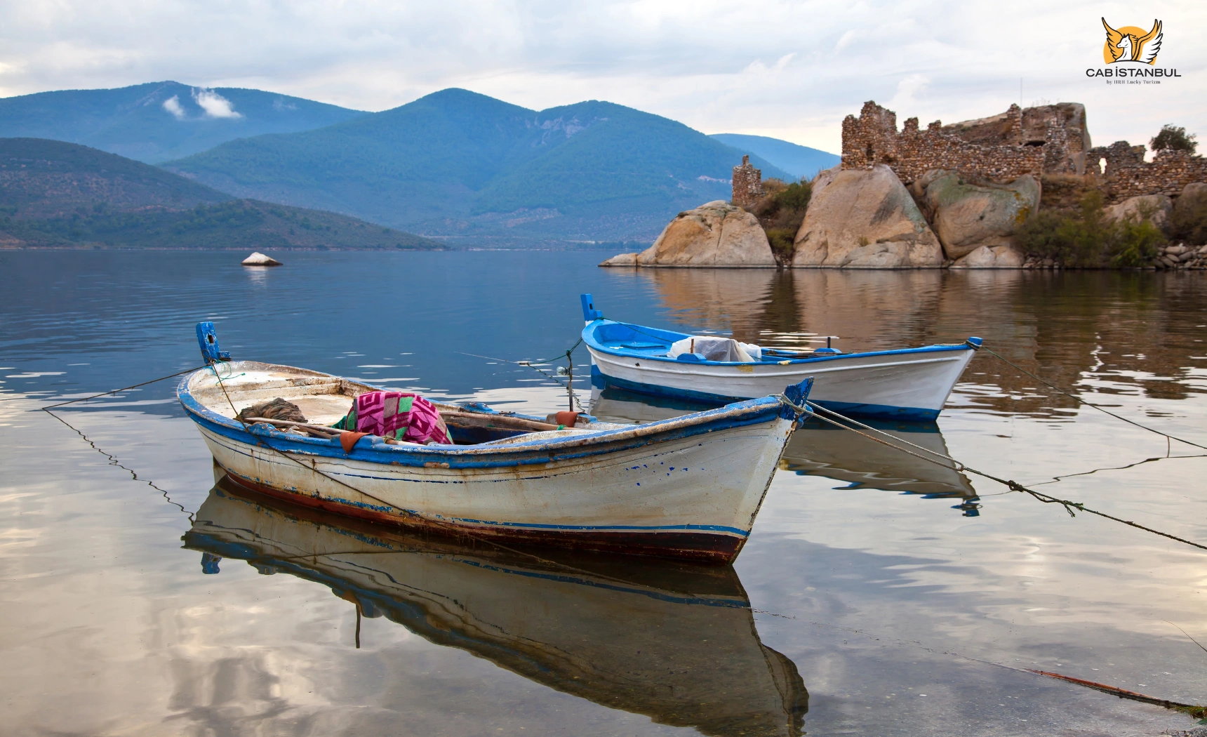
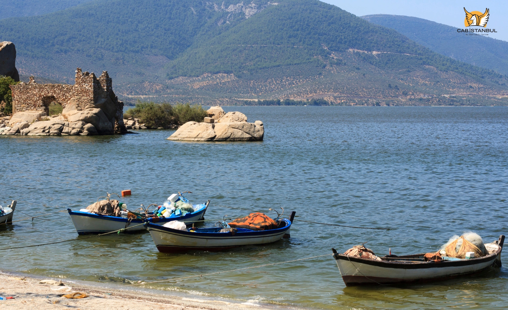
Lake Bafa (Bafa Gölü) is a brackish inland lake on the Aydın–Muğla border — often reached from Bodrum, yet not inside Bodrum. The same landscape holds Lake Bafa Nature Park, the village of Kapıkırı woven through Herakleia under Latmos, and the granite ridges of the Latmos / Beşparmak Mountains. This guide keeps geography honest, separates myth from archaeology, and updates visitor practicals for 2026 without hotel room rates.
Cab Istanbul is an independent transfer and chauffeur provider. It does not operate Bafa pensions, boat tours or Nature Park admissions. A driver is transport — not a licensed archaeology guide. For wider coastal routing, see Aegean coast attractions.
Geography
Where is Lake Bafa — and why “Bodrum” is only a route label?
Most of the lake’s western and northern shores sit toward Söke (Aydın); the eastern heritage shore around Kapıkırı belongs to Milas (Muğla). Local speech also uses Çamiçi Gölü / Çamiçi for the same lake area — an alias, not a second lake.
- Bodrum: roughly 87–90 km / 1h15–1h30 by car — a realistic day trip or overnight add-on, not municipal geography.
- BJV (Milas–Bodrum Airport): about 46–54 km depending on Bafa town vs Kapıkırı.
- ADB İzmir: about 130 km / 2–2.5 hours.
- Didim / Kuşadası / Söke / Milas: all closer corridor hubs than Bodrum for some travellers — see the transport table below.
Video is visual context only — fees, access and conservation rules follow official sources, not clips.
Protected area
Lake Bafa Nature Park — status, year and what it is not
Official name: Bafa Gölü Tabiat Parkı (Nature Park). Declared 8 July 1994 under DKMP / Ministry of Agriculture and Forestry — not 1989. Listed area is about 11,842 ha (sources also cite up to ~12,281 ha). It is not a national park, and this guide does not treat it as a Ramsar listing unless you verify that status separately.
The lake formed when the ancient Gulf of Latmos was cut off by Büyük Menderes alluvium — a gradual late-antique to medieval silting process, not a single calendar year. Today the water is brackish / variable in salinity, surface area roughly 60–65 km², and maximum depth about 20–21 m in scholarly ranges (older “25 m” brochure figures are not used here as the sole depth).
Media often call Bafa the Aegean’s “largest lake.” Safer wording: it is among the largest natural lakes in Aegean Turkey and is frequently described that way — avoid absolute ranking claims without a formal hydrology ranking source.
Popular places
What to visit around Lake Bafa
| Place | Area | Why visit | Practical note |
|---|---|---|---|
| Lake Bafa Nature Park | Aydın–Muğla lake basin | Protected landscape, bird habitat, olive/pine shores | Tabiat Parkı since 1994 — check DKMP entry practice day-of |
| Kapıkırı village | Milas / eastern shore | Living village overlapping Herakleia remains; breakfast and lake views | Best base for walking the ruins without a long transfer |
| Herakleia under Latmos | Kapıkırı | Hellenistic walls, Athena temple, agora, theatre, Endymion sanctuary | DOSIM lists archaeological site as free |
| Athena Temple | Herakleia / Kapıkırı | Well-preserved Hellenistic templum in antis above the shore | Short walk from village lanes — sturdy shoes |
| Endymion sanctuary | ~200 m from Athena Temple | Apsidal cella remains tied to Latmos myth tradition | Myth story is legend; the sanctuary is archaeology |
| Yediler Monastery | Gölyaka / Latmos slopes | Largest Latmos Byzantine monastery complex; fresco traces; hiking goal | Trail hike — water, footwear, heat awareness |
| Latmos prehistoric rock art | Beşparmak rock shelters | Neolithic/Chalcolithic human-family imagery unique in western Anatolia | Conservation sensitive — prefer guided access; no touching/flash |
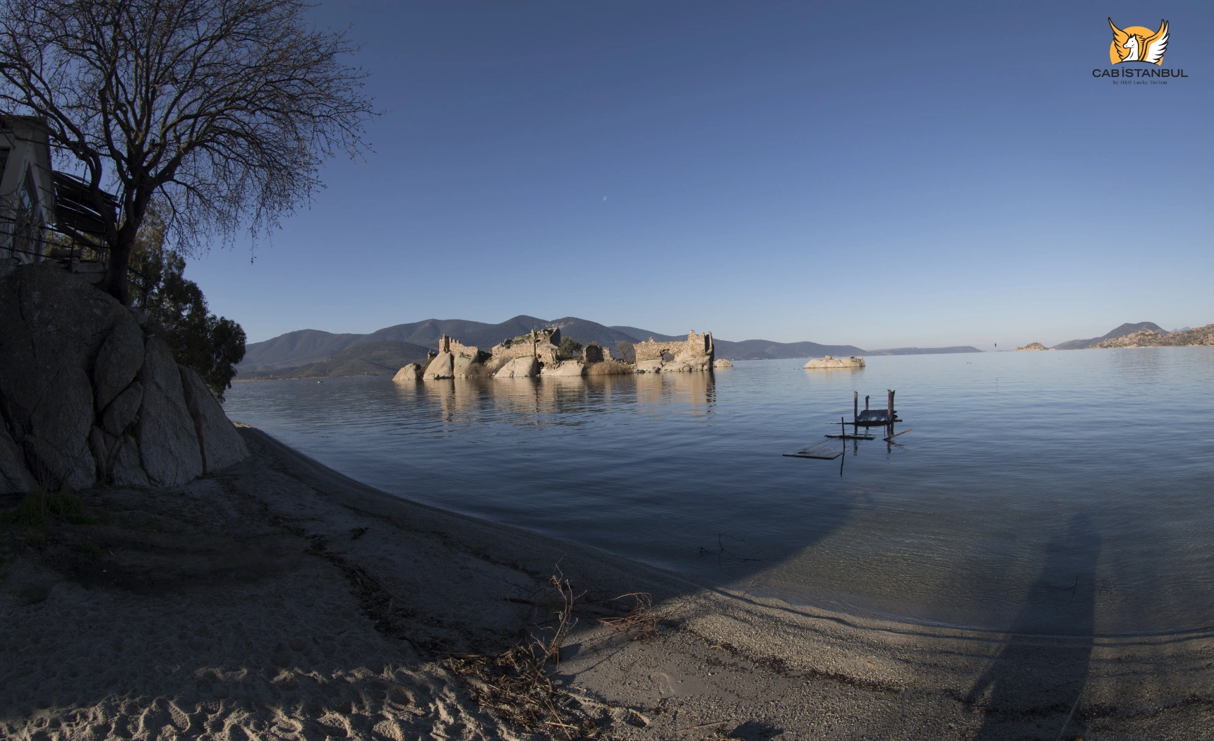
| Lake islets (İkiz, Menet, Kapıkırı, Kahve Asar, Uyuz) | On the lake | Byzantine monastery/defence remains on several islets | Boat access seasonal/private — not a guaranteed daily ferry |
| Beşparmak / Latmos viewpoints | East of the lake | Granite landscape, olive terraces, sunrise/sunset photography | Summit Tekerlekdağ ~1,375 m — multi-hour mountain day, not a casual stroll |
Herakleia
Herakleia under Latmos — the Carian city beside Kapıkırı
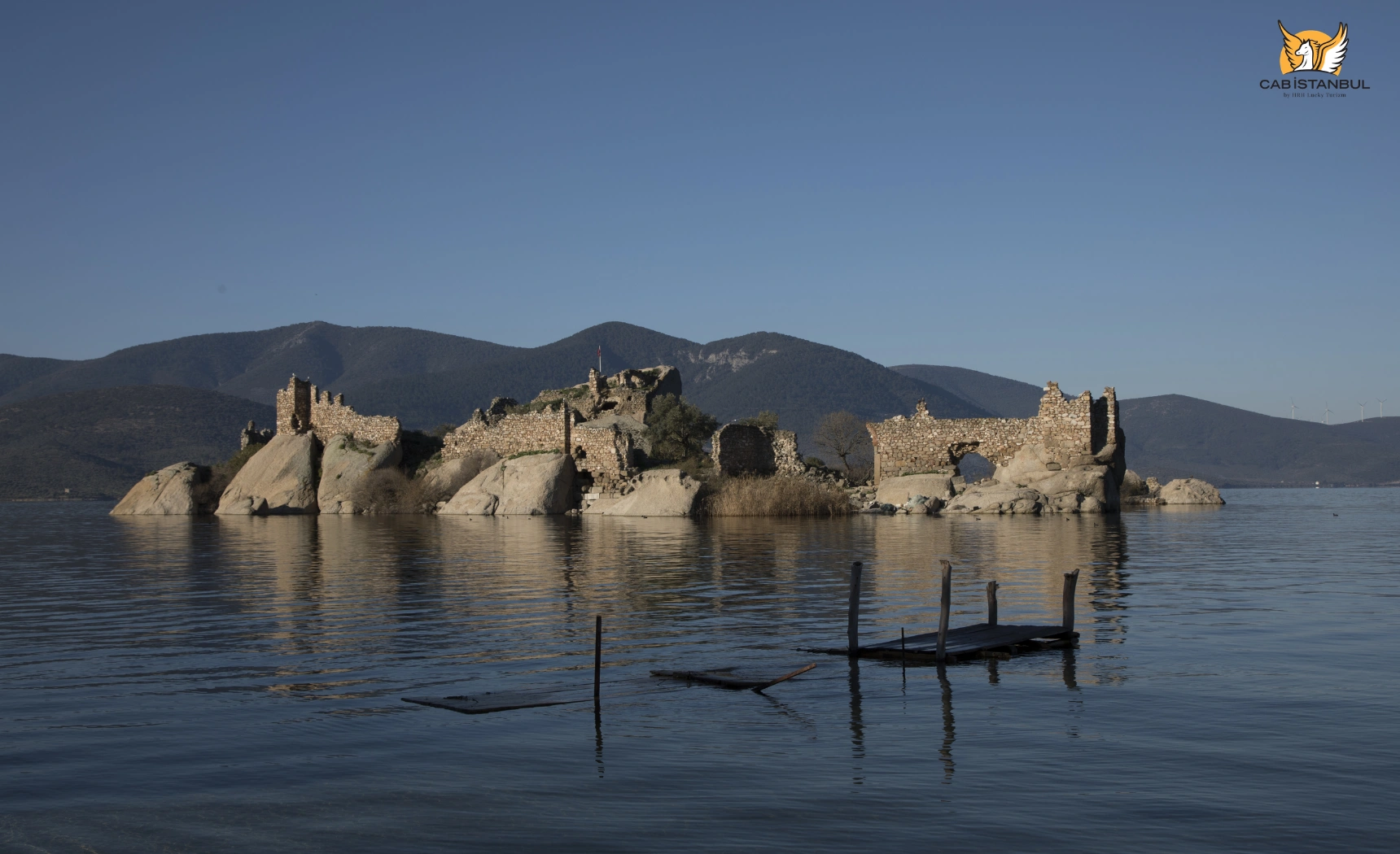
Herakleia under Latmos (Latmos Herakleia / Herakleia ad Latmos) is a Carian city whose earlier name was linked to Latmos. It once faced an open gulf; after silting, the harbour became lake-edge. Hellenistic planners left a grid town wrapped by walls about 6.5 km long with roughly 65 towers.
Visible highlights include the Athena Temple on a rock terrace, the two-storey south side of the agora, the theatre, a bouleuterion, rock tombs along shore approaches, and the Endymion sanctuary. Hilltop fortification / castle remains overlook the village and lake — describe them as fortifications rather than inventing a single “8th-century Byzantine castle” label for every ruin.
Heraclitus belongs to Ephesus, not Bafa. Older marketing that called this region his birthplace is removed here.
| Place / feature | Period / type | Why it matters | Practical note |
|---|---|---|---|
| City walls & towers | Hellenistic fortification | ~6.5 km circuit with numerous towers | Follow marked village paths; uneven stone |
| Athena Temple | Hellenistic sanctuary | Best-preserved temple shell; lake overlook | Inscriptions link the cult to Athena |
| Agora | Hellenistic civic centre | Shop rooms and galleries still readable | East of Athena Temple in village core |
| Theatre | Hellenistic performance | Cavea seating and skene traces | Northeast sector — allow walking time |
| Bouleuterion | Civic council building | Confirms urban institutions beyond temples | Often paired with agora visit |
| Endymion sanctuary | Cult site + myth tradition | Apsidal cella / pronaos remains | ~200 m from Athena Temple |
| Necropolis / rock tombs | Funerary landscape | Tombs cut into bedrock near shore approaches | Easy to miss without slow walking |
| Yediler Monastery | Byzantine monastic complex | Largest Latmos monastery; fresco traces | Approach via Gölyaka trail context |
| Prehistoric rock paintings | Neolithic / Chalcolithic rock art | Human-centred imagery; family scenes | Separate from Byzantine frescoes; guided access preferred |
DOSIM lists Muğla Milas Herakleia Örenyeri as free (checked Sep 2026). Nature Park vehicle/person fees, if collected at a controlled entrance, are a separate DKMP matter — confirm on the day rather than trusting blog TL figures.
Kapıkırı
Kapıkırı village — living overlay on Herakleia
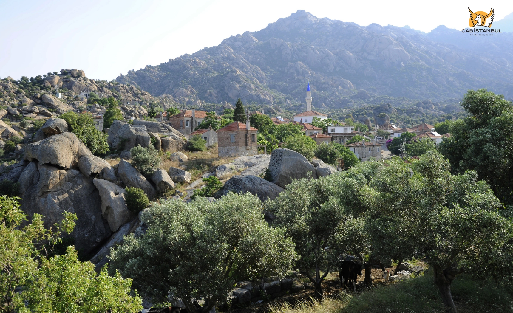
Kapıkırı is a small Milas village whose lanes and houses sit among ancient walls, temples and rock. Tourism, olives, fishing and agriculture share the economy. Exact resident counts change — this guide does not repeat an unverified “300 people” figure.
Stay overnight if you want dawn light on the Athena terrace, quieter birdwatching and time for a Latmos hike. Day-trippers from Bodrum can cover Kapıkırı + main ruins in one long day, but trails and monasteries need a second day.
Myth & mountains
Selene, Endymion and the Latmos / Beşparmak ridge
In mythology, the moon goddess Selene falls in love with the shepherd Endymion on Latmos and grants eternal sleep. Keep that as myth. The Endymion sanctuary below the Athena terrace is the archaeological counterpart — not proof of the story.
Latmos is the ancient name; Beşparmak Dağları is the modern Turkish name for the same mountain system. The high point Tekerlekdağ is commonly cited around 1,375 m (nearby sources vary ~1,367–1,400 m). Hiking season is best in spring and autumn; summer heat and thin water sources make long climbs serious.
Prehistoric rock art — not “180 caves”
Since research led by Anneliese Peschlow from the 1990s, scholars have recorded on the order of 170–220+ rock-art sites / panels across Latmos rock shelters — not a fixed “180 caves” inventory. Popular accounts date many paintings to roughly eight millennia ago (Neolithic / Chalcolithic ranges such as the 6th–5th millennium BCE). Imagery centres on humans and family groups in red ochre, with few animals.
Byzantine Christian frescoes and hermitages are a separate layer. Do not mix them into one “cave art” paragraph. Rock-art access is conservation-sensitive: prefer local guides, avoid publishing fragile GPS pins, and never touch or climb painted surfaces.
Yediler Monastery
Yediler Manastırı, in the Gölyaka sector southeast of Herakleia, is the largest Latmos monastic complex — churches, chapels, cells, cisterns and defensive rock works with fresco traces. Expect a rocky hike (often several hours round-trip depending on start point), not a paved museum path.
Islands & activities
Islets, boats, hiking and what not to promise
Official cultural listings name five lake islets: İkiz Ada, Menet Adası, Kapıkırı Adası, Kahve Asar Adası and Uyuz Ada. Several carry Byzantine remains. Older English labels such as “Karga Asari” are corrected to Kahve Asar.
Boat trips from Kapıkırı are typically seasonal or privately arranged through pensions — not a guaranteed daily tourist ferry. This guide removes the old “official 5 km canoe trail” claim and the unverified “400–500 climbing routes” claim. Granite climbing exists in Latmos culture, but rock-art conservation and archaeology make casual promotion irresponsible.
| Activity | Area | Best season / context | Important note |
|---|---|---|---|
| Village & ruin walks | Kapıkırı / Herakleia | Year-round; cooler mornings | Free archaeological site — sturdy shoes |
| Birdwatching | Shore wetlands / lake basin | Spring & autumn migration peaks | ~261 species often cited for the basin — binoculars help |
| Photography | Athena terrace, olive slopes, lake light | Golden hour; winter clarity | Respect private gardens and nesting birds |
| Latmos / Yediler hiking | Gölyaka–Latmos trails | Spring, September–October | Heat, water, footing — guided options useful |
| Rock-art visits | Selected Latmos shelters | Cooler months | Conservation first; guided preferred |
| Boat outing | From Kapıkırı when available | Calm seasons | Private/seasonal — confirm locally; not guaranteed |
| Kayaking / canoeing | Lake surface where permitted | Calm spring / September | No verified official 5 km marked trail retained here |
| Swimming | — | — | Not recommended as a trip purpose — brackish water and variable quality |
Nature
Birdlife, olives, food and environmental context
Recent public reporting for the basin commonly cites around 261 bird species (older “224+” figures are superseded here as a planning range, not a field checklist). Expect waterbirds, migratory flocks, and seasonal flamingo presence. Spring and autumn are strongest for birdwatching.
This guide removes sensational mammal lists that casually place bears or lynx on the lakeshore without ecological evidence. Focus on verified habitats: wetlands, reed edges, olive terraces and Mediterranean scrub.
Local fishery traditions mention species such as mullet (kefal), levrek and eel (yılan balığı) in cultural listings — wording that as lake fishery context, not as a restaurant menu guarantee. Village breakfasts, olive oil and Milas-area olive culture (including Memecik associations regionally) are the safer culinary story. Exact restaurant directory names are omitted when currency is unclear.
Environmental note for travellers: Bafa’s level and quality respond to Büyük Menderes inflows, drought drawdown and episodic pollution/eutrophication. 2024–2025 coverage described severe shoreline retreat and later rainfall recovery. Visit for landscape and heritage; do not expect a pristine swimming lake.
Nearby archaeology
Miletus, Didyma and Priene — same corridor, different sites
| Site | Relation to Bafa | Why visit | Practical note |
|---|---|---|---|
| Miletus | North-west archaeology corridor | Theatre and Milesian urban landscape | Separate ticketed site — not “inside” Lake Bafa |
| Temple of Apollo Didyma | Didim peninsula south-west | Oracle sanctuary of Miletus | See Didyma / Didim guide |
| Priene | Güllübahçe / Söke ridge | Hellenistic grid city and Athena temple | Steep site — pair with Söke–Bafa road days |
| Euromos (optional) | Milas hinterland | Temple of Zeus in olive landscape | Useful Milas-side add-on if routing allows |
Stay
Where to stay near Lake Bafa — no room rates
| Stay | Area | Style / best for | Key current features |
|---|---|---|---|
| Selenes Pansiyon | Kapıkırı | Lakeside pension / nature base | Lake views, restaurant, pool, trailhead access |
| Agora Pansiyon | Kapıkırı | Family guesthouse / food-focused stay | Long-running family house beside Herakleia; rooms + bungalows |
| Silva Oliva Hotel & Farm | Pınarcık / lakeside olive belt | Small hotel in olive landscape | Farm-hotel character, restaurant, lake-area base outside Kapıkırı lanes |
| Lakeside olive-grove hotels (e.g. Natura-type stays) | Pınarcık / park shores | Quiet nature overnight | Confirm current name and open status when booking |
Nightly prices, OTA scores and package rates are omitted by policy. Book directly with properties. Cab Istanbul does not sell hotel inventory.
Getting there
Transport — Bodrum, BJV, Söke, İzmir and Istanbul
| From | Approx distance / time | Practical note |
|---|---|---|
| Bodrum → Kapıkırı / Lake Bafa | ~87–90 km / ~1h15–1h30 | Corrected from “40 minutes” brochure claims — traffic and start point matter |
| Milas → Bafa / Kapıkırı | ~25–40 km | Closest major town hub; minibuses on Söke–Milas corridor |
| BJV airport → Bafa / Kapıkırı | ~46–54 km / ~35–75 min | Best air gateway; taxi or rental car |
| Söke → Bafa | ~40 km | Useful Aydın-side approach |
| Kuşadası → Bafa | ~60 km / ~1–1.5 h | See Kuşadası trip guide |
| Didim → Bafa | ~30–48 km | Common half-day add-on from Didim bases |
| ADB İzmir → Bafa | ~130 km / ~2–2.5 h | Secondary airport when İzmir is your hub |
| Istanbul → Bafa | Fly BJV (~1 h air) + road; or ~610+ km drive | Coach often 10–12+ h — flying is usually saner |
| Istanbul airport / city chauffeur products | — | Istanbul Airport transfer and car with driver in Istanbul are Istanbul products — not BJV/ADB shuttles |
| Multi-day Türkiye chauffeur | Istanbul–Aegean chains | Intercity car with driver in Turkey — transport only |
For Bodrum overnight context see the Bodrum travel guide. Cab Istanbul has no local Bodrum/Bafa branch and does not sell a “Bodrum–İzmir Airport Transfer to Bafa” product under that Istanbul transfer brand.
Itineraries
Best time, duration and sample 1–2 day plans
- Spring: hiking, bird migration, mild temperatures.
- Early summer: long light; start trails early.
- July–August: heat stress on Latmos paths — prefer lake-edge archaeology mornings.
- September–October: strong second season for walking and photography.
- Winter: quiet village atmosphere; short days; check road/trail conditions.
| Plan | Outline | Tip |
|---|---|---|
| Half day | Kapıkırı lanes → Athena Temple → lake overlook → coffee | Works from Didim or Milas; tight from Bodrum |
| 1 day | Kapıkırı + Herakleia circuit + shore birdwatching + sunset | Realistic Bodrum day trip if you leave early |
| 2 days | Day 1 Herakleia/Kapıkırı; Day 2 Yediler or guided rock-art hike | Overnight in Kapıkırı or Pınarcık olive belt |
| Archaeology combo | Bafa morning + Miletus or Didyma afternoon | Do not overpack Priene the same day unless you start very early |
Kapıkırı only: 3–5 hours on foot among ruins and village lanes.
Kapıkırı + Yediler: full day with hiking fitness.
Bodrum day trip: budget ~3 hours road round-trip plus 4–5 hours on site — overnight is kinder.
FAQ
Lake Bafa — frequently asked questions
Where is Lake Bafa?
On the Aydın–Muğla border in south-west Türkiye. Kapıkırı / Herakleia sit on the Milas (Muğla) eastern shore; much of the western basin relates to Söke (Aydın).
Is Lake Bafa in Bodrum?
No. It is a separate destination roughly 87–90 km from Bodrum — a day trip or overnight from Bodrum resorts, not a Bodrum neighbourhood attraction.
Is Lake Bafa in Aydın or Muğla?
Both. The Nature Park and lake basin span the provincial border. Kapıkırı is in Milas/Muğla.
What is Lake Bafa Nature Park?
A Tabiat Parkı (Nature Park) declared 8 July 1994, managed under DKMP — about 12,000 ha class scale (DKMP list figure 11,842.07 ha).
Was Lake Bafa once part of the Aegean Sea?
Yes in geological/historical terms: it was the Gulf of Latmos, later closed by Büyük Menderes alluvium into an inland/lagoon lake.
How deep is Lake Bafa?
Scholarly ranges centre on about 20–21 m maximum depth. Older “25 m” brochure figures are not treated as the sole authority here.
What is Herakleia under Latmos?
A Carian ancient city at Kapıkırı with Hellenistic walls, Athena Temple, agora, theatre and Endymion sanctuary — once a gulf harbour, now lake-side.
Is Kapıkırı built inside the ancient city?
Yes in practical terms — modern houses and lanes interleave with Herakleia remains.
Is there an entrance fee for Herakleia?
DOSIM lists Muğla Milas Herakleia Örenyeri as free (checked Sep 2026). Nature Park control points are separate — confirm DKMP practice on the day.
Who was Endymion — and is the Selene story history?
Mythology. Selene and Endymion are a Latmos love/sleep legend. The sanctuary ruins are archaeology; the love story is not historical fact.
Are the Latmos rock paintings prehistoric?
Yes — Neolithic/Chalcolithic rock art studied since the 1990s, with popular dating around ~8,000 years. They are not the same as Byzantine frescoes.
How many rock-art sites are there?
Research inventories speak of roughly 170–220+ sites/panels — not a frozen “180 caves” count.
Can visitors freely access every rock-art site?
Not responsibly. Many locations are fragile. Prefer guided visits, avoid damaging GPS shares, and never touch paintings.
What is Yediler Monastery?
The largest Latmos Byzantine monastery complex near Gölyaka — churches, cells and fresco traces reached by hiking trails.
How many islands are in Lake Bafa?
Official listings name five: İkiz, Menet, Kapıkırı, Kahve Asar and Uyuz.
Are regular boat trips available?
Usually seasonal or private via local pensions — not a guaranteed daily public boat service.
Can I kayak on Lake Bafa?
Sometimes arranged privately in calm seasons, but this guide does not retain an official “5 km canoe trail” claim.
Can I swim in Lake Bafa?
Not recommended as a trip purpose. Water is brackish and quality/level vary with drought and inflows.
Is Lake Bafa good for birdwatching?
Yes — especially in migration seasons. Flamingos and many waterbirds are part of the visitor narrative.
Are there bears around Lake Bafa?
This guide does not claim bears (or casual lynx lists) for the lakeshore without strong ecological evidence.
Was Heraclitus born at Bafa?
No. Heraclitus is associated with Ephesus. The old birthplace claim is removed.
What is the best time to visit?
Spring and September–October for hiking and birds; summer for early-morning archaeology only if you accept heat.
How long should I spend?
Half day for Kapıkırı highlights; 1 full day for ruins + shore; 2 days if adding Yediler or rock-art hiking.
Where can I stay?
Kapıkırı pensions such as Selenes and Agora, plus olive-belt hotels like Silva Oliva near Pınarcık — no room rates published here.
Which airport is best?
BJV (Milas–Bodrum) is the practical primary choice. ADB İzmir works as a longer secondary option.
How do I travel from Istanbul?
Fly to BJV, then drive/taxi ~46–54 km. Overland coach or multi-day chauffeur is possible but long. Use intercity chauffeur only as transport — not as a Bafa tour package.
Can I combine Lake Bafa with Miletus or Didyma?
Yes on a careful day or two-day plan. See the Didyma guide for sanctuary fees and Didim geography.
Do I need a car?
Strongly helpful for Kapıkırı, monasteries and birding pull-offs. Minibuses serve the Söke–Milas corridor but last-mile options thin out.
Is a licensed guide useful for Latmos rock art?
Yes for conservation and route-finding. A Cab Istanbul chauffeur is not a licensed cultural guide.
What does Çamiçi mean here?
Çamiçi Gölü / Çamiçi is a local alias for the Bafa lake area — same primary entity, not a second lake.
Next step
Plan Lake Bafa as nature + Herakleia — then add Bodrum only as a base
Keep the labels straight: Lake Bafa Nature Park on the Aydın–Muğla border, Kapıkırı as the living eastern-shore hub, and Herakleia under Latmos as free archaeology woven through the village. Use Latmos for rock art and Yediler only with hiking honesty; treat boats as seasonal; skip swimming marketing; and fly BJV when coming from Istanbul. For coastal context read Bodrum, Kuşadası and Aegean coast attractions — then arrange local road legs yourself or an intercity chauffeur for multi-day Türkiye routing without confusing Istanbul airport products for BJV shuttles.