
Ayder Plateau (Ayder Yaylası) is one of Turkey's most visited highland destinations — a 1,350-metre high settlement in Çamlıhemşin district, Rize, that draws visitors with natural hot springs, a famous bridal-veil waterfall, dense spruce and beech forests, and direct access to the trekking routes of the Kaçkar Mountains. It is not a hidden secret, but what it offers — the combination of thermal bathing, highland walks, and a genuinely dramatic mountain landscape — remains compelling.
Where Is Ayder Plateau?
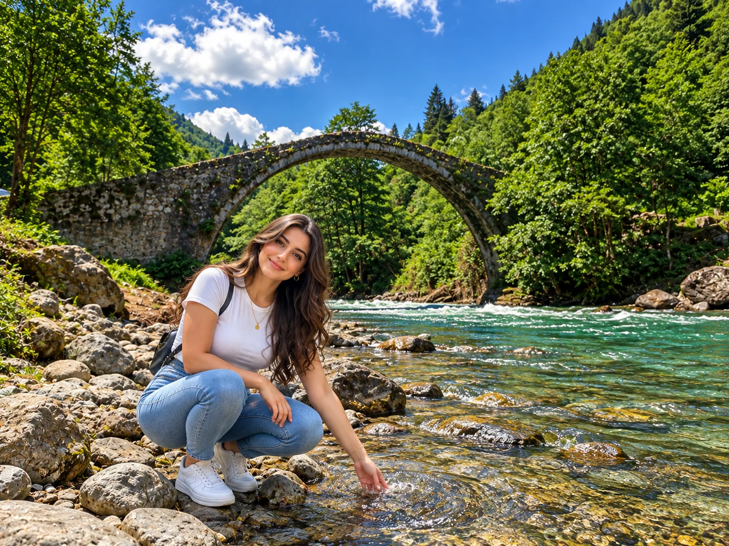
Ayder is in the Çamlıhemşin district of Rize province, in Turkey's Eastern Black Sea region. It lies approximately 87 kilometres from Rize city centre and 19 kilometres from the Çamlıhemşin district seat. This means Ayder is a Rize destination — not a Trabzon one — though many visitors travelling from Trabzon pass through the region on their way here.
The plateau falls entirely within Kaçkar Dağları Milli Parkı (Kaçkar Mountains National Park), established by Council of Ministers decree on 11 July 1994. The park covers 51,550 hectares and encompasses the high alpine terrain, glacial lakes, dense forests, and highland settlements — including Ayder — of the Eastern Kaçkar range. This protected status shapes how development and land use operate in and around the plateau.
Administratively, Ayder is a mahalle (district) of Çamlıhemşin — a small municipality with a long tradition of yayla culture, Hemşin heritage, and highland hospitality. The surrounding district is home to several other notable yaylas at varying altitudes, making Çamlıhemşin a natural hub for anyone exploring the Kaçkar landscape.
The Kaçkar Mountains and Ayder's Natural Setting
The Kaçkar Dağları are the highest range on Turkey's Black Sea coast. The main Kaçkar peak reaches 3,937 metres, with glaciated high terrain above the treeline, alpine lakes, and valleys that drop sharply back toward the sea. Ayder, at 1,350 metres, sits in the lower-alpine zone — high enough to feel genuinely different from the coast, but accessible year-round by paved road.
The forests covering the slopes around Ayder are primarily ladin (oriental spruce) and kayın (beech), with dense woodland giving way to subalpine meadows at higher elevations. The combination of high annual rainfall, cool temperatures, and varied altitude makes the ecosystem here exceptionally rich — the Kaçkar range is one of the most biodiverse mountain zones in Turkey. Wildflower blooms across the high yaylas in June and July are particularly striking.
The climate at Ayder follows the Eastern Black Sea pattern: wet and mild, with fog and cloud common even in summer. Temperatures are significantly cooler than the coast at the same time of year, and brief afternoon showers are normal even in July and August. This is part of what makes the landscape so intensely green.
Gelintülü Waterfall
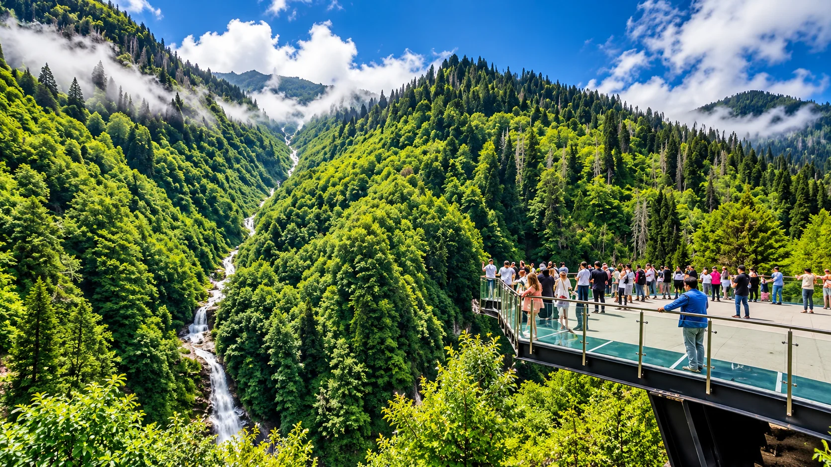
Gelintülü Şelalesi (Bridal Veil Falls) is the waterfall most closely associated with Ayder. It falls in a tall, narrow cascade down a forested cliff face — the slender, flowing shape that gives it its name. There is a dedicated viewpoint (seyir terası) from which the full drop is visible, and on clear days the waterfall is visible from parts of the plateau itself.
The waterfall is most powerful in late spring and early summer when snowmelt maximises flow; by August it loses some volume but remains an impressive sight. The path from Ayder to the viewpoint is well-worn and takes around 30–45 minutes on foot at a comfortable pace. The waterfall and the surrounding forest make it the most photographed landmark in the area — and a worthwhile stop at any time of year when the plateau is accessible.
The name "Gelintülü" — meaning "with a veil" or "bridal veil" — refers to the appearance of the cascade itself: fine, flowing water that resembles the sweep of a bridal veil against the dark green of the surrounding forest. It is part of the same Hemşin cultural landscape that gives the whole district its distinctive character.
Ayder Hot Springs
Ayder has been associated with thermal bathing for generations. The Ayder Kaplıcaları (hot springs) are located within the yayla settlement and have been developed into organised bathing facilities with separate sections for men, women, and private family use. The cure pools operate at temperatures of approximately 37–40°C, and the facilities are open year-round — making Ayder a winter destination as well as a summer one.
A newer thermal facility — the Tenzile Erdoğan Termal Tesisleri — has also been opened in the area. This modern complex has fully separate men's, women's, and children's sections and serves up to 400 visitors at a time. Visitors can choose between the traditional kaplıca experience and the larger modern facility depending on preference.
The thermal bathing experience at Ayder is one of the plateau's defining attractions — the combination of mountain air and warm mineral water, particularly after a day of walking, is genuinely restorative. No specific medical benefits are claimed here; the springs are valued for the comfort and relaxation they offer.
Things to Do in Ayder
Ayder's activities divide between the plateau itself and the wider Çamlıhemşin and Fırtına Valley area. Within the plateau, the main draws are the hot springs, the Gelintülü viewpoint trail, highland walks through the surrounding meadows and forests, and the food and accommodation of the yayla settlement. Local guesthouses and mountain restaurants serve Karadeniz breakfasts and regional dishes; the kahvaltı (breakfast) culture in the highland lodges is particularly celebrated — fresh butter, local honey, eggs, and cheese eaten at altitude with mountain air around you.
Beyond the plateau, the surrounding area offers white-water rafting on the Fırtına Deresi (operated by guides based in Çamlıhemşin and Ardeşen between spring and early autumn), visits to Zilkale castle in the upper Fırtına Valley, hiking toward higher yaylas such as Pokut and Sal, and the Palovit waterfall just 8 kilometres away. A two- or three-day stay in Ayder is the natural frame for combining all of these.
Fırtına Valley and the Stone Bridges
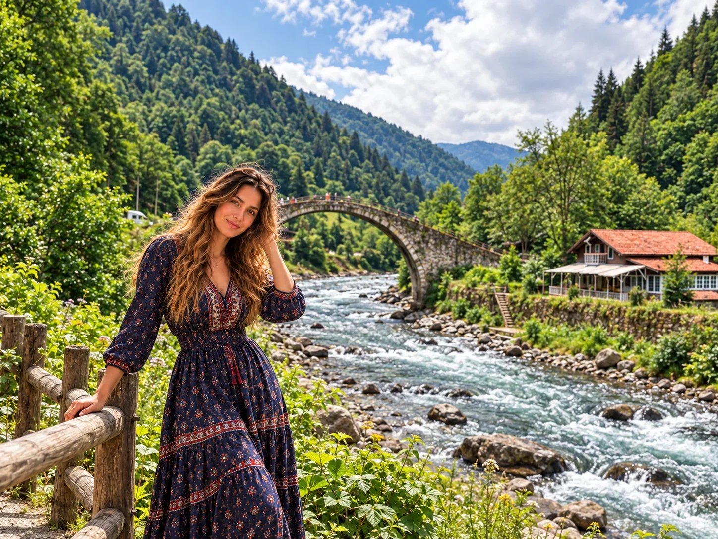
The road from the coast to Ayder runs through Fırtına Vadisi (Fırtına Valley — "Storm Valley"), and this journey is itself one of the region's major experiences. The Fırtına Deresi runs fast and clear between steep, forested walls, and the valley road passes a series of traditional taş kemer köprüler (stone arch bridges) — some dating to the 18th century — that still carry vehicles and pedestrians across the river at various points.
The valley is also the setting for white-water rafting: the Fırtına Deresi offers challenging rapid runs, and guided half-day and full-day trips are organised by operators based in Çamlıhemşin and Ardeşen. The rafting season runs approximately from late April through September, subject to water levels. The combination of the drive up, the bridges, and the option to raft makes the Fırtına Valley as much a destination as Ayder itself.
Zilkale: The Medieval Castle
Zilkale stands at approximately 750 metres altitude in the upper Fırtına Valley, on the steep rocky slopes that close in as the road climbs toward the high country. Its origins are debated; most historians place it in the medieval period, and the castle's function likely related to controlling access through this strategic valley passage. The structure is largely intact and the trail to it passes through the same dense forest that characterises the valley.
Zilkale is reachable as a day excursion from Ayder — the drive back down through Fırtına Valley combined with a stop at the castle and the stone bridges makes for a full half-day. The view from the castle walls across the forested valley is one of the more striking panoramas in the region. Given Zilkale is in the valley below Ayder's altitude, it sits in a distinctly different microclimate — usually warmer and sunnier in summer.
Palovit Waterfall
Palovit Şelalesi is located approximately 8 kilometres from Ayder, making it one of the easiest day excursions from the plateau. The waterfall drops over a broad, stepped rock face in a wide, fan-shaped cascade — a different character entirely from the narrow Gelintülü. At peak flow in spring, the power and noise of Palovit is considerable; by late summer it settles into a more modest display, but remains worth the short drive.
The route to Palovit from Ayder passes through the same Çamlıhemşin highland landscape — forested slopes, glimpses of the surrounding peaks, and the general atmosphere of the Kaçkar interior. Combined with Gelintülü, it is reasonable to visit both waterfalls in the same day.
Nearby Highlands: Pokut, Sal, Huser, Kavrun and Elevit
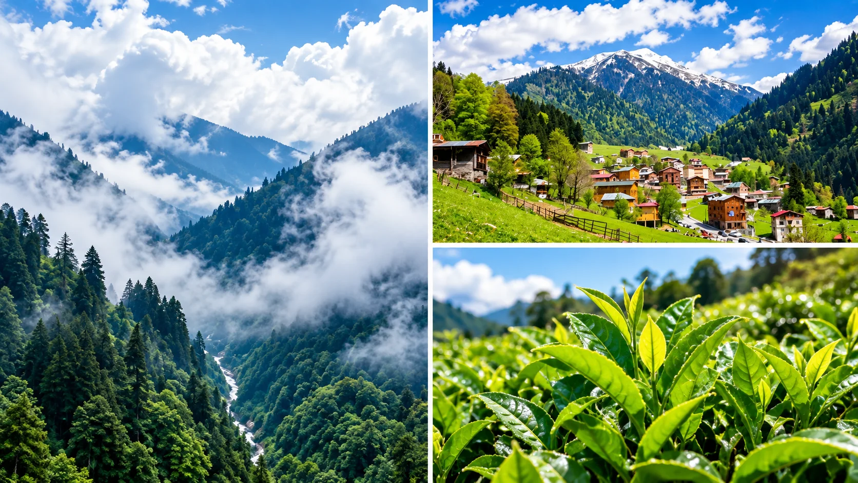
Çamlıhemşin district has several other notable yaylas beyond Ayder. Pokut and Sal yaylaları are reached via a different fork from Çamlıhemşin (the road toward Ayder splits from the Pokut–Sal direction at the district centre). Pokut and Sal are quieter and less developed than Ayder, with traditional wooden architecture and unobstructed mountain views. Walking between Pokut and Sal takes approximately 15 minutes along the ridge.
Huser Yaylası (also written Avusor) is located roughly 12 kilometres from Ayder and can be reached either by a 2–3 hour hiking trail from behind the plateau or by vehicle. Kavrun and Elevit are further options in the broader Kaçkar landscape.
Road conditions: Ayder itself has a well-maintained paved road. The secondary roads to Pokut, Sal, Huser, and Kavrun are stabilised dirt tracks with steep gradients and narrow bends — a high-clearance 4x4 vehicle is strongly recommended for these, and some are not navigable by standard saloon cars. Local guides with 4x4 vehicles are available in Çamlıhemşin for those wanting to reach the higher yaylas.
Breakfast and Local Cuisine in Ayder
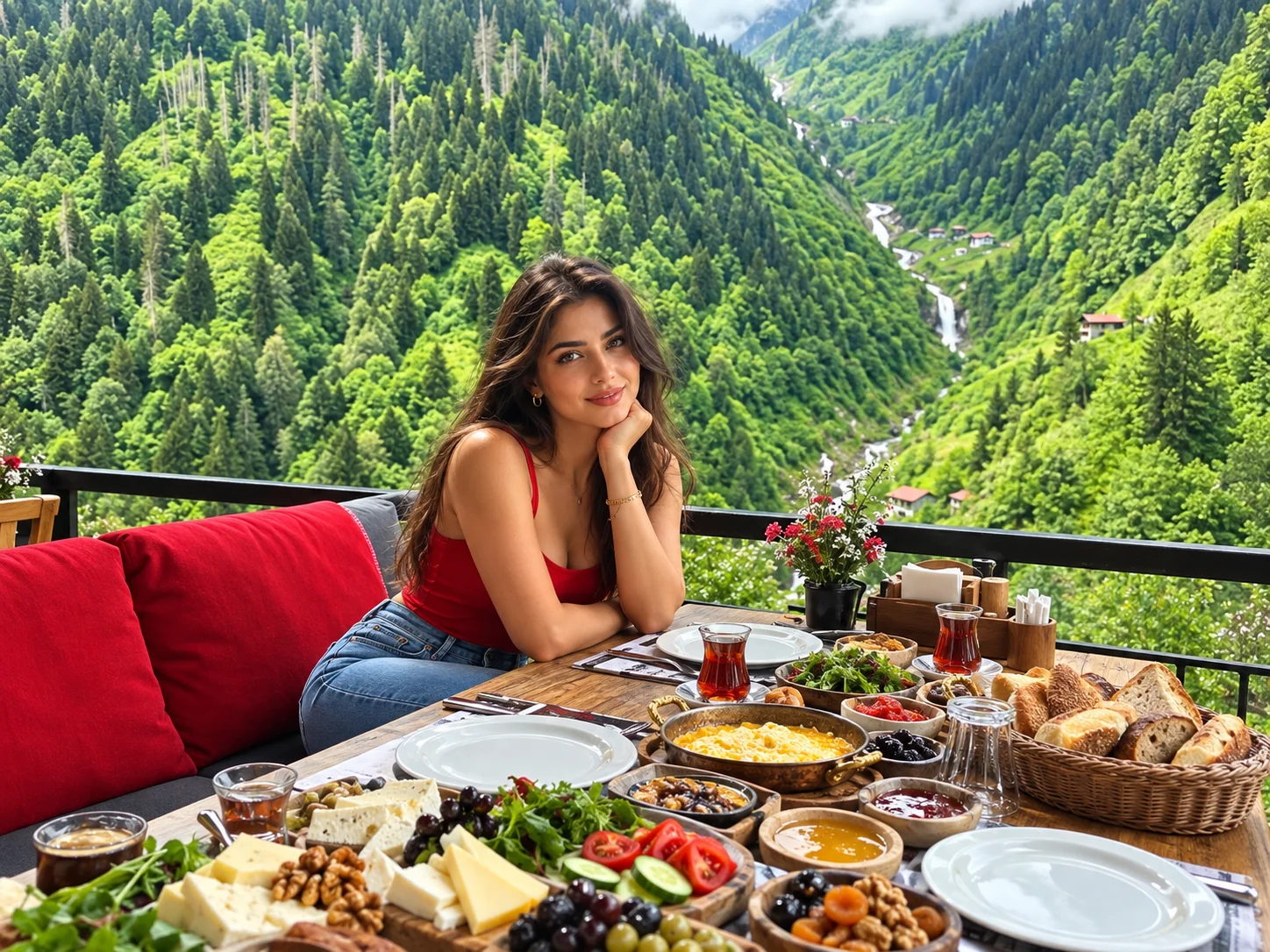
The food culture of the Ayder and Çamlıhemşin area is a genuine draw. Breakfast at a yayla guesthouse — local honey, fresh butter, mountain cheese, eggs, and dark Rize tea — is one of the pleasures that visitors consistently remember. The honey produced in the broader Rize highlands includes varieties from Kaçkar wildflower sources; the Anzer honey produced in the İkizdere district (a longer drive away) is among the most prized in Turkey.
The main dishes of the region reflect the Black Sea kitchen: muhlama (also called kuymak) — a creamy, savoury dish of cornmeal and local cheese cooked over direct heat — is the signature yayla food and appears on virtually every menu in Ayder. Karalahana (dark collard greens cooked with butter), mısır ekmeği (cornbread baked in cast iron), and fresh alabalık (trout) from the mountain streams are also central to the local table. Laz böreği, a custard-filled pastry unique to the Eastern Black Sea, provides the regional sweet note.
When to Visit Ayder
Ayder is accessible and rewarding in different ways across the seasons:
- Spring (April–May): Waterfalls are at peak flow from snowmelt. The forests are vivid green. Roads can be wet and some higher yaylas may still be snow-covered.
- Summer (June–August): The main tourist season. Wildflower blooms reach their peak in June–July. Ayder is busy — notably with visitors from Gulf countries and domestic tourists alike. Book accommodation well in advance for July and August.
- Autumn (September–October): Crowds thin. The forests begin to change colour. Temperatures cool significantly, and the weather becomes more unpredictable. A quieter and often more atmospheric time to visit.
- Winter (November–March): Snow transforms the plateau. The hot springs remain open, making Ayder an unusual winter thermal destination. Road conditions in winter require checking in advance.
The Eastern Black Sea climate means weather can change quickly at any time of year. Layered clothing and a waterproof jacket are useful regardless of month.
Getting to Ayder Plateau
From Rize-Artvin Airport
Rize-Artvin Airport (RZV) is the nearest airport to Ayder, opened in May 2022 on a reclaimed coastal platform between Rize and Artvin. From the airport, the most direct public transport option is a dolmuş (shared minibus) connection: take a local taxi or service to either Çamlıhemşin (~30 minutes) or Pazar (~10 minutes), then connect to a dolmuş heading toward Ayder. The Çamlıhemşin–Ayder dolmuş takes approximately 45 minutes; the Pazar–Ayder dolmuş takes around 1 hour 15 minutes. Dolmuş services generally run during daytime hours. A private intercity transfer service from the airport is the most convenient door-to-door option, particularly for families or those with luggage.
How to Get to Ayder from Trabzon
Many visitors to the region arrive via Trabzon, which has a larger international airport with more direct routes. Trabzon is approximately 150 kilometres from Ayder along the coastal highway. The journey by car takes around 2.5 to 3 hours depending on traffic and the route chosen. There is no direct public bus between Trabzon city centre and Ayder; the practical route involves taking a service to Pazar or Çamlıhemşin first and then connecting to a local dolmuş. Renting a car in Trabzon or arranging a private transfer are the more comfortable options. For Trabzon's own highlights, see our guide to places to visit near Trabzon.
From Istanbul
From Istanbul, the most efficient approach is to fly directly to Rize-Artvin Airport (RZV) — flights from both IST and SAW operate to Rize, and the journey takes approximately 1 hour 40 minutes in the air. From the airport, arrange a private transfer or dolmuş connection to Ayder. An alternative is to fly to Trabzon and continue overland. Driving the full distance from Istanbul (~1,100 km) requires planning a multi-day journey.
Video: Ayder Yaylası — the plateau, the waterfalls, and the Çamlıhemşin highland landscape.
For a direct door-to-door journey from Istanbul or from Rize-Artvin Airport to Ayder, a private intercity car with driver is the most practical option. Public transport connections exist but require multiple changes and rely on dolmuş schedules that thin out in the evenings.
Interesting Facts About Ayder
A few details about Ayder that go beyond the standard itinerary:
- The Kaçkar Dağları Milli Parkı, within which Ayder sits, was established in 1994 and covers 51,550 hectares — making it one of Turkey's larger mountain national parks. Ayder is the main gateway settlement on the northern (Black Sea) side of the range.
- The surrounding Hemşin culture is one of the most distinctive in the Eastern Black Sea. Hemşinli people have their own linguistic heritage (a variety of Armenian with Turkic loanwords), distinctive architecture (stone houses with wooden upper floors), and traditions including specific music and festival forms. The Çamlıhemşin district is a centre of this culture.
- Ayder's development into a mass-tourism destination has been rapid and relatively recent — within the span of a few decades, what was a small traditional yayla settlement has become one of the busiest highland resorts in Turkey, with implications for both the built environment and the natural landscape.
- The stone arch bridges of Fırtına Valley — the taş köprüler — were built during the Ottoman period, some in the 18th century. They continue to carry traffic and pedestrians today and are engineering landmarks in their own right.
- The Kaçkar range's north-facing slopes receive exceptionally high precipitation, making the biodiversity of the region remarkable. The forests and meadows support a wide variety of endemic plant species, including many wildflower types found nowhere else in Turkey.
Practical Information
| Category | Details |
|---|---|
| Location | Ayder Mahallesi, Çamlıhemşin district, Rize province — NOT Trabzon |
| Altitude | 1,350 metres above sea level |
| Distance from Rize city | ~87 km; approximately 1.5–2 hours by car |
| Distance from Trabzon | ~150 km; approximately 2.5–3 hours by car via the coastal highway |
| Nearest airport | Rize-Artvin Airport (RZV) — opened May 2022; direct flights from Istanbul (IST, SAW) |
| Best time to visit | June–August for wildflowers and full access; May and September for fewer crowds; winter for hot springs in snow |
| Road to Ayder | Paved and well-maintained; secondary yayla roads (Pokut, Huser, Kavrun) require 4x4 |
| Hot springs | Ayder Kaplıcaları — year-round; separate men's, women's, private sections; Tenzile Erdoğan Termal Tesisleri also operational |
| Currency | Turkish Lira (TRY); ATMs in Çamlıhemşin district centre |
Frequently Asked Questions: Ayder Plateau
Where is Ayder Plateau — is it in Rize or Trabzon?
Ayder Plateau (Ayder Yaylası) is in Rize province, specifically in the Çamlıhemşin district. It is not in Trabzon. Many visitors search for "Ayder Trabzon" because Trabzon is the larger airport city in the region, but Ayder is approximately 87 km from Rize city centre and roughly 150 km from Trabzon. If you are travelling from Trabzon, you will drive along the coast toward Rize and then up through the Fırtına Valley to reach Ayder.
How do I get to Ayder from Rize-Artvin Airport?
From Rize-Artvin Airport (RZV), you can reach Ayder via public dolmuş (shared minibus) with a connection in either Çamlıhemşin (about 30 min from airport, then 45 min dolmuş to Ayder) or Pazar (about 10 min from airport, then roughly 1h 15min dolmuş to Ayder). Dolmuş services run during daytime hours. For convenience — especially with luggage or late arrivals — a private intercity transfer is the most straightforward option.
How long should I spend in Ayder?
Two nights is the minimum to do Ayder justice: one day for the plateau itself (Gelintülü waterfall, hot springs, highland walks) and one day for the surrounding area (Fırtına Valley, Zilkale, Palovit waterfall). Three nights allows a more relaxed pace and the option to explore higher yaylas such as Pokut or Huser. If you are combining Ayder with a broader Rize trip, plan for at least two dedicated Ayder nights.
Are the Ayder hot springs open in winter?
Yes. Ayder Kaplıcaları operates year-round and is one of the reasons Ayder attracts visitors even in the colder months. In winter, the plateau is typically snow-covered, and the combination of thermal bathing and mountain scenery makes it a distinctive experience. Road conditions to Ayder in winter should be checked before travel, as the route up from the valley can be affected by snow and ice.
Is Ayder suitable for families?
Ayder is well-suited to families. The main plateau is navigable on foot, the Gelintülü waterfall trail is not technically demanding, and the hot springs have family sections. Children who enjoy mountain environments and outdoor eating will find the yayla guesthouse experience memorable. Families planning to visit Palovit or the stone bridges need only a car — these do not require difficult hiking. Higher yaylas (Pokut, Huser) involve either 4x4 roads or long hikes and are better suited to older, more active visitors.
Can I reach Pokut and the other highland yaylas by regular car?
Ayder itself is reached by a good paved road suitable for any vehicle. Most other yaylas in the area — Pokut, Sal, Huser, Kavrun — require a 4x4 or high-clearance vehicle due to stabilised dirt tracks with steep gradients and no barriers. Local operators in Çamlıhemşin offer 4x4 transfers to these destinations if you do not have a suitable vehicle.
What is the best month to visit Ayder?
June and July offer the best combination of wildflowers, full accessibility, and pleasant temperatures. July and August are the busiest months — peak season — when accommodation must be booked well in advance. May is excellent for waterfall flow (snowmelt) but some high tracks may still be blocked. September is quieter, the weather is cooler, and the landscape takes on autumn tones. Winter visits are possible and rewarding for the hot spring experience, with snow adding another dimension to the plateau.
What should I eat in Ayder?
The must-try dish in Ayder is muhlama (kuymak) — a creamy cornmeal and cheese preparation cooked over direct heat that is the signature food of the Karadeniz highlands. Highland breakfasts featuring local honey, butter, and mountain cheese are another defining experience. Other regional dishes include karalahana (dark collard greens), mısır ekmeği (cornbread), fresh trout, and laz böreği (custard pastry). All are widely available in the yayla guesthouses and restaurants on the plateau.