
Bursa Province · Uludağ foothills · Nature day trips
Bursa is one of northwestern Turkey’s best bases for waterfall day trips — but the falls are not clustered in one valley. Popular stops sit in different directions: Saitabat and Alaçam to the east toward Kestel, Suuçtu far west in Mustafakemalpaşa, Oylat via İnegöl, and hiking-led falls such as Softaboğan on the Uludağ foothills. This 2026 guide treats Suuçtu and Saitabat as the headline pair, then maps secondary falls, seasons, one-day routes and transport — with clear swim, camp and fire rules instead of blanket “jump in / pitch a tent” advice.
Cab Istanbul provides chauffeur and intercity transport only. A driver is not a licensed nature guide and does not sell park tickets, camping permits or food packages. Pair waterfall days with Cumalıkızık, Uludağ or Uluabat Lake only when geography and timing allow.
At a glance
Popular Bursa waterfalls and nature stops
There is no official “exactly nine waterfalls” list for Bursa. Use the registry below as a practical visitor map — identifiable places with public access, not a marketing count.
| Place | District / area | Why visit | Practical note |
|---|---|---|---|
| Suuçtu Waterfall | Mustafakemalpaşa · Muradiyesarnıç / Çataltepe · Karadere | Best-known dramatic single-drop setting inside Suuçtu Nature Park | ~38 m commonly cited · ~100–120 km from Bursa centre · picnic in designated areas · swimming not advised |
| Saitabat Waterfall | Kestel · Saitabat neighbourhood | Closest popular family waterfall stop from Bursa centre | ~22 km class · ~5 m (Kestel Bel.) · stream bed closed for entry Aug 2026 — view from observation areas |
| Sudüşen Waterfall | Gemlik · Haydariye · Nacaklı stream | Verified Gemlik valley waterfall with approach facilities | ~10 m · swimming not verified as permitted |
| Küreklidere Waterfall | Yıldırım · near Hamamlıkızık / Derekızık · Deliçay | Multi-tier forest cascade often cited around 80–82 m | Moderate hike · swimming not advised |
| Oylat Waterfall | İnegöl · Oylat / Hilmiye | Waterfall trail paired with thermal and cave destination cluster | ~3 km trail from thermal zone · no medical claims |
| Alaçam Waterfall | Kestel · Alaçam village | Village canyon trail; strong spring snowmelt/flow context | Trail not effortless for every visitor · swimming not verified |
| Softaboğan Waterfall | Yıldırım / Uludağ foothills · Dombay Çukuru · Çobankaya–Bakacak | Hiking waterfall for fit walkers, not a casual family pull-off | Swimming not endorsed · National Park approach fees may apply |
| Yarhisar Waterfall | Yenişehir · Yarhisar | Quieter secondary stop for private-car travellers | Medium relevance · swimming not verified |
| Kösehoroz Waterfall | Mustafakemalpaşa · Kösehoroz · Değirmendere | Forest walk (~2 h class from village) for prepared hikers | Guide often recommended · rock pond exists — do not treat as swim destination |
| Balaban Waterfall | Yıldırım · Kırkpınar / Kocabalık context | Tourism-listed secondary cascade | Brief stop · not the same as Balaban Mesire Alanı picnic park |
| Balaban Mesire Alanı | Yıldırım picnic park | High-volume picnic / recreation area | Not a waterfall — separate entity from Balaban Waterfall |
Compare before you go
Access, walking, picnic, swimming and best season
Swimming rules differ by site. Where officials have closed stream beds, treat entry as prohibited. Where permission is unclear, do not invent a “safe swim” green light.
| Waterfall | Access | Walking | Picnic | Swimming | Best season |
|---|---|---|---|---|---|
| Suuçtu | Paved approach to Nature Park; private car typical | Short walk from parking / park facilities | Designated picnic context — follow park signs | NOT ADVISED / not verified as permitted | Late winter–spring for stronger flow; summer for shade (crowds) |
| Saitabat | Road to village; ~20–25 km east of Bursa centre | Short village / observation access | Designated picnic YES · uncontrolled stream picnic NO | PROHIBITED in stream bed (Aug 2026 measures) | Spring–early summer; expect summer crowds |
| Sudüşen | Gemlik road + valley facilities | Easy–moderate valley approach | Likely facilities near entrance | NOT VERIFIED | Spring–summer |
| Küreklidere | Forest approach near Hamamlıkızık corridor | Moderate trail | Soft / informal | NOT ADVISED | Spring for flow; shoulder seasons for cooler hiking |
| Oylat | Via İnegöl thermal / cave cluster | ~3 km trail after arrival | Soft | NOT VERIFIED | Year-round destination cluster; trail depends on weather |
| Alaçam | Kestel village road + canyon trail | Trail / canyon — not “effortless for everyone” | Village trout / picnic soft | NOT VERIFIED | Spring snowmelt / peak flow |
| Softaboğan | Uludağ foothills via Çobankaya or Bakacak | Serious hike required | Soft | NOT ADVISED (do not endorse swimming) | Late spring–summer hiking window; check fire-season rules |
| Kösehoroz | Village access then long forest walk | ~2 h class trail; guide recommended | Soft | NOT ADVISED | Settled spring–autumn hiking days |
| Yarhisar / Balaban | Private car / soft trail | Local / soft | Soft / weak | NOT VERIFIED | Spring–summer |
Open fires and barbecue are often restricted in parks and forest zones — especially in summer fire-risk periods. Check current DKMP / park / forest signs rather than assuming you can grill freely.
West Bursa · Mustafakemalpaşa
Suuçtu Waterfall and Suuçtu Nature Park
Suuçtu (also written Suuctu in English transliteration) is Bursa’s best-known dramatic single-drop waterfall — commonly cited at about 38 metres. It is not officially ranked as “the biggest waterfall in Bursa,” and older copy that said “38 feet” was simply wrong. The fall sits inside Suuçtu Tabiat Parkı (Nature Park under DKMP since 2011), roughly 18–20 km from Mustafakemalpaşa district centre and roughly 100–120 km west of Bursa city — a half-day-plus outing, not a “near the city centre” stop.
Approach roads are paved into the park area; the final walk to viewpoints is short by waterfall standards. Beech, oak and pine woodland are commonly described around the site. Tourism and encyclopedia sources sometimes note that the stream helps supply Mustafakemalpaşa drinking water — present that as a qualified local note, not a marketing slogan.
- Picnic: Use designated picnic areas and follow posted park rules.
- BBQ / open fire: Often restricted — verify current park and forest fire rules on the day; do not plan to “barbecue freely.”
- Camping: Overnight tents at the waterfall are restricted / not recommended. Do not treat Suuçtu as a campground product.
- Swimming: Not advised and not verified as permitted. Rocky pools and cascade bases are scenic — not an invitation to enter the water.
- Fees: Suuçtu Nature Park charges entrance and/or vehicle fees. Secondary 2025 tariff figures circulate online — do not treat them as locked 2026 official prices. Verify current DKMP / park tariff on arrival.
- Public transport: Last mile is typically private car; there is no reliable bus to the park gate.
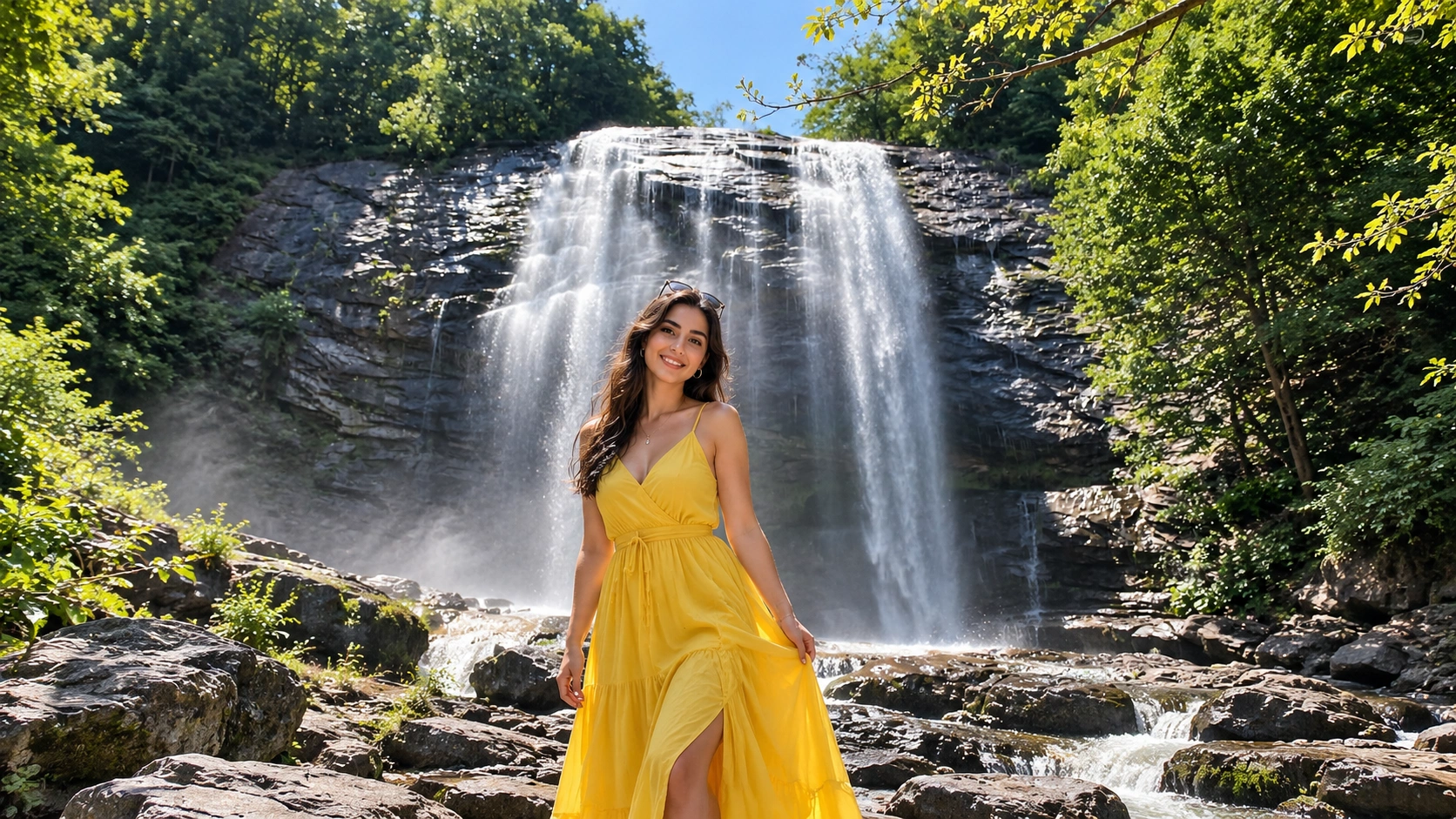
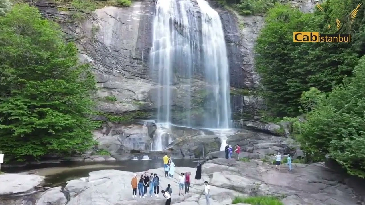
Video is visual context only — park fees, fire rules and swimming status follow posted regulations, not clips.
East Bursa · Kestel
Saitabat Waterfall — closest popular stop
Saitabat sits in Kestel’s Saitabat neighbourhood, about 22 km from Bursa centre on VisitBursa picnic guidance — usually the easiest “waterfall plus village breakfast” day for families based in the city. Kestel Belediyesi cites a height of about 5 metres; do not invent taller brochure figures. Some travel writing calls the place Güvercinlik — treat that as a local / travel alias only, not the municipal page name. Soft municipal copy links the canyon to Uludağ-side waters; keep that as soft geography, not a hydrology lecture.
August 2026 update: Following Bursa Valiliği / Kestel measures reported from 3 August 2026, the stream bed is closed. Swimming and uncontrolled stream-side recreation are prohibited. Visit for viewing from observation / seyir areas and use only designated picnic zones. Extreme-sports marketing around Saitabat is removed from this guide.
- Food: Village breakfast and trout restaurants are a real visitor context — not a fixed menu guarantee.
- Picnic: Designated picnic area yes; uncontrolled stream picnic no.
- Overnight camping: Not verified as an overnight product at the waterfall.
- Gate fees: Exact ticket figures are unclear — confirm locally if any fee applies on your visit day.
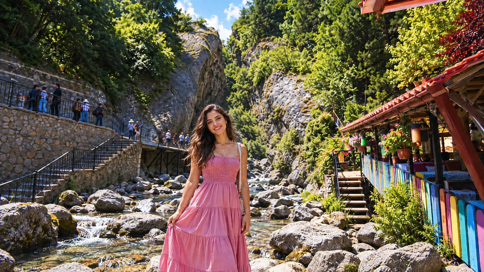
Video is orientation only — follow current municipal and governorate access rules on the day you visit.
Secondary map
Sudüşen, Küreklidere, Oylat, Alaçam, Softaboğan and quieter falls
Sudüşen Waterfall (Gemlik)
Sudüşen is a verified Gemlik stop near Haydariye on the Nacaklı stream, commonly described around 10 metres (VisitBursa). Valley facilities make it more approachable than deep-forest hikes. Swimming permission is not verified — enjoy the setting without assuming water entry is allowed.
Küreklidere Waterfall (Yıldırım)
Küreklidere sits in Yıldırım near the Hamamlıkızık / Derekızık corridor on the Deliçay. Local guides commonly cite a four-tier cascade of about 80–82 metres — present as a widely reported figure, not a survey-certified monument measurement. Expect a moderate forest hike; swimming is not advised. Access is often described as free-entry in informal guides, but rules and road conditions still deserve a day-of check.
Oylat Waterfall (İnegöl)
Oylat works best as a destination cluster: thermal facilities, cave visit and a waterfall trail of roughly 3 km from the thermal zone. Plan it as scenery and a nature walk — zero medical or healing claims. Cave and thermal products are separate logistics from the trail itself.
Alaçam Waterfall (Kestel)
Alaçam near Alaçam village pairs canyon trail walking with village trout / picnic context. Spring snowmelt often strengthens the flow. The trail is real walking — not an effortless roadside pull-off for every visitor. Swimming is not verified as permitted.
Softaboğan Waterfall (Uludağ foothills)
Softaboğan in the Dombay Çukuru / Çobankaya–Bakacak corridor is a hiking waterfall for fit walkers. Cold, deep or slippery pools may exist in trail descriptions — this guide does not endorse swimming. Approaching via Uludağ National Park roads may involve vehicle fees; summer fire-season rules apply. Pair with the wider Uludağ mountain context only if you already accept a hiking day, not a casual family loop.
Yarhisar, Kösehoroz and Balaban
Yarhisar (Yenişehir) is a quieter private-car secondary stop. Kösehoroz (Mustafakemalpaşa) needs a serious forest walk from the village — roughly two hours class, with a guide often recommended; a rock pond is mentioned in cultural sources, but do not push swimming. Balaban Waterfall appears in tourism listings in the Yıldırım / Kırkpınar context — keep it brief. Do not confuse it with Balaban Mesire Alanı, a separate high-volume picnic park that is not a waterfall.
When to go
Seasonality for Bursa waterfalls
| Season | What to expect |
|---|---|
| Spring | Stronger flows overall — Suuçtu often vigorous from late winter into early spring; Alaçam benefits from snowmelt peaks |
| Summer | Cooling shade and heavy crowds at Saitabat / Suuçtu; some flows lower; elevated fire risk — follow fire bans and park signs |
| Autumn | Forest colour and quieter trails; flows become rainfall-dependent |
| Winter | Ice, mud and road caution; shorter daylight — choose paved Nature Park approaches over exposed mountain trails |
Pick the waterfall to match the season: spring for volume, early weekday mornings in summer for fewer people, and settled autumn days for forest colour without inventing year-round “always full” promises.
One-day planning
Day-trip routes A, B and C — plus Softaboğan for hikers
Geography matters more than Instagram stacking. Do not try to combine Suuçtu, Saitabat and Softaboğan as one easy day.
| Route | Direction | Stops | Who it suits |
|---|---|---|---|
| A — East / Kestel day | Bursa → east | Saitabat (view-only under stream rules) → optional Alaçam or Cumalıkızık → return | Families and first-time Bursa visitors wanting the closest waterfall stop |
| B — West / Mustafakemalpaşa | Bursa → west | Mustafakemalpaşa → Suuçtu Nature Park → optional Kösehoroz only for prepared hikers | Travellers with a half-day-plus window and private car / chauffeur |
| C — İnegöl / Oylat | Bursa → east via İnegöl | Oylat thermal / cave cluster → waterfall trail | Visitors who want a destination cluster, not a single photo stop |
| Softaboğan hikers’ note | Uludağ foothills | Çobankaya or Bakacak trailheads → Softaboğan | Fit hikers only — not a casual family add-on to Route A |
Uluabat Lake wetland scenery and Cumalıkızık village work as same-region companions on separate half-days — see Uluabat Lake and Cumalıkızık — not as free inserts into every waterfall loop.
Getting there
Transport — Istanbul to Bursa, then Bursa to the falls
Arriving in Bursa does not put every waterfall a short drive away. Saitabat is close; Suuçtu is a western half-day. Public minibuses may reach some villages, but last-mile car, taxi or walking is almost always required.
| Route | Typical pattern | Notes |
|---|---|---|
| Istanbul → Bursa | Private / chauffeur via Osmangazi Bridge ~1.5–2.5 h traffic-dependent; coaches from European side often ~2.5–3.5 h; Anatolian-side starts shorter | Times are mode- and traffic-dependent — not a universal “always 2 hours” |
| Bursa → Saitabat | East ~20–25 km class | Closest popular family waterfall stop |
| Bursa → Suuçtu | West via Mustafakemalpaşa · ~100+ km class | Half-day-plus; private car typical for the park gate |
| Bursa → Oylat | East via İnegöl | Trail time after arrival — not just a drive |
| Bursa → Softaboğan | Uludağ road / Çobankaya–Bakacak | Hike required after road approach |
| Bursa → Sudüşen / Küreklidere / Alaçam | Gemlik, Yıldırım or Kestel corridors | Still plan last-mile access; do not assume city-bus door-to-cascade service |
| Public transport honesty | Minibus may reach villages (e.g. Saitabat or Kösehoroz village) | Last mile almost always needs car, taxi or a walk — especially Suuçtu Nature Park |
| Cab Istanbul chauffeur | Istanbul↔Bursa and Bursa day routing with driver | Transport only — driver ≠ licensed guide; not an airport-transfer-as-waterfall-tour product |
Chauffeur logistics
Cab Istanbul — transport for Bursa waterfall days
Use Cab Istanbul when you need door-to-door timing across Istanbul–Bursa and then out to Mustafakemalpaşa, Kestel or İnegöl without reinventing last-mile taxis at every stop. The service is transport only: your driver does not replace a licensed guide, sell Nature Park tickets, or authorise swimming, camping or fires.
- Bursa tour / chauffeur routing — city-side and day-trip logistics from a Bursa base.
- Intercity car with driver in Turkey — Istanbul↔Bursa and multi-stop provincial routing.
- Car with driver in Istanbul — Istanbul-leg city transport before or after the Bursa trip.
Istanbul Airport Transfer products are airport-leg services — not proof of a packaged waterfall tour.
FAQ
Bursa waterfalls — frequently asked questions
What are the best-known waterfalls near Bursa?
For most travellers: Suuçtu (dramatic Nature Park drop west of Mustafakemalpaşa) and Saitabat (closest popular stop in Kestel). Strong secondary options include Sudüşen, Küreklidere, Oylat, Alaçam and Softaboğan for hikers.
How many waterfalls does Bursa have?
There is no trusted official “exactly nine” total. Bursa Province has multiple identifiable public falls and picnic landscapes — use a practical registry, not a fake count.
Which waterfall is closest to Bursa city centre?
Saitabat is usually the closest popular stop — about 20–25 km east toward Kestel. Suuçtu is much farther west.
Where is Suuçtu Waterfall?
In Mustafakemalpaşa district (Muradiyesarnıç / Çataltepe · Karadere area), inside Suuçtu Nature Park — roughly 18–20 km from the district centre and about 100–120 km from Bursa city.
How far is Suuçtu from Bursa?
Treat it as a western half-day-plus drive (~100+ km class via Mustafakemalpaşa), not a short city outing.
How tall is Suuçtu Waterfall?
About 38 metres is the widely cited height. Older “38 feet” wording was incorrect.
Is Suuçtu the biggest waterfall in Bursa?
No official ranking supports that claim. Call it the best-known dramatic single-drop setting — not “the biggest.”
Does Suuçtu charge an entrance fee?
Yes — Suuçtu Nature Park typically charges person and/or vehicle fees. Verify the current DKMP / park tariff on arrival; do not rely on old exact TL figures from blogs.
Can you swim at Suuçtu?
Not advised, and swimming is not verified as permitted. Enjoy viewpoints and designated picnic areas instead.
Can you camp at Suuçtu Waterfall?
Overnight tents at the waterfall are restricted / not recommended. Do not plan Suuçtu as a camping product.
Can you barbecue at Suuçtu?
Open fire and BBQ are often restricted in the park, especially in fire-risk seasons. Check current signs — never assume you can grill freely.
When is the best season for Suuçtu?
Late winter into spring for stronger flow; summer for shade and cooling — with larger crowds and stricter fire awareness.
Where is Saitabat Waterfall?
In Kestel’s Saitabat neighbourhood, roughly 22 km from Bursa centre — the easiest popular waterfall day for city-based visitors.
Is Saitabat also called Güvercinlik?
Some travel writing uses Güvercinlik as a local / travel alias. Prefer the municipal name Saitabat; do not treat Güvercinlik as the official page title.
Can you swim at Saitabat in 2026?
No. As of August 2026 measures reported via Bursa Valiliği / Kestel, the stream bed is closed. View from observation areas only.
Are there restaurants at Saitabat?
Village breakfast and trout restaurants are a real visitor context. Treat menus and opening hours as local and day-dependent, not guaranteed by a blog.
How tall is Saitabat Waterfall?
Kestel Belediyesi cites about 5 metres. Do not invent taller brochure heights.
What about Küreklidere Waterfall?
A Yıldırım forest cascade near Hamamlıkızık / Derekızık, commonly reported around 80–82 m across multiple tiers. Moderate hiking; swimming not advised.
Is Oylat Waterfall hard to reach, and can I combine it with the cave?
Expect roughly a 3 km trail from the Oylat thermal zone after driving via İnegöl. Combining waterfall, cave and thermal as a destination cluster is normal — without any medical or healing claims.
Is Alaçam Waterfall easy?
It is a village / canyon trail stop with stronger spring flow — not an effortless pull-off for every visitor. Swimming is not verified as permitted.
What is Softaboğan, and is it inside Uludağ National Park approaches?
A hiking waterfall in the Dombay Çukuru / Çobankaya–Bakacak foothills corridor. National Park vehicle fees may apply on approach. Swimming is not endorsed; it is not a casual family stop.
Is Sudüşen Waterfall in Gemlik?
Yes — Sudüşen near Haydariye in Gemlik is verified on VisitBursa guidance, commonly around 10 metres.
What about Yarhisar, Balaban and Kösehoroz?
Secondary options: Yarhisar (Yenişehir) for private-car travellers; Balaban as a brief tourism-listed cascade (not Balaban Mesire Alanı); Kösehoroz as a long Mustafakemalpaşa forest hike with swimming not advised.
Is there an Aras Waterfall in Bursa?
This guide does not include Aras — the entity is too weakly documented for a production itinerary.
Are Bursa waterfalls good for families?
Saitabat (viewing / designated picnic) and Suuçtu Nature Park short walks suit many families. Softaboğan and Kösehoroz are hiking days. Always follow current swim and fire rules.
Which waterfalls need real hiking?
Softaboğan and Kösehoroz clearly; Küreklidere and Alaçam are moderate trail days; Oylat adds ~3 km after arrival. Suuçtu and Saitabat are shorter access walks once you are on site.
Where can I picnic?
Use designated picnic areas at Suuçtu Nature Park and Saitabat. Uncontrolled stream-bed picnics at Saitabat are not allowed under current measures. Balaban Mesire Alanı is a picnic park — not a waterfall.
Where is swimming allowed?
Do not assume a blanket yes. Saitabat stream bed: prohibited (Aug 2026). Suuçtu, Softaboğan, Küreklidere, Kösehoroz: not advised. Others: not verified — follow posted rules.
What about open fires and BBQ?
Often restricted in parks and forest zones, especially in summer. Check current park / forest rules — no “barbecue freely” advice.
Can I visit several waterfalls in one day?
Yes if you stay in one geography corridor (for example Saitabat + optional Alaçam / Cumalıkızık). Do not stack Suuçtu + Saitabat + Softaboğan as one easy day.
What is the best one-day route from Bursa?
Route A east for Saitabat; Route B west for Suuçtu; Route C via İnegöl for Oylat. Softaboğan is a separate hikers’ day on Uludağ foothills approaches.
How do I get from Istanbul to Bursa for waterfall days?
Private / chauffeur via Osmangazi Bridge is often about 1.5–2.5 hours depending on traffic; coaches from the European side commonly take longer. Then plan a separate Bursa→waterfall leg — the falls are not all “nearby after arrival.”
Is public transport enough for the last mile?
Usually not. Minibuses may reach some villages, but Suuçtu Nature Park and many trailheads still need private car, taxi or a walk.
Can Cab Istanbul take us to Bursa waterfalls?
Yes as transport — see Bursa tour and intercity car with driver. Your driver is not a licensed nature guide, and airport-transfer products are not waterfall-tour packages.
Plan the day
Leave Bursa with an honest waterfall plan
Treat Bursa’s waterfalls as a provincial map, not a single valley checklist: Saitabat for the closest viewing-and-village day under August 2026 stream-bed rules, Suuçtu for the ~38 m Nature Park set-piece west of Mustafakemalpaşa, and Oylat, Küreklidere, Alaçam or Softaboğan only when trail time and fitness match. Skip invented waterfall counts, “biggest in Bursa” rankings, blanket swim/camp/fire tips and airport-transfer CTAs dressed up as nature tours. Confirm park fees and fire notices on the morning you go, pair geography-matched side trips such as Cumalıkızık, Uludağ or Uluabat Lake when the clock allows, and use Bursa chauffeur routing or an intercity car with driver for logistics only — never as a substitute for posted safety rules.