
Artvin occupies a unique corner of northeastern Turkey where the humid Black Sea coast rises abruptly into the Kaçkar and Karçal mountain ranges. Within a single day's drive you can move from sub-tropical forest valleys to alpine plateaus above 2,500 metres — passing medieval Georgian churches, landslide lakes, canyon trails and coastal towns along the way. This guide covers Artvin province district by district so you can plan a route that fits your interests and time.
What Brings You to Artvin?
Use the quick index below to jump to the area that matches your interests. Districts are far apart and the mountain roads are slow — knowing which zone you want helps you avoid unnecessary backtracking.
- Forest lake → Borçka Karagöl (Borçka district)
- Alpine lake + plateau → Şavşat Karagöl / Karagöl-Sahara National Park
- UNESCO Biosphere Reserve / village culture → Maçahel / Camili (Borçka)
- Canyon → Cehennem Deresi (Ardanuç)
- Waterfall → Mençuna Şelalesi (Arhavi)
- Medieval Georgian churches → Barhal, İşhan, Dolishane (Yusufeli / Merkez)
- National park + glass terrace → Hatila Valley (Artvin city)
- Black Sea coast → Arhavi / Hopa / Kemalpaşa
- Rock-hole waterfall → Deliklikaya (Murgul)
- Road trip / canyon drive → Çoruh–Yusufeli corridor
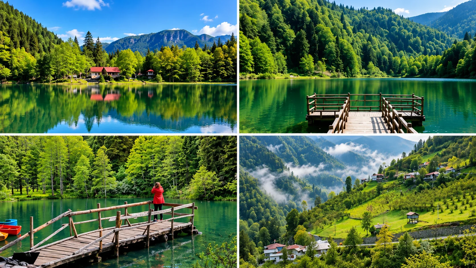
Why Artvin's Geography Is Different
The terrain is steep and close. The Çoruh River — one of the fastest-flowing rivers in the world — has carved a deep corridor through which roads and rail cannot easily pass. Elevations range from near sea level at Hopa to over 3,700 metres on the Kaçkar peaks less than 100 kilometres inland. This dramatic gradient creates distinct climate zones in every valley: the coastal districts of Hopa and Arhavi receive heavy Black Sea rainfall and support dense deciduous forest; the inland Çoruh valley is drier; the high plateaus of Şavşat and Arsiyan have cold snowy winters.
This geography has also shaped Artvin's history. Medieval Georgian kingdoms — primarily the Bagratid dynasty — built churches, monasteries and castles across the river valleys between the 9th and 11th centuries. Many still stand. The combination of Georgian architectural heritage, the Camili Biosphere Reserve, Kaçkar alpine approaches and a Black Sea coastline makes Artvin one of the most varied provinces in Turkey for cultural and nature travel.
Artvin Province — A Video Overview
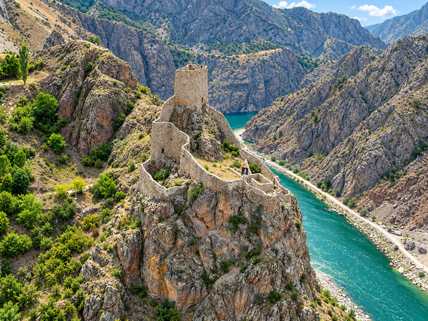
Artvin City Centre and the Çoruh Valley
The city of Artvin sits on a steep hillside above the Çoruh River at roughly 600 metres elevation. The central district is compact but rich in viewpoints, and several important historical sites lie within 15 kilometres.
Artvin Castle (Livane Kalesi)
The castle rises on a rock face 70 metres above the Çoruh, dating to around 937–939 AD when it was built by the Bagratid king Büyük Oşet according to Georgian royal records. The 1,600-square-metre fortress contains a chapel ruin and a water cistern. Important note for visitors: Artvin Castle currently sits within a military zone. Access is only possible with garrison permission and an escort — contact Artvin Governorate for current visitor protocols before planning a visit.
Atatepe Atatürk Monument
At 22 metres in length and weighing 50 tonnes, the copper-clad steel statue of Atatürk at Atatepe is the largest Atatürk statue in the world. It depicts Atatürk's march at the Battle of Kocatepe and was completed in 2012. The site offers wide-angle views over the Artvin valley and is particularly photogenic at dusk. Atatepe is accessible by road and is one of the city's main viewpoints.
Kafkasör Plateau
Kafkasör Yaylası lies approximately 6 kilometres from the city centre at around 1,900 metres. It is the setting of Artvin's best-known annual event: the Kafkasör Kültür Turizm ve Sanat Festivali, which includes traditional bull wrestling competitions. The 2026 edition was the 45th, held 8–12 July with 157 bulls and an estimated 105,000 visitors. Outside festival season, the plateau is a quiet walking and picnic destination with views across the surrounding valleys. Note: The traditional bull wrestling seen here is distinct from Spanish bullfighting — it is a contest between bulls without human intervention.
Hatila Valley National Park
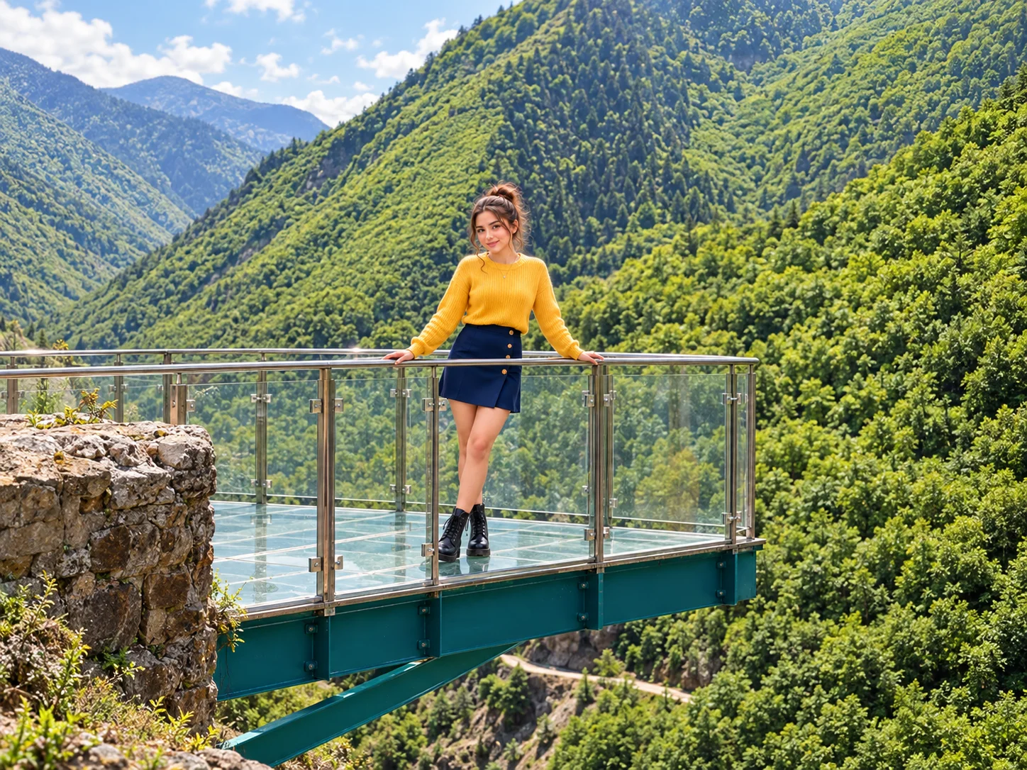
Hatila Valley National Park begins just 10–12 kilometres from Artvin city centre, making it the most accessible major natural site in the province. The park protects a deep canyon carved by the Hatila stream, surrounded by dense forest with notable biodiversity including rare relict plant species.
The glass viewing terrace at Sıkıldım Rock is the park's signature attraction. It projects out 220 metres above the valley floor, at an altitude of 490 metres. The sensation of looking straight down into the forested gorge is dramatic. The terrace was built in 2015 and remains operational — check current conditions at the park entrance as seasonal maintenance closures can occur.
The park has marked hiking trails, picnic areas and seasonal facilities. It is open year-round though spring and summer offer the best trail conditions. There is an entrance fee; check the park management for current pricing as fees change periodically.
Borçka Karagöl
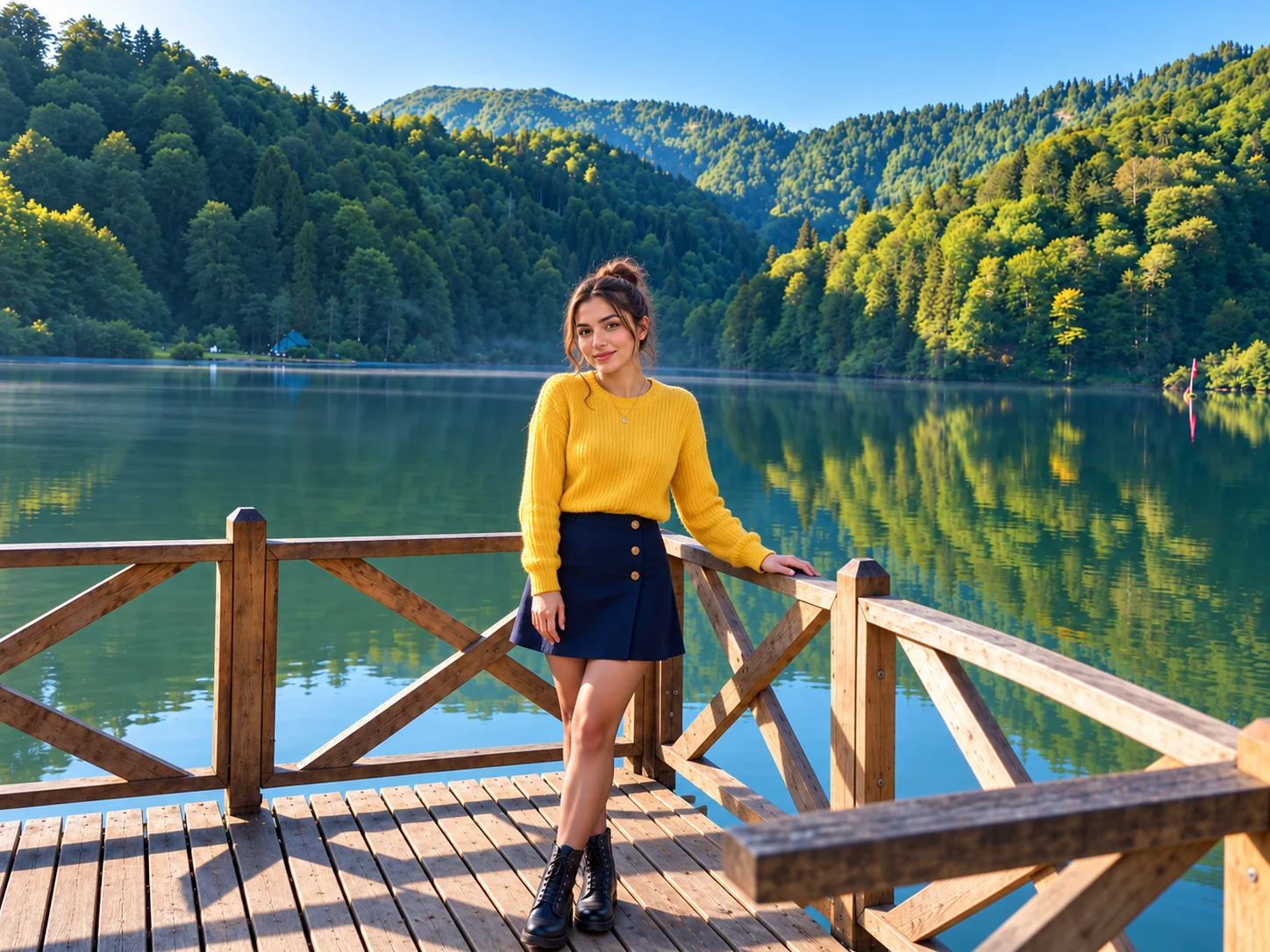
Borçka Karagöl is perhaps Artvin's most-photographed natural site. The lake was formed in the 19th century when a landslide blocked the Klaskur stream — making it a landslide-dammed lake, not a volcanic crater lake as sometimes stated. The Turkish Ministry of Environment declared it a Nature Park (Tabiat Parkı) in 2002.
The lake sits within dense forest and is mirror-calm on still days. In autumn — roughly mid-October to mid-November depending on the year — the surrounding beech and alder trees turn bright yellow and orange, making it one of the most spectacular autumn colour destinations in the Black Sea region. In summer the thick forest canopy keeps temperatures noticeably cooler than the valley below.
A marked walking loop circles the lake, taking about 45–60 minutes at a comfortable pace. Picnic areas and a café are available near the main entrance. Camping: Designated paid camping and caravan areas exist within the nature park, but camping directly on the lakeshore is not permitted under protected-area regulations. There is an entrance fee for vehicles; confirm current rates at the gate.
Borçka Karagöl vs Şavşat Karagöl — Two Lakes, Two Experiences
Artvin has two well-known lakes called Karagöl. They are roughly 100 km apart by road and offer very different landscapes:
| Borçka Karagöl | Şavşat Karagöl | |
|---|---|---|
| District | Borçka | Şavşat |
| Landscape | Dense forest, humid Black Sea belt | Alpine meadow, drier interior |
| Status | Nature Park (Tabiat Parkı) | Karagöl-Sahara National Park |
| Best season | Autumn (colour), summer (coolness) | Summer / late spring (wildflowers) |
| Facilities | Café, designated camping, parking | More limited — check on arrival |
Maçahel / Camili — Turkey's Only UNESCO Biosphere Reserve
The Camili Basin (locally known as Maçahel) in the Borçka district is Turkey's first and only UNESCO Biosphere Reserve, designated on 29 June 2005 under the Man and the Biosphere Programme. The reserve comprises six villages — Camili, Düzenli, Efeler, Şerafettin, Balıklı and Veliköy — in a high valley bordered by the Karçal mountains and the Georgian border.
The basin is one of the most biodiverse areas in Turkey. It lies within the Colchic rainforest belt and contains old-growth forest with species including Eastern hornbeam, Oriental beech and alder. The area also functions as a protected breeding zone for the Caucasian bee (Apis mellifera caucasica), whose genetic lineage is documented as unmixed here. The annual honey harvest is a cultural event celebrated with local ceremonies; Maçahel honey is a recognised regional product.
The road to the Camili basin climbs from Borçka and is passable with a standard car in summer and autumn, but can be closed or difficult in winter and early spring. There is basic accommodation in the villages; advance booking is advisable during peak season (July–September). The villages themselves — traditional stone and wood architecture, organic gardens, beehives — are as much an attraction as the natural scenery.
Efeler Forest
Within the Maçahel/Camili zone, the Efeler Forest is a rare tract of old-growth temperate rainforest. It lies within the Artvin Çoruh National Park buffer zone and forms part of the biosphere reserve. Walking here in fog — common in this valley — creates a distinctive atmosphere quite unlike most Turkish forests. The forest is open to visitors on foot; check with Borçka district forestry administration for current trail access.
Şavşat
Şavşat is a highland district roughly 100 km east of Artvin city, at elevations mostly above 1,000 metres. The landscape is drier and more open than the forested Borçka valleys, with broad alpine meadows and plateaus. It deserves a dedicated day or overnight stay rather than a quick detour.
Karagöl-Sahara National Park
The national park protects two distinct landscapes: Şavşat Karagöl (a lake in a forested setting at altitude) and the Sahara Plateau, a broad highland pasture used for traditional summer grazing. Together they offer a combination of scenic lakeside walking, picnicking and a glimpse of active yayla (highland pasture) culture. The park has basic facilities; camping may be available in designated areas — confirm with the park directorate for current rules.
Satlel Castle (Şavşat Castle)
The ruins of Satlel Castle stand above Şavşat town. Built in the 9th century by the Georgian Bagratid king Adarnase I, the castle retains a section of its walls, a rectangular chapel ruin (8 x 4.8 m) and a cistern cut into bedrock. The site was used by the Ottomans and later fell into disuse in the 19th century. It is open and accessible on foot from the town.
Arsiyan Plateau and Papart
Arsiyan Yaylası is one of the highest accessible plateaus in the district, known for small alpine lakes and meadows that peak in wildflower colour in June and July. The road to the upper sections is rough and requires a high-clearance vehicle in places. Papart refers to a valley and cluster of traditional highland settlements known for intact wooden yayla architecture. Both areas are quiet and see far fewer visitors than the major national park zones.
Ardanuç
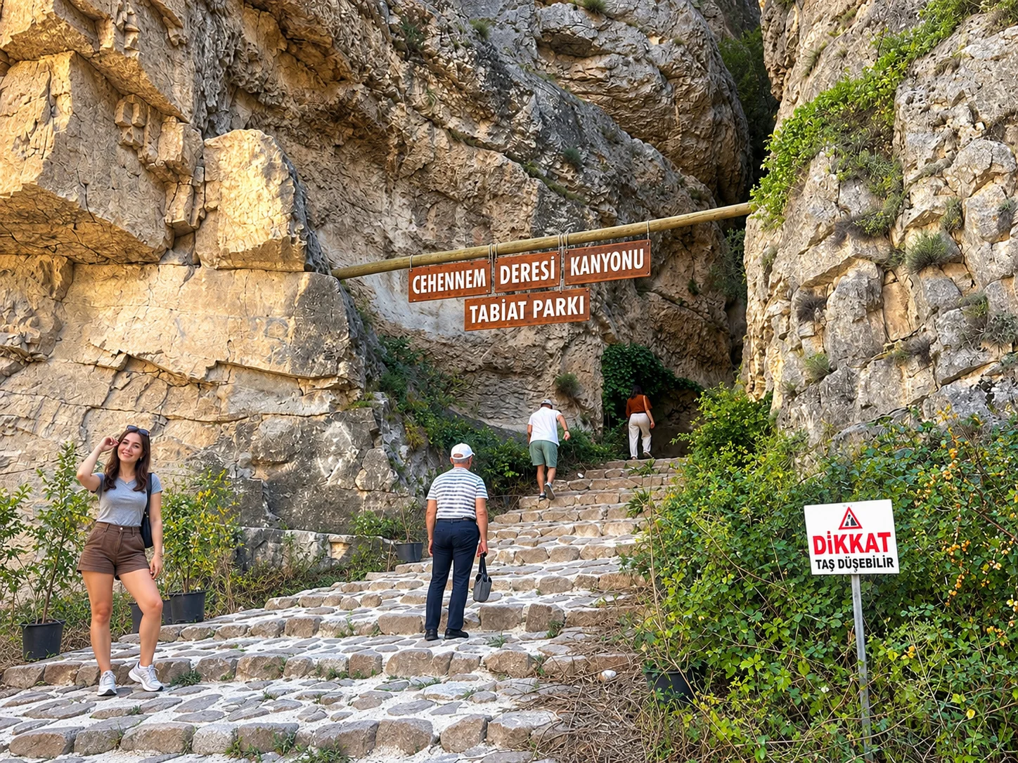
Cehennem Deresi Canyon
The Cehennem Deresi canyon runs through Ardanuç district and follows a narrow gorge of columnar basalt. Local tourism promotion has labelled it "the world's second largest canyon," but this claim has no basis in international geological or geographic records — the canyon's walkable section is relatively compact. The actual appeal is real and worth visiting: the basalt columns, the narrowness of the gorge, the scale of the rock walls above and the quality of the trail make it an impressive half-day excursion. The path is uneven and can be slippery when wet; solid footwear is essential and the gorge should not be attempted during or after heavy rainfall.
There is no entrance fee for the canyon trail. The site is accessible from Ardanuç town via a short drive.
Ardanuç Castle (Gevhernik)
Above Ardanuç town stand the remains of a medieval Georgian castle, also referred to as Gevhernik. The structure has Bagratid-era origins and was later used by the Ottomans. The ruins are partially intact and accessible on foot, offering views over the Çoruh basin. It is one of several castle ruins in Artvin that do not see heavy tourist traffic.
Bilbilan Plateau
Bilbilan Yaylası in the upper reaches of Ardanuç is a traditional summer grazing plateau. It is quieter and less visited than Kafkasör or Sahara, making it a good choice if you are looking for genuine yayla culture without festival crowds. Access is via an unpaved road that requires a capable vehicle.
Yusufeli and the Georgian Heritage Route
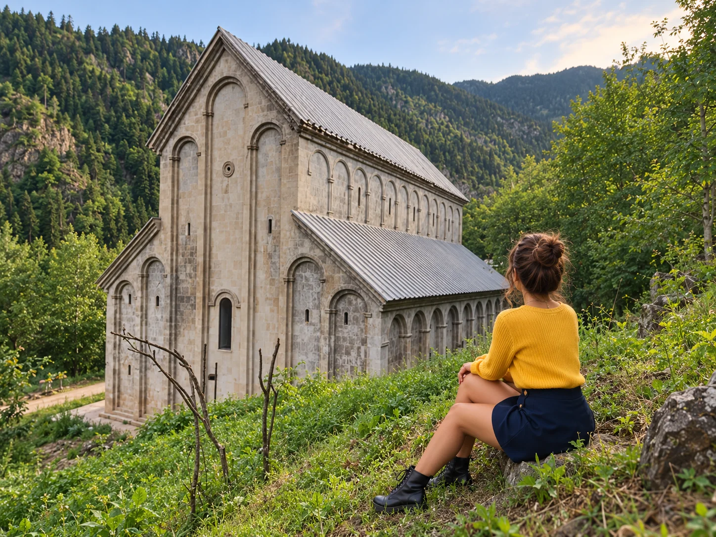
Yusufeli district holds the highest concentration of medieval Georgian religious architecture in Turkey. For anyone interested in Byzantine-era Caucasian church building, this district alone justifies the journey to Artvin.
The Yusufeli Dam was completed in November 2022, flooding the old district centre and several valley-floor settlements. The old town centre is now mostly underwater, and access is prohibited. A new Yusufeli town has been established at higher elevation. The main Georgian heritage churches — Barhal, İşhan — are located above the reservoir level and remain accessible, but road access may have changed compared to pre-dam maps. Use current navigation apps and check locally before driving, especially in the Barhal and İşhan valley approaches.
Barhal Church (Parkhali / Altıparmak)
Barhal Church — known in Georgian as Parkhali — stands in Altıparmak Village, approximately 12 kilometres northwest of Yusufeli. It was built during the reign of the Bagratid king Bagrat II (958–994 AD) and is dedicated to St John the Baptist. The three-aisled basilica plan, with dimensions of 28.55 x 8.65 metres, is one of the better-preserved examples of 10th-century Bagratid ecclesiastical architecture in the region. The building is currently used as a mosque and can be visited; restoration work has been carried out by the General Directorate of Foundations.
İşhan Church (Işhani)
İşhan Church in Yusufeli district was constructed between 955 and 1027 AD and functioned as a significant Bagratid Georgian monastery. The domed basilica plan is architecturally ambitious for its era. The building was converted to a mosque during the Ottoman period, which helped preserve its structure. It is open for visits; restoration under a Turkish-Georgian bilateral protocol was initiated in 2012. The site is on uneven rocky terrain — wear appropriate footwear.
Dolishane Church (Hamamlı / Artvin Merkez)
Despite occasional misattribution in travel sources, Dolishane Church is not in Yusufeli — it is located in Hamamlı Village in the Merkez (central) district of Artvin, accessible via the Artvin–Şavşat road. It was built between 954 and 958 AD by the Bagratid king Sumbath and represents a relatively intact example of mid-10th-century Georgian monastery architecture. The setting — within the Berta valley approach — is quieter than the more frequently visited church sites.
Trekking in the Barhal and Yaylalar Valleys
The Barhal valley and the village of Yaylalar serve as trailheads for routes into the Kaçkar Mountains on the Artvin side. These approaches receive considerably fewer trekkers than the Ayder side in Rize province. Routes to the high passes and the summit of Kaçkar Dağı (3,937 m) are technically demanding and require proper mountain equipment, a reliable map and ideally a local guide. The season is generally mid-June to mid-September. The villages of Yaylalar and Olgunlar offer basic accommodation during summer.
Arhavi
Mençuna Şelalesi
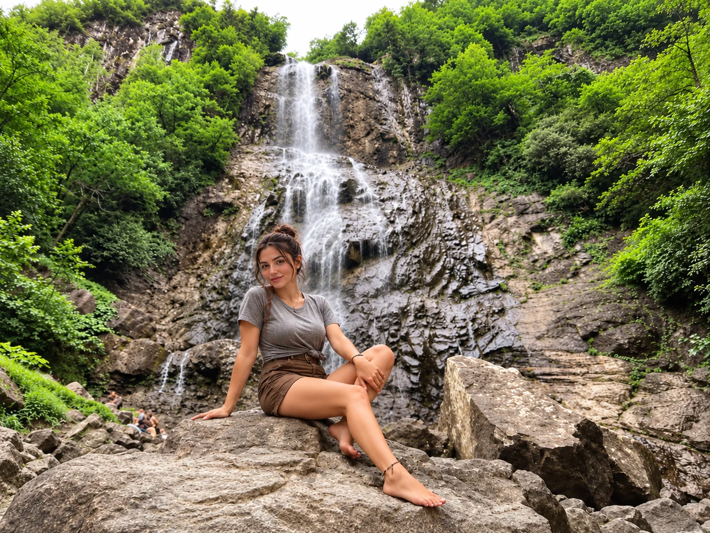
Mençuna Şelalesi is Arhavi's best-known attraction and one of the most impressive waterfalls in the eastern Black Sea. The falls drop approximately 90 metres over dark volcanic rock into the Kamilet stream below. The waterfall is most powerful in spring when snowmelt feeds the flow; late summer flow is reduced but still scenic. To reach the falls from the road, a walking trail of about 30 minutes through forest is required — wear shoes with grip as the path includes rocks and some incline. The trail and waterfall area are freely accessible.
Mençuna Şelalesi — Video
Ortacalar Çifte Köprü (Çiftekemer Köprüsü)
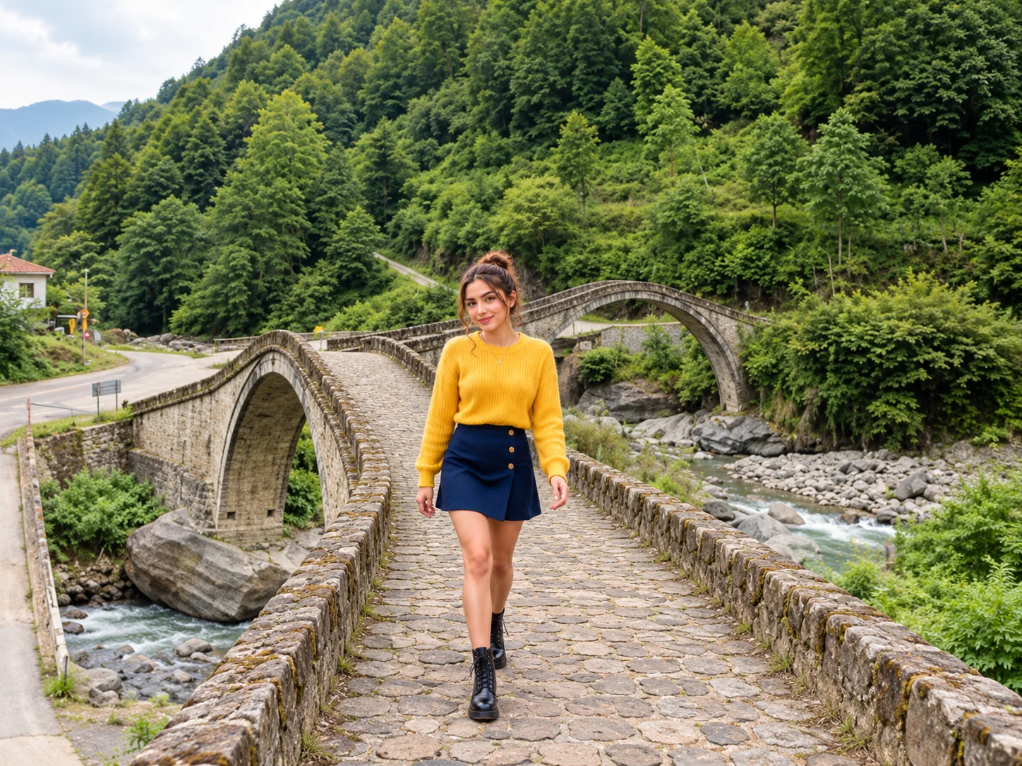
The Çifte Köprü (Double Bridge) sits in Ortacalar Village, 2.5 km from the village centre, in Arhavi district — not in Ardanuç or over the Cehennem Deresi canyon as sometimes written. The two single-arch stone bridges are positioned perpendicular to each other, one crossing the Kamilet stream and the other crossing the Soğucak stream. Each bridge is 35.5 metres long and 2.8 metres wide, pedestrian-only. The construction date is uncertain but estimated at the 18th–19th century. They are a well-preserved example of Black Sea stone bridge craft and easy to combine with a visit to Mençuna Şelalesi on the same day.
Kamilet Valley
The Kamilet Valley connects Arhavi's coastal strip to the higher forested interior and effectively forms the route to both Mençuna and the Ortacalar bridges. The valley road passes through dense forest and alongside the stream — it is worth driving slowly to take in the scenery. The valley sits within a protected natural area; the old-growth sections contain Eastern Black Sea tree species not commonly found elsewhere in Turkey.
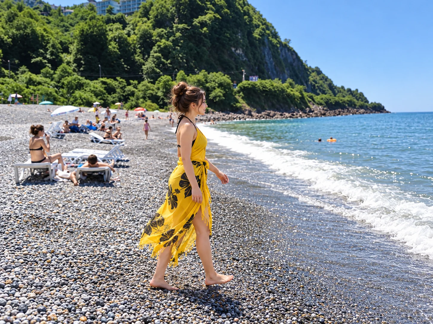
Hopa, Arhavi and Kemalpaşa — The Coast
Artvin province reaches the Black Sea through a narrow coastal strip in the western part of the province. The coast is dramatically different from the highlands: warm and humid, with tea plantations on the hillsides and Black Sea access below.
Arhavi has a pebble beach (shingle rather than sand) used by local residents and visitors in summer. The beach is relatively quiet and unspoiled. The combination of forested hills directly behind the coast creates a landscape unlike typical Aegean or Mediterranean beaches.
Hopa is the main port town, slightly more developed, with a working harbour and promenade. The town has good restaurant options for fresh fish. Kemalpaşa, close to the Georgian border at Sarp, is a lively border-trade town with a promenade and seafront area.
The Black Sea along Artvin's coast can have variable wave conditions and seasonal currents, particularly in autumn and early winter. Always check local conditions before swimming, avoid single-person sea bathing in rough weather, and pay attention to any posted warnings at beach areas.
Murgul — Deliklikaya Waterfall
Murgul district is primarily known for copper mining, but Deliklikaya Şelalesi (Rock-Hole Waterfall) in Başköy offers a genuinely unusual natural attraction. The waterfall derives its name from the fact that water flows through a natural opening in the rock — an uncommon geological formation in the region. The site is about 25 km from Murgul town centre along an unpaved road (the last 1–2 km before the waterfall are rough and require a capable vehicle). Best visited in spring and early summer when water flow is highest. Freely accessible, no entrance fee.
What to Eat in Artvin
Artvin's food culture reflects the province's position at the junction of Laz, Georgian and broader Black Sea culinary traditions. Several dishes are specific to the region:
- Kuymak / Mıhlama — cornmeal cooked with butter and local cheese until it forms a molten, stringy mass. A staple across the eastern Black Sea; in Artvin it is made with local kaşar-style cheeses.
- Silor — thin rolled dough, moistened and baked, served with yoghurt and spiced sauce. A dish particular to Artvin.
- Kalaco — an Artvin-specific preparation of stale cornbread pan-fried with butter, onion and tuzlu ayran (salted yoghurt drink).
- Kaygana — a pan-fried egg and flour batter, common at breakfast across the Black Sea.
- Mısır Ekmeği — dense cornbread; a constant on Black Sea tables.
- Hamsili Ekmek / Hamsili Pilav — bread and rice prepared with anchovies. Anchovies are a defining ingredient of Black Sea cuisine and appear across multiple dishes.
- Cevizli Kete — a thin pastry filled with walnut and sugar.
- Laz Böreği — a custard-filled layered pastry popular across the eastern Black Sea, including Artvin; not exclusive to Artvin.
- Karalahana Sarması — black kale stuffed with rice or meat, a winter staple.
- Maçahel Balı — the honey produced in the Camili biosphere reserve is sought after for the region's Caucasian bee population and the diversity of alpine nectar sources.
Getting to Artvin
Rize-Artvin Airport
The Rize-Artvin Airport (code: RZV) opened in May 2022. Built on reclaimed sea land at Yeşilköy in Pazar (Rize province), it is Turkey's second airport constructed on sea fill after Trabzon. It serves both Rize and Artvin province. From the airport, Artvin city centre is approximately 90 minutes by road; the coastal towns of Hopa and Arhavi are closer (30–45 minutes). Check current airline schedules as routes and frequencies change seasonally.
Trabzon Airport
Trabzon remains a major hub with more frequent and diverse domestic connections. From Trabzon, Artvin city is roughly 3 to 3.5 hours by road via the D010 coastal highway. This route passes through Rize — you can combine a Trabzon stopover and extend your Black Sea journey.
Road Access
Artvin's mountain roads are significantly slower than map distances suggest. The D010 coastal highway is fast along the Black Sea; inland roads climb steeply and have many bends. Budget generously for driving times between districts. The roads to Maçahel, Papart, Arsiyan and Yaylalar are unpaved or semi-paved and require careful driving, especially after rain.
Best Time to Visit
| Season | Conditions | Best for |
|---|---|---|
| May–June | Green, warm, some rain | Wildflowers, waterfalls at full flow, Kafkasör plateau, Georgian churches |
| July–August | Dry and warm in most areas, cool on highlands | Plateau festivals, hiking, Karagöl lakes, Kaçkar trekking |
| September–October | Autumn colour, mild, some fog | Borçka Karagöl autumn foliage, hiking, photography |
| November–March | Cold, snow at altitude, some road closures | Şavşat/Arsiyan winter scenery; Hopa–Arhavi coast milder |
Artvin receives significant rainfall, particularly in the coastal and Maçahel districts. Even in summer, pack a waterproof layer for forest and highland walks.
Suggested Itineraries
1 Day — City and Near-City
Start at Atatepe for city panorama views, continue to Artvin Castle viewpoint (note: interior requires garrison permit), then drive to Hatila Valley for the glass terrace and a short trail walk. Afternoon: drive up to Kafkasör Plateau for views and tea. Return to city for dinner.
2 Days
Day 1: Artvin city, Hatila Valley, Kafkasör. Day 2: Full day in Borçka Karagöl and, if road conditions allow, an afternoon visit to Maçahel/Camili. The Maçahel road adds roughly 1–1.5 hours each way from Borçka; check road conditions before attempting both in a single day.
3–4 Days — Choose Your Region
Nature route: Day 1 Artvin/Hatila. Day 2 Borçka Karagöl. Day 3 Maçahel/Camili. Day 4 Şavşat and Karagöl-Sahara.
Heritage route: Day 1 Artvin city + Dolishane. Day 2 Yusufeli — Barhal, İşhan. Day 3 Ardanuç — Cehennem Deresi + Ardanuç Castle. Day 4 return via Çoruh valley.
Coast + waterfall route: Day 1 Hopa/Kemalpaşa coast. Day 2 Arhavi — Mençuna Şelalesi + Ortacalar Çifte Köprü. Day 3 Artvin city + Hatila. Day 4 Borçka Karagöl.
Getting Around
A private vehicle is effectively essential for visiting Artvin's attractions outside the city centre. Minibuses (dolmuş) connect major towns but run infrequently and do not serve nature park trailheads or highland sites. Driving yourself gives flexibility; hiring a local driver is a practical option for visitors who prefer not to navigate the mountain roads independently. For multi-day journeys originating in Istanbul or western Turkey, an intercity chauffeur service covers the long distances while keeping the flexibility to stop at sites along the route.