
Antalya Province · Güllük Dağı · Pisidia
Termessos Ancient City sits inside Güllük Dağı (Termessos) National Park, about 30–35 km northwest of Antalya centre at roughly 1,000–1,050 m—a Pisidian mountain örenyeri reached by road into the park, then an uphill trail. This 2026 English guide follows Arrian’s campaign narrative (pass cleared; city not captured), keeps Solymi and “unconquered” claims qualified, updates hours and the €3 DOSIM foreign ticket, and treats Cab Istanbul as transport only.
Cab Istanbul provides intercity car with driver transport only. Drivers are not licensed archaeological guides and tickets are not included. Pair Termessos with other places to visit in Antalya or the wider list of ancient cities near Antalya—including flat Pamphylia contrast at Perge—when daylight and fitness allow.
At a glance
Popular places around Termessos
| Place / area | Best for | Location context | Practical note |
|---|---|---|---|
| Termessos Örenyeri | Full mountain archaeology hike | Güllük Dağı NP / Antalya–Korkuteli | Ticket or MüzeKart; bring water |
| Park parking & trailhead | Start of the ascent | Inside national park | Ruins are uphill—not roadside |
| Gymnasium / baths zone | Early monumental fabric | Often early on the ascent | “First structure” depends on route |
| Colonnaded street (modest) | Local urban axis photos | Near gymnasium approach | Not Perge-scale |
| Agora & stoas | Civic core | Central plateau zone | Attalos II / Osbaras traditions |
| Theatre | Cavea + mountain view | Main visitor highlight | ~4,200 seats (qualified) |
| Bouleuterion | Council-house fabric | ~100 m SW of theatre | Prefer bouleuterion over “odeon” |
| Rock cisterns | Engineering highlight | East of agora | Five interconnected |
| Necropolis | Rock-cut tombs & sarcophagi | W / S / N slopes | Not “king graves” |
| Karain Cave corridor | Optional same-day add-on | Same NW Antalya belt | Only with early start |
Geography & park
Where Termessos is — Pisidia mountain city, not a flat plain site
Official museum mapping places Termessos at Bayatbademleri, Güllük Dağı, Termessos Milli Parkı, on the Antalya–Korkuteli highway corridor (Yenicekahve / park turnoff). Ancient Termessos belonged to Pisidia—a mountain city controlling a pass between Pamphylia and the Phrygian interior—not the flat Pamphylian plain cities such as Perge. City elevation is about 1,000–1,050 m. Distance from Antalya centre is about 30–35 km northwest (roughly 45–60 minutes by road); older “10 km” claims are wrong and removed.
Güllük Dağı (Termessos) National Park was established in 1970 (about 6,700 ha). The archaeological site sits inside the park. UNESCO tentative-list context for the park-and-city landscape exists—do not claim inscribed World Heritage status. Tourism sometimes nicknames the site an “Eagle’s Nest” for elevation and defensibility; use that label sparingly as a modern marketing phrase, not a historical title. Access model: drive into the park, park, then hike uphill on rocky trails and uneven ancient paving—this is not a roadside flat ruin walk.
Origins
Solymi tradition, Luwian debate, no secure foundation year
Termessos is securely a Pisidian mountain city in Greek sources (including Arrian) and museum summaries. Self-identification with the Solymi / Solymians—and literary links via Homer and Strabo—belongs to tradition and poetic memory, not a surveyed foundation certificate. Museum wording that ties Solymi identity to a Luwian descent line should stay qualified: it is scholarly debate, not proven ethnicity. Soft Bronze Age continuity talk appears in tourism encyclopedias; this guide omits any invented exact foundation date.
Alexander 333 BC
Pass cleared, city not taken — one consistent campaign account
After operations in Pamphylia, Alexander moved toward the mountain pass near Termessos in 333 BC (common dating; some sources differ on 334). Per Arrian (Anabasis 1.27–28): Termessians held the heights; Alexander cleared the pass, camped near the city, contemplated a siege, then despaired of capturing Termessos without great time loss. He did not take the city. He marched on to Sagalassos (which he did capture). Some Termessians later aided Sagalassians—that does not mean Alexander captured Termessos.
Museum Turkish summaries that speak of siege pressure and a city that did not surrender align with not captured. Remove older contradictions that invent a Termessian counter-attack followed by Alexander taking the city. Call the city “unconquered” only in a qualified sense: not taken by Alexander on this campaign—not “never conquered by anyone.” Museum chronology also notes a later Ptolemaic control phase.
Hellenistic & Roman
Alcetas, walls, and privileged autonomy under Rome
In the Diadochi wars, Alcetas (brother of Perdiccas) fled Antigonus Monophthalmus and took refuge at Termessos in 319 BC. Tradition records civic division between elders and youths, his suicide, mistreatment of the corpse, then local honour. A rock-cut tomb with horseman relief in the northwest necropolis group is traditionally / probably linked to Alcetas—attribution is not archaeologically proven. Caption and prose should say “monument traditionally linked to Alcetas,” not “the proven tomb of Alcetas.”
Hellenistic Termessos prospered with walls, alliances (for example with Adada), and pass control. Rome enters as friendship and legal privilege rather than absolute independence: around 71/70 BC, Senate friendship and the epigraphic tradition of the Lex Antonia de Termessibus document ally status and local legal privileges within the Roman political order. Imperial-era coins claiming autonomy fit that privileged civic self-image—not a claim of standing outside Rome’s sphere. Late antique decline and a often-cited 5th-century AD abandonment remain qualified; earthquake/aqueduct stories are soft tradition. Vegetation and limited excavation shaped the “untouched” look; systematic digs are noted as starting from 2025—seasonal fieldwork, not a daily visitor show.
Archaeology on site
Walls, gymnasium, agora, theatre, cisterns and necropolis
Visitor Termessos is a mountain loop: outer walls and approach fabric, gymnasium and a modest colonnaded street with shops, agora with stoas, theatre with a view toward the plain, bouleuterion nearby, five interconnected rock cisterns east of the agora, probable Zeus Solymeus civic cult context, and a vast rock-cut necropolis. Keep the colonnade modest—do not inflate it to Perge’s canal street.
- Outer walls / approach: Hellenistic–Roman defensive system controlling steep approach and pass traffic.
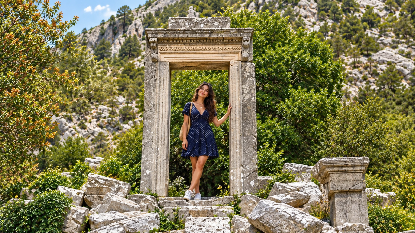
- Monumental temple doorway (probable Hadrian-period entrance): Ionic temple steps/entrance noted on the ascent in official route texts—use for the carved monumental doorway; do not label it an “Artemis and Hadrian Gate.”
- Gymnasium (+ associated baths): large multi-room complex often met early on the current park path—qualify any “first structure” claim to today’s route order.
- Colonnaded street + shops: present near the gymnasium in official TR route texts; local and modest in scale.
- Agora: civic core with stoa traditions (Attalos II to the northwest; Osbaras stoa).
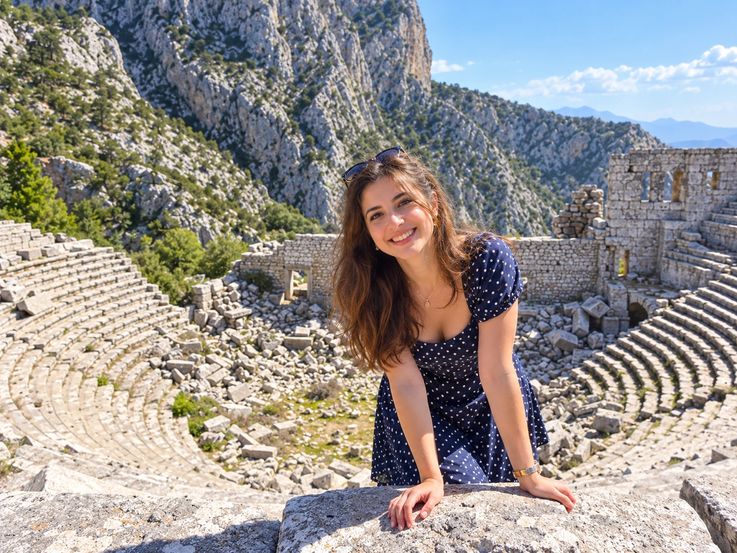
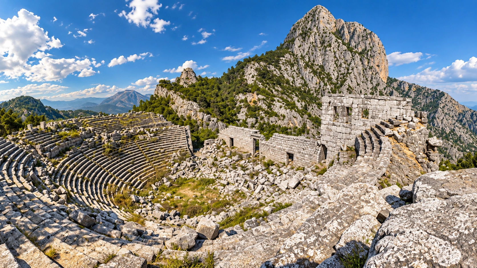
- Theatre: Hellenistic cavea with Roman-stage fabric; capacity often given around 4,200 seats—qualify as inventory figure, mountain-view highlight.
- Bouleuterion / council house: standing fabric roughly 100 m southwest of the theatre—prefer this label over tourism “music odeon” filler (odeon may appear in blogs; qualify).
- Five interconnected rock cisterns: east of the agora—major water-engineering stop.
- Zeus Solymeus: civic cult; temple identification probable near the council/odeon area—no generic Zeus filler.
- Artemis: named in tourism; dedication stays qualified unless an inscription locks it in a caption.
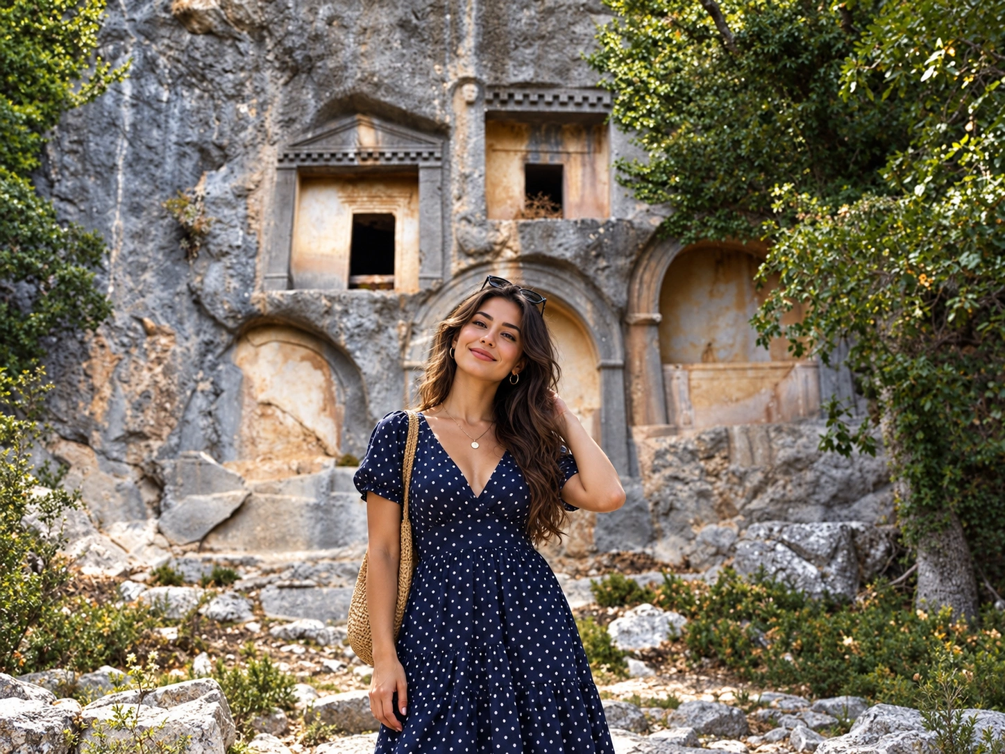
- Necropolis: extensive rock-cut tombs and sarcophagi on western, southern and northern slopes—not royal or “king graves.”
- Alcetas monument: northwest rock-tomb group—traditional / probable attribution only.
| Monument / area | Period / function | Why it matters | Visitor note |
|---|---|---|---|
| Outer walls / approach | Hellenistic–Roman defence | Pass control & steep entry | Rocky ascent |
| Monumental temple doorway | Probable Hadrian-period temple entrance | Carved lintel landmark on ascent | Artemis not verified in filename |
| Gymnasium / baths | Athletic / bathing complex | Large multi-room fabric | Often early on trail |
| Colonnaded street | Local urban axis | Shops near gymnasium | Modest—not Perge-scale |
| Agora + stoas | Civic / commercial | Core plateau square | Photo stop |
| Theatre | Hellenistic cavea + Roman stage | ~4,200 seats (qualified) | Mountain view toward plain |
| Bouleuterion | Council / assembly | Standing near theatre | Not “music odeon” filler |
| Five rock cisterns | Water engineering | Interconnected cut system | East of agora |
| Zeus Solymeus context | Civic cult (probable) | Local Solymian Zeus | Identification qualified |
| Necropolis | Rock-cut tombs / sarcophagi | Vast burial landscape | Not king/royal graves |
| Alcetas-linked tomb | Rock-cut with horseman relief | Diadochi-era tradition | Traditional / probable ID |
Videos are visual atmosphere only. They do not confirm today’s ticket price, hours, trail conditions or excavation access.
Practical 2026
Tickets, hours, hiking difficulty and timing
| Practical detail | Current information |
|---|---|
| Location | Bayatbademleri, Güllük Dağı, Termessos Milli Parkı (Antalya–Korkuteli) |
| Ancient region | Pisidia · city ~1,000–1,050 m |
| Distance from Antalya | ~30–35 km NW · ~45–60 min typical drive |
| Open days | Daily (muze.gov.tr) |
| Listed hours | 08:00–19:00; ticket desk 17:00 (muze.gov.tr) |
| Foreign ticket | €3 (DOSIM Termessos Örenyeri) |
| Turkish citizens | MüzeKart valid (muze.gov.tr / DOSIM) |
| Stale prices | Ignore old 70 TL CMS lines |
| Park tariffs | Possible separate DKMP person/vehicle charges—confirm on site; do not merge with örenyeri €3 |
| Parking | Park-interior parking before the trail; confirm fee/rules |
| Trail difficulty | Moderate–strenuous mountain hike; rocky, heat, uneven paving |
| Accessibility | Not wheelchair or stroller friendly; limited-mobility visitors need strong caution |
| Visit duration | Main loop ~3–5 h; deeper half day+ |
| Food / water | Limited on site—bring water |
| Best season | Spring/autumn; summer early start; winter wet/short daylight |
| Excavation note | Systematic digs from 2025—seasonal, not a daily show |
Wear sturdy shoes, start early in summer heat, and treat the trail as a real hike. Old “70 TL” visitor tips are stale for 2026 planning; use the DOSIM €3 foreign tariff and MüzeKart rules, then reconfirm at the desk.
Getting there
Transport and realistic itineraries
| Route | Practical options | Important note |
|---|---|---|
| Antalya center → Termessos | Private car / taxi / chauffeur | ~30–35 km · ~45–60 min · preferred |
| Antalya Airport → Termessos | Car / taxi / chauffeur | Via city or highway corridor |
| Korkuteli-direction bus | May drop near highway junction only | Long access road remains—impractical without taxi/transfer |
| Combine with Karain Cave | Same NW corridor | Optional same day only with early start |
| Contrast with Perge | Separate Pamphylia plain day | Different fitness & terrain profile |
Private car is the practical default. Korkuteli-bound buses that leave you at a highway junction do not make a casual tourist plan—the park access road and uphill trail still remain. This guide does not invent bus route numbers. Cab Istanbul remains intercity chauffeur transport only—not a hiking guide, ticket desk or Termessos tour product.
| Itinerary | Stops | Best for | Important note |
|---|---|---|---|
| Half day (3–4 h on site) | Trail → gymnasium zone → agora → theatre → cisterns | Fit first visit | Bring water; watch desk 17:00 |
| Full ruin loop (4–5 h+) | Above + bouleuterion + necropolis + Alcetas-linked tomb area | Archaeology hikers | Moderate–strenuous; uneven rock |
| NW corridor day | Early Termessos + optional Karain Cave | Two-stop northwest day | Only with daylight & energy margin |
| Contrast planning | Termessos mountain day vs Perge plain day | Different Antalya archaeology moods | Do not force both into one rushed hike |
FAQ
Termessos Ancient City frequently asked questions
Inside Güllük Dağı (Termessos) National Park on the Antalya–Korkuteli corridor—museum address Bayatbademleri, Güllük Dağı—about 30–35 km northwest of Antalya centre at roughly 1,000–1,050 m elevation.
Pisidia. It is a mountain pass city, not a flat Pamphylian plain site like Perge.
About 30–35 km northwest, typically 45–60 minutes by road. Older “10 km” claims are incorrect.
No. In 333 BC he cleared the nearby pass, camped by the city, then left without capturing it and marched to Sagalassos (Arrian 1.27–28). Ignore older myths that invent a Termessian defeat of Alexander’s army at the city itself.
Only in a qualified sense: Alexander did not take it on that campaign. Museum chronology also notes later Ptolemaic control—so “never conquered by anyone” is too strong.
A modern tourism nickname for elevation and defensibility—not an ancient official title. Use it sparingly.
Literary and traditional self-name linked to Homer/Strabo and museum foundation tradition. Treat Solymi origin and Luwian descent claims as qualified debate—not proven ethnicity—and omit invented foundation years.
Alcetas, brother of Perdiccas, took refuge and died at Termessos in 319 BC. A rock-cut tomb with horseman relief is traditionally / probably linked to him—not archaeologically proven.
It enjoyed friendship, legal privileges and civic autonomy claims (including Lex Antonia de Termessibus tradition)—privileged status within the Roman order, not absolute independence outside Rome.
DOSIM lists €3 for foreign visitors; MüzeKart is valid for Turkish citizens. Old 70 TL figures are stale—confirm the day’s tariff at the desk. Possible separate national-park charges are not the same as the örenyeri ticket.
muze.gov.tr lists 08:00–19:00 daily with ticket desk closing at 17:00. Plan the hike so you are not still deep on the trail after desk hours.
Moderate to strenuous: rocky paths, heat, elevation gain and uneven ancient paving. Bring water; there is limited food/water on site.
No. It is not wheelchair or stroller friendly. Visitors with limited mobility or older travellers need strong caution and realistic expectations.
About 3–5 hours for the main ruin loop; allow a deeper half day if you add the necropolis and move slowly in heat.
Cultural inventory sources often cite about 4,200—use that as a qualified figure, not a national ranking.
Prefer bouleuterion / council house. Tourism sometimes says “odeon”; that music-venue filler is weaker than the assembly-building reading.
No. The rock-cut necropolis tombs are burial monuments—not proven royal or “king graves,” despite older filenames and marketing.
Not as a casual plan. Korkuteli-direction buses may leave you near a junction; the park access road and uphill trail remain. Prefer car, taxi or chauffeur plus a pre-arranged return.
Termessos is a Pisidian mountain hike inside a national park; Perge is a flatter Pamphylian urban ruin walk at Aksu. Different fitness, monuments and day logistics—see the Perge guide for contrast.
Cab Istanbul offers intercity chauffeur transport only—no hiking guide, local tour package or tickets included.
Termessos rewards visitors who treat it as a mountain archaeology hike first: clear Alexander’s 333 BC pass campaign without inventing a city capture, walk theatre, agora and cisterns with qualified cult and necropolis language, use the €3 DOSIM tariff and 08:00–19:00 / desk 17:00 hours, and keep Cab Istanbul to chauffeur transport beside Antalya’s wider ancient-city circuit.