
Fatih: Istanbul's Grand Historic District
Fatih is the oldest and largest of Istanbul's 39 districts — the entire historic peninsula enclosed by the Byzantine Land Walls. Home to 36 neighbourhoods, it stretches from Sultanahmet and Eminönü in the east to Yedikule and the Marmara coast in the west, from the Golden Horn waterfront in the north to the Sea of Marmara in the south. One district; three thousand years of layered history.
Why Visit
Three Millennia in One District
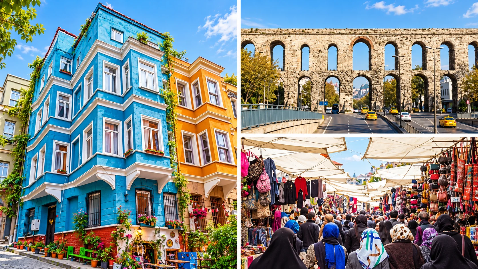
Byzantine churches-turned-mosques, Ottoman külliye complexes, Roman aqueducts, ancient land walls, Greek and Jewish heritage quarters, a weekly mega-market, bridal bazaars, wholesale fashion districts, and some of Istanbul's most atmospheric neighbourhoods — all within the walled city of Fatih.
Key Areas
Neighbourhoods at a Glance
Sultanahmet: iconic monuments. Çarşamba: mega-market. Zeyrek: Byzantine quarter. Laleli: fashion district. Fener–Balat: heritage waterfront. Yedikule: fortress & walls. Edirnekapı: Mihrimah Mosque, Kariye. Eminönü: ferry hub & bazaars.
Getting There
Access from Istanbul Airports
From Istanbul Airport (IST): Metro M11 → Gayrettepe → M2 to Vezneciler (~55 min) or private transfer (~30–40 min). From Sabiha Gökçen (SAW): Metro M4 to Ayrılık Çeşmesi, then ferry or bus. Private airport transfer drops you anywhere in Fatih door to door.
Sultanahmet: The Iconic Core
The Sultanahmet district contains four of the world's most visited monuments in fewer than 500 metres. Each has its own dedicated guide — this section links out so the rest of this page focuses on the rest of Fatih.
6th Century
Hagia Sophia →
Built AD 537 by Emperor Justinian I. Cathedral, Ottoman mosque, museum (1934–2020), and active mosque today. The largest building in the world for a thousand years. Full visitor guide: opening hours, ticketing, dress code.
Ottoman 1616
Sultan Ahmed Mosque →
The Blue Mosque (1609–1616), Sultan Ahmed I's imperial complex opposite Hagia Sophia. Famous for its six minarets and 20,000 Iznik tiles. Closed to tourists during prayer times — full timing guide on the dedicated page.
15th Century
Topkapı Palace →
The Ottoman sultans' primary residence 1465–1856. Treasury, Harem, Sacred Relics, Imperial Kitchens. Book tickets online — queues can reach 2 hours in summer. Dedicated page covers all four courtyards in detail.
Byzantine Cistern
Basilica Cistern →
The 6th-century underground cistern with 336 columns, Medusa heads, and atmospheric lighting. One of Istanbul's most photographed sights. Open daily — full guide including the new expanded section on the dedicated page.
Hippodrome
Sultanahmet Meydanı
The ancient Hippodrome (capacity 100,000, built AD 203) is today the Sultanahmet public square. Three surviving monuments: the Egyptian Obelisk (Thutmose III, c.1450 BC), the Serpent Column from Delphi (479 BC), and the Constantine Column.
Palace Museum
İbrahim Paşa Palace — Turkish & Islamic Arts
The 16th-century palace of Grand Vizier İbrahim Paşa on the western edge of the Hippodrome. Now the Museum of Turkish and Islamic Arts — one of Istanbul's finest collections of Seljuk and Ottoman artefacts, carpets, and manuscripts.
Fatih Camii & the Conqueror's Külliye
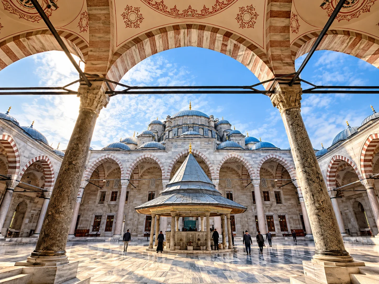
The Fatih Mosque (Fatih Camii) is the district's namesake and spiritual centre — built by Mehmed II "the Conqueror" between 1463 and 1470 on the site of the Church of the Holy Apostles, the second-largest Byzantine church after Hagia Sophia and the burial place of Constantine the Great.
The original mosque was severely damaged in the 1766 earthquake and entirely rebuilt by Sultan Mustafa III in the late 18th-century Ottoman Baroque style. The vast külliye (mosque complex) that Mehmed originally commissioned included eight medreses, a hospital, imaret (soup kitchen), caravanserai, and library — the largest social welfare complex in the Ottoman world at that time. Parts of the original medrese buildings survive around the mosque courtyard.
The Tomb of Mehmed II
The türbe (mausoleum) of Mehmed II stands in the cemetery garden behind the mosque — a heavily visited pilgrimage site. The Conqueror died in 1481 at age 49 during a military campaign in Anatolia. His tomb, rebuilt in the Ottoman Baroque period, is open to visitors and remains a site of continuous prayer and commemoration.
Visiting Fatih Camii
The mosque is an active place of worship and always open to respectful visitors outside prayer times. Entry is free. The enormous courtyard with its ablution fountain, surrounded by 18 domed porticoes, is one of the most impressive mosque forecourts in Istanbul. The neighbourhood around it — also called Fatih — is a traditional conservative quarter with excellent lokanta restaurants on Akdeniz Caddesi.
Çarşamba Pazarı: The Wednesday Bazaar
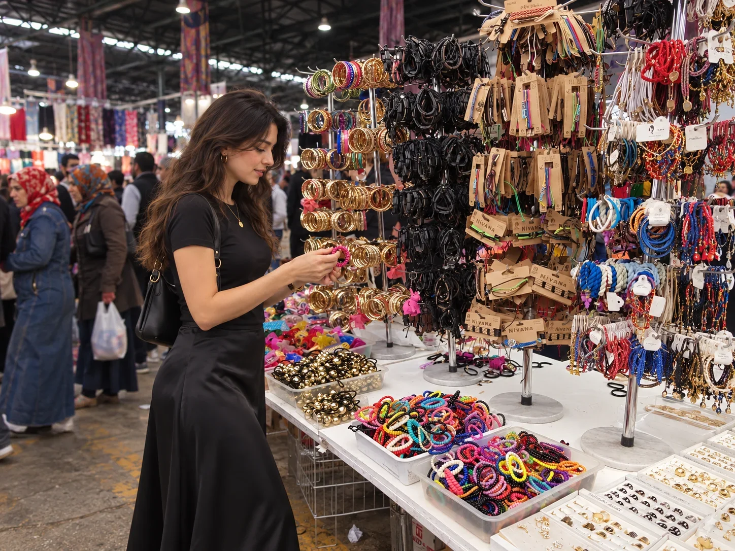
Every Wednesday, the streets of Çarşamba neighbourhood transform into one of Istanbul's largest — and most atmospheric — open-air markets. Stalls spill across multiple city blocks, filling the lanes between Fevzipaşa Caddesi and Yavuz Selim Bulvarı with produce, textiles, household goods, spices, cheese, olives, pickles, dried fruits, clothing, and tools.
The market is a working neighbourhood bazaar rather than a tourist attraction — prices are low, the crowd is local, and the atmosphere is genuine Ottoman commercial street culture. The name "Çarşamba" simply means Wednesday in Turkish. Bring cash (most vendors don't accept cards), arrive before noon for the best selection, and wear comfortable shoes for the uneven cobblestones.
What to Buy
Fresh seasonal produce, tarhana (fermented grain-tomato soup base), dried herbs and spices, fresh cheeses, tulumba pastries, hand-dyed fabrics, work boots, and a range of Ottoman-era household items. The spice section near the mosque end is particularly well-stocked with dried peppers, thyme, and sumac.
Çarşamba Neighbourhood
Beyond market day, Çarşamba is a dense, lived-in neighbourhood centred on the Fatih Mosque. Its character is distinctly traditional — many residents dress in conservative religious attire, small medreses and Quranic schools line the side streets, and the tea-house culture remains strong. The neighbourhood rewards slow walking and quiet observation.
Kadınlar Pazarı & the Valens Aqueduct
4th Century Roman
Bozdoğan Kemeri — Valens Aqueduct
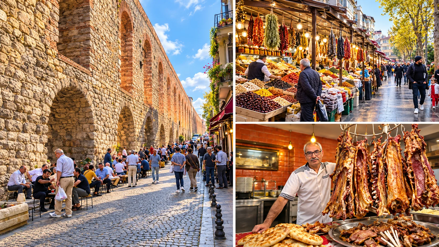
Built between AD 368 and 375 by Emperor Valens, the aqueduct carried water from sources in Thrace into the heart of Constantinople. 970 metres of the original structure survive — still standing up to 18.5 metres high — making it one of the most complete Roman water-supply monuments in the world. Atatürk Bulvarı passes through its double-tiered arches today.
Historic Market
Kadınlar Pazarı
The open-air market stretching along the base of the Valens Aqueduct has been a commercial zone for centuries. Today it is a daily street market selling fresh produce, dried goods, textiles, and household items — busiest in the morning hours. The surrounding streets are full of small workshops, cobblers, and neighbourhood tradesmen.
Walking the Aqueduct
The Aqueduct Walk
The best viewpoint is from Atatürk Bulvarı looking north through the arches. Walking east along Şehzadebaşı Caddesi (toward the Şehzade Mosque) gives a ground-level perspective on the monument's scale. The aqueduct is free to view from the street at all times — it is not a ticketed site.
Gelinlikçiler Çarşısı & Fevzipaşa Caddesi

Wedding Culture
The Bridal Bazaar
Fevzipaşa Caddesi between Fatih and Aksaray hosts Istanbul's most concentrated cluster of bridal shops — dozens of ateliers and showrooms displaying elaborate wedding gowns, engagement dresses, and accessories. The district is known as Gelinlikçiler Çarşısı ("bridal market") and draws customers from across Turkey and the Balkans.
Shopping Culture
Wholesale Textile Row
Alongside bridal wear, Fevzipaşa Caddesi is lined with wholesale textile shops — fabric merchants, notions suppliers, and lace dealers who supply the district's ateliers and small manufacturers. Many shops sell to the public at near-wholesale prices. It is a working commercial street, not a tourist bazaar.
Local Tip
When to Visit
Weekday mornings are quietest. On Wednesdays the Çarşamba market fills adjacent streets and traffic is heavy — plan either to combine with the market or to visit on a different day. Most shops close early on Sundays. The district is entirely walkable from the Fatih Mosque (10 min on foot).
Zeyrek, Vefa & Şehzade
Zeyrek — The Byzantine Hill
Zeyrek is one of Istanbul's most intact medieval neighbourhoods — dense, labyrinthine, and largely unchanged in street plan since Byzantine times. At its heart stands Zeyrek Camii, the former Church of the Pantocrator, founded in 1136 by Empress Eirene, wife of John II Komnenos. The complex originally comprised three churches and a monastery — now a single mosque. It is a UNESCO World Heritage Site as part of the Historic Areas of Istanbul.
The neighbourhood around it is a working-class mahalle of timber-framed houses in varying states of restoration. It offers some of Istanbul's finest panoramic views across the Golden Horn toward Balat and Fener. The steep lanes are best explored on foot; the neighbourhood is free to enter and wander.
Vefa — Boza & Byzantine Churches
The Vefa district, just south of Zeyrek, is home to Vefa Bozacısı — Istanbul's most famous boza shop, founded in 1876 by Albanian immigrant Hacı Sadık. Boza is a lightly fermented millet drink, thick and mildly sweet, traditionally served with roasted chickpeas. Atatürk visited the shop in 1937 and his glass is still displayed on the wall. Open daily.
Şehzade Camii
The Şehzade Mosque on Şehzadebaşı Caddesi was built by the great Ottoman architect Mimar Sinan between 1543 and 1548 for Sultan Süleyman the Magnificent in memory of his son Şehzade Mehmed, who died young. It was Sinan's first major imperial commission and is considered his earliest large-scale masterpiece — a pair of half-domes and an unusually symmetric floor plan. Entry is free during non-prayer hours.
Laleli: Istanbul's Fashion District
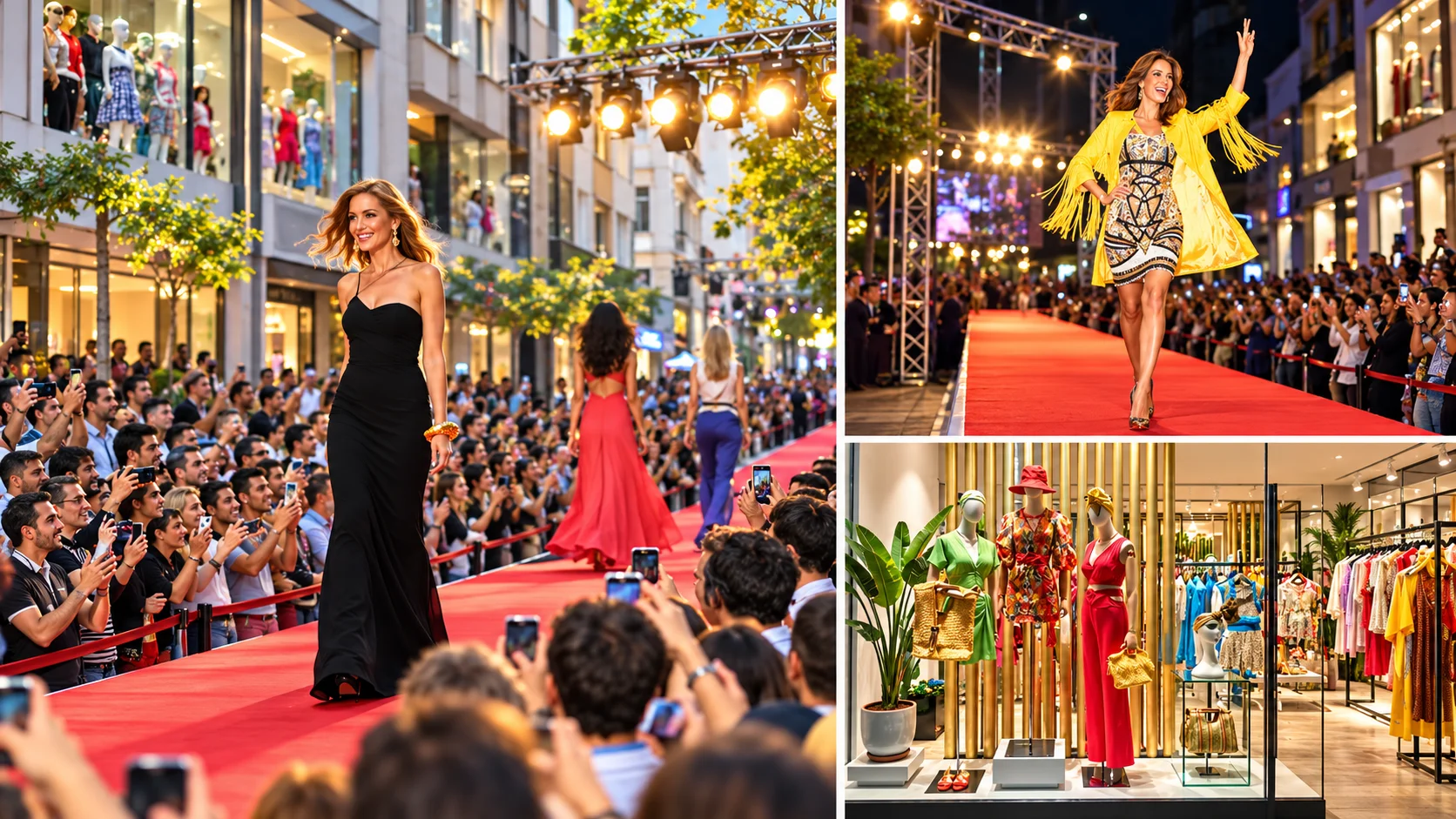
Fashion Hub
Laleli Wholesale District
Laleli is Istanbul's primary wholesale fashion and textile district — hundreds of showrooms and retail shops selling clothing, leather goods, and accessories at competitive prices. International buyers from the Balkans, Central Asia, Middle East, and Africa have shopped here for decades. The district is particularly lively on weekdays when wholesale transactions dominate.
Annual Event
Laleli Fashion Shopping Festival
Organised by LASİAD (Laleli Businessmen's Association), the Laleli Fashion Shopping Festival runs every August. The 12th edition took place in August 2026, attracting thousands of retail and wholesale buyers. The festival features discounts, runway events, and international buyer programmes across the district's showrooms.
Historic Mosque
Laleli Camii
The Laleli Mosque (1760–1764), built by Sultan Mustafa III, is a fine example of Ottoman Baroque architecture with European Rococo influences — unusual undulating facades and an elevated terrace over a commercial arcade (arasta) underneath. The mosque's interior features coloured marble and elaborate tilework. Free entry, open outside prayer times.
Yenikapı & the Theodosius Harbour
One of the most significant archaeological discoveries in Turkish history unfolded beneath the modern Yenikapı transport hub. Excavations for the Marmaray rail tunnel (2004–2013) exposed the Portus Theodosiacus — the ancient harbour of Theodosius I, in operation from the 4th century until it silted up in the Byzantine period.
The Shipwreck Fleet
The Yenikapı excavation yielded 36 Byzantine shipwrecks — the largest assemblage of ancient ships ever found in a single excavation. Dating from the 5th to the 11th centuries, the vessels range from small fishing boats to large merchant galleys. Many are preserved in Istanbul's Archaeology Museums; the excavation site itself has since been built over by the Yenikapı transport interchange.
Yenikapı Transport Hub
Today Yenikapı is one of Istanbul's most important transit nodes. The Marmaray commuter rail connects it under the Bosphorus to Üsküdar and the Asian side in minutes. The M1A metro links it westward to Aksaray, the airport coach terminal at Esenler, and onward to the suburbs. The Yenikapı Ferry Terminal serves Bandırma (for Bursa by high-speed train), Yalova, Bursa, and Avşa island — as well as intercity ferry services to Marmara islands.
Yenikapı Sahil — The Coastal Strip
The Yenikapı coastal reclamation area is a wide promenade stretching along the Sea of Marmara. On summer evenings it fills with families, cyclists, street food vendors, and fishermen. The waterfront is free to walk and offers views across to the Princes' Islands. It connects eastward to the Eminönü–Sirkeci coastal path.
Istanbul Archaeology Museums
The Byzantine ships and thousands of artefacts from the Yenikapı dig — Byzantine amphora, anchors, rope, tools, and personal items — are now displayed at the Istanbul Archaeology Museums in nearby Gülhane. The museum complex is one of the finest archaeological collections in the Middle East. See the full guide: Istanbul Museums.
Samatya, Kocamustafapaşa & South Fatih
Samatya — Multi-Ethnic Waterfront Quarter
Samatya (Byzantine: Psamathia) is one of Istanbul's oldest Greek and Armenian neighbourhoods, clinging to the Marmara hillside between Yenikapı and Yedikule. The district retains a small but active Greek Orthodox community — the Balıklı Rum Hastanesi (Greek Hospital of the Spring), founded in 1898, sits at its heart, with a Byzantine-era sacred spring (hagiasma) in its grounds.
Samatya's streets are quieter than the main tourist circuits, with traditional meyhanes (taverns), fish restaurants, and neighbourhood tea gardens. The Surp Kevork Armenian Church (1688) and several smaller Orthodox churches remain active. The coastal promenade along the Sea of Marmara begins near here and extends all the way to Yenikapı.
Kocamustafapaşa
The Kocamustafapaşa neighbourhood takes its name from a mosque built by Grand Vizier Koca Mustafa Paşa on the site of a Byzantine monastery (converted to mosque after 1453). The mosque complex retains its Byzantine church structure, unusual for Istanbul. The neighbourhood is typical south Fatih — dense residential, traditional, and largely unvisited by tourists.
İmrahor İlyas Bey Camii — The Stoudios Monastery
Near the Yedikule walls, İmrahor İlyas Bey Camii occupies the ruined remains of the Stoudios Monastery, founded in AD 463 — the oldest surviving monastic site in Istanbul. The roofless nave and intact marble floor of the original basilica of St John the Baptist are visible within the mosque grounds. The site is open to visitors and largely overlooked — one of Istanbul's most evocative archaeological ruins.
Yedikule & the Theodosian Walls
Yedikule Hisarı — The Castle of Seven Towers
The Yedikule Fortress stands at the southern end of the Byzantine Land Walls, where they meet the Sea of Marmara. It was built by Mehmed II in 1457 — four years after the conquest — by connecting four existing Byzantine towers of the Golden Gate fortification with three new Ottoman towers, creating a seven-tower compound.
The fortress served multiple functions over the centuries: a treasury vault, a state prison, and an execution site. Ottoman Sultan Osman II was brought here and executed in 1622 — the only Ottoman sultan killed by his own Janissary troops. The tower where he was held still stands. The fortress also held foreign ambassadors during diplomatic crises. See full history: Yedikule Museum.
Today Yedikule is a museum. The towers and connecting walls are accessible, and the views from the battlements — over the Sea of Marmara, the land walls stretching northward, and the old city roofscape — are among the finest in Istanbul.
Theodosian Land Walls — Kara Surları
The Theodosian Walls, built between AD 408 and 450 during the reign of Theodosius II, are the most complete surviving ancient city fortification in the world. The system stretches 6.5 kilometres from the Golden Horn at Ayvansaray to the Sea of Marmara at Yedikule — a triple-layered defence of inner wall, outer wall, and moat.
The walls kept Constantinople from conquest for over a thousand years — surviving Hunnic raids, Bulgar sieges, Arab attacks, and multiple Crusader approaches — until 29 May 1453 when Ottoman forces breached the Romanos Gate (Topkapı Gate) after a 54-day siege.
Walking the Walls
The best-preserved sections are between Yedikule and the Belgrat Kapısı and between Topkapı Gate (Romanos Gate) and Edirnekapı. A linear walk along the outer face of the walls — partly through allotment gardens inside the moat zone — takes around 2–3 hours for the full length. The walls are free to walk along at all times. Several towers are climbable at Yedikule; other sections require care on uneven ground.
Topkapı Semti & the Romanos Gate
Important: Topkapı neighbourhood (semti) is an entirely different place from Topkapı Palace (Sarayı). The palace is in Sultanahmet near the waterfront. The neighbourhood called Topkapı is 4 kilometres further west, at the Byzantine Land Walls — named after the historic gate in the wall, not the palace.
The Romanos Gate — Topkapı
The Topkapı Gate — formally known as the Porta Romana (Romanos Gate) — is the most historically significant point on the Theodosian Walls. On the morning of 29 May 1453, Ottoman forces under Mehmed II broke through at this gate after a 54-day siege, ending the Byzantine Empire that had stood for 1,123 years.
The gate today is a busy road crossing through the ancient walls. The surrounding area is largely residential. A modest commemorative marker stands near the breach point. Despite its immense historical significance, it attracts relatively few tourists — making it one of Istanbul's more powerful and quiet historical sites to visit.
Topkapı Neighbourhood Today
The Topkapı semti is a dense, working-class neighbourhood stretching from the Land Walls westward toward the inner ring road. It has no major tourist sites beyond the gate itself and the adjacent wall section. The district is however notable for its traditional covered market on Maltepe Caddesi, its lokanta culture, and its role as a bus terminal area (the nearby Esenler Coach Terminal — Büyük İstanbul Otogarı — is adjacent to the western neighbourhoods of the district).
Combine with the Wall Walk
Visitors walking the Theodosian Walls typically pass through the Topkapı Gate section as part of a longer north-south walk. The gate is approximately midway along the walls. Combine with Yedikule (southern end, 30-min walk) or Edirnekapı (northern end, 45-min walk) for a full wall experience.
Sulukule, Karagümrük & Western Fatih
Sulukule
Sulukule is one of the oldest Roma settlements in Europe, with a community documented in Constantinople since the 9th century. The neighbourhood sits just inside the land walls near Edirnekapı. Its traditional Roma music and entertainment houses — once famous throughout Istanbul — ceased to exist following the urban renewal project of 2009, which demolished much of the old neighbourhood and displaced thousands of residents. The rebuilt district is now largely residential new construction.
Sulukule's Roma community and their cultural traditions — music, dance, craftsmanship — are an important part of Istanbul's history. Some community members continue to organise cultural events and workshops in the area; local cultural organisations can provide information on any active programmes.
Karagümrük
Karagümrük is a traditional mahalle between Fatih Mosque and the western walls, with a history as a tannery and craftsmen's district. Today it is primarily residential. The neighbourhood is known locally for its Karagümrük SK football club (founded 1926, one of Istanbul's oldest clubs, recently returned to the top division) and its several Ottoman-period neighbourhood mosques. The Mosque of Ferruh Kethüda (16th century, attributed to Sinan) is a notable example of single-domed Sinan-school architecture.
Aksaray
Aksaray is primarily a transport and commercial hub — the M1A metro terminus on the European side, a major bus corridor, and a dense commercial district of hotels, shops, and services. The Pertevniyal Valide Sultan Mosque (1871) on Aksaray Square is a striking late Ottoman building. The district has limited sightseeing interest beyond transit purposes but is a useful base for budget travellers visiting western Fatih.
Edirnekapı: Gate, Mosque & Byzantine Mosaics
Edirnekapı — The Adrianople Gate
The Edirnekapı (Adrianople Gate) in the Theodosian Walls is the point from which the road to Edirne (ancient Adrianopolis) and onward to Europe departs. It was one of the main ceremonial entry gates of Byzantine Constantinople and remains a working road crossing in the walls today. The surrounding neighbourhood is dense and residential, with the walls providing an extraordinary backdrop to everyday street life.
Mihrimah Sultan Camii
Standing directly on the Edirnekapı section of the land walls, the Mihrimah Sultan Mosque (1565) was designed by Mimar Sinan for Mihrimah Sultan, beloved daughter of Süleyman the Magnificent. The mosque is celebrated for its luminous interior — the side walls are almost entirely windows, flooding the space with diffused light. Sinan reportedly designed it so that the sun sets through the mosque's western windows on 21 March, Mihrimah Sultan's birthday. Free entry outside prayer times.
Kariye — The Chora Church
The Kariye Mosque (formerly the Church of the Holy Saviour in Chora) contains the finest surviving Byzantine mosaics and frescoes in the world, covering the narthex and parekklesion with breathtaking 14th-century narrative cycles. Built in the 11th century and decorated in the early 14th century under the patronage of Theodore Metochites, the building became a mosque after 1453, a museum in 1958, and was reconverted to an active mosque in August 2020.
Visitors may enter and view the mosaics; entry fee: 20 Euro. The mosque is closed on Fridays and during prayer times (mosaics may be partially covered during prayers). The full guide — with ticketing, photography rules, and mosaic descriptions — is available at Kariye Mosque guide.
Video: Kariye Müzesi — Byzantine mosaic cycles in the Chora Church, Edirnekapı, Fatih.
Fener & Balat: Waterfront Heritage Quarters
Fener — The Greek Patriarchate
Fener (Byzantine: Phanar) is the historic centre of Istanbul's Greek Orthodox community and home to the Ecumenical Patriarchate of Constantinople — the spiritual leader of Orthodox Christianity worldwide. The Patriarchate's compound on Sadrazam Ali Paşa Caddesi includes the Church of St George (1836), used for all major Patriarchal services. Visitors may enter the church courtyard and church (appropriate dress required, free).
The neighbourhood's name — "Fener" means lighthouse — comes from an old lighthouse on the Golden Horn promontory. The Greek community that gave the district its character (the Phanariots, influential Ottoman-era Greek intellectuals and administrators) has largely emigrated, but the Patriarchate remains, and the neighbourhood retains its Ottoman-era architecture along steep hillside streets.
Balat — Jewish Quarter & Colourful Houses
Balat (Byzantine: Blachernai-adjacent) is the historic centre of Istanbul's Sephardic Jewish community, settled here after the Ottoman invitation to Jewish refugees expelled from Spain in 1492. The neighbourhood's narrow lanes, colourful pastel houses, and worn Ottoman architecture make it one of Istanbul's most photographed districts.
The Ahrida Synagogue — Istanbul's oldest active synagogue, dating to the 15th century — stands in Balat's interior lanes (visits by prior arrangement). The neighbourhood's regeneration over the past decade has added cafés and design studios alongside the traditional ironmongers, cobblers, and neighbourhood markets. The full visitor guide is at Balat Attractions.
Eminönü, Sirkeci & the Golden Horn Waterfront
Eminönü — Istanbul's Ferry Hub
Eminönü is the city's historic waterfront heart — the point where the Golden Horn meets the Bosphorus, and the main departure point for ferries to Üsküdar, Kadıköy, the Princes' Islands, and the Bosphorus cruise. The Mısır Çarşısı (Egyptian Spice Bazaar), built in 1660 as part of the New Mosque complex, sells spices, dried fruits, Turkish delight, and tea just steps from the ferry docks. The streets around it — particularly Hasırcılar Caddesi — are lined with wholesale spice, nut, and dried goods merchants.
The Yeni Camii (New Mosque) directly on the waterfront was completed in 1663 — despite the name, it is over 350 years old. The Galata Bridge connects Eminönü to Karaköy and Galata, with anglers lining both levels year-round.
Sirkeci — The Orient Express Terminal
Sirkeci Station (1890) was the western terminus of the legendary Orient Express railway service — the endpoint of the long-distance train from Paris via Vienna, Budapest, and Sofia. The station building, designed by German architect August Jachmund in an Orientalist style blending Ottoman and European elements, is now partly a railway museum. Local train services (Halkalı–Gebze Marmaray) still use the station.
Gülhane Park
Gülhane Park, adjacent to the Topkapı Palace walls, is Istanbul's oldest public park — a former imperial rose garden. It contains the Istanbul Archaeology Museums complex (three separate museum buildings with collections from Troy, Babylon, Egypt, and the Ottoman world) and the Çinili Köşk (Tiled Pavilion, 1472), one of the oldest surviving Ottoman secular buildings.
Mahmutpaşa, Beyazıt & the Grand Bazaar
Mahmutpaşa Çarşısı
Mahmutpaşa is the steep street market descending from the Grand Bazaar toward Eminönü — one of Istanbul's most intense commercial corridors. Thousands of small shops and stalls sell clothing, fabric, accessories, toys, electronics, and household goods at wholesale prices. On weekdays the street is packed with wholesalers, retailers, and buyers from across Turkey. Named after Grand Vizier Mahmut Paşa who built a market complex here in 1462, just after the Ottoman conquest.
Grand Bazaar — Kapalıçarşı
The Grand Bazaar (Kapalıçarşı — "Covered Market") was founded in 1461 by Mehmed II, making it one of the world's oldest and largest covered markets. Its current form comprises over 4,000 shops in 61 covered streets under a continuous vaulted roof. Full visitor guide: Grand Bazaar Istanbul.
Beyazıt — Istanbul University & the Tower
Beyazıt Meydanı (Beyazıt Square) is home to the Beyazıt Camii (1501–1506) — the oldest surviving imperial Ottoman mosque in Istanbul, built by Beyazıt II. The mosque's spacious courtyard and twin minarets frame one side of the square. The main entrance to the Grand Bazaar faces the mosque across the square.
Istanbul University occupies the adjacent grand neo-Ottoman complex, its main gate on the square. Inside the university grounds stands the Beyazıt Tower (Beyazıt Yangın Kulesi) — an 85-metre fire watch tower built in 1828. The tower's observation platform is open to visitors (fee applies) with 360° views over the historic peninsula.
Süleymaniye: The Imperial Mosque & Hill
The Süleymaniye Mosque is widely considered Mimar Sinan's greatest achievement — a vast imperial mosque complex built for Süleyman the Magnificent between 1550 and 1557. The mosque sits on the Third Hill of Istanbul, visible from across the Bosphorus and Golden Horn. Its four minarets (two shorter, two taller) and cascading dome sequence have defined Istanbul's silhouette for five centuries.
The külliye (mosque endowment complex) surrounding it was the largest ever built in the Ottoman Empire: four medreses (Islamic law schools), a hospital, a hammam, an imaret, shops, and tombs — all still standing. The türbe (mausoleum) of Süleyman the Magnificent and Hürrem Sultan (Roxelana) are in the garden behind the mosque, open to visitors and free. The full guide is at Istanbul Museums.
Süleymaniye Hill
The Süleymaniye neighbourhood around the mosque is a well-preserved Ottoman quarter with restored medrese buildings, antique bookshops (Sahaflar Çarşısı is nearby), and traditional lokantalar. The north-facing terrace garden of the mosque complex offers sweeping views over the Golden Horn to Galata and Karaköy. In the early evening, this viewpoint rivals any in Istanbul.
Süleymaniye Hamamı
The Süleymaniye Hamamı, built by Sinan in 1557 as part of the mosque complex, is one of Istanbul's most architecturally distinguished historic bathhouses. Restored and operational, it offers traditional Turkish bath services. Booking in advance is recommended, especially for weekend sessions.
Suggested Itineraries for Fatih
Fatih is too large to cover in a single day. These three routes organise the district by geography and theme — each designed as a full day on foot with optional private car transfers between areas.
Day 1 — East Fatih
Sultanahmet, Beyazıt & Süleymaniye
Morning: Hagia Sophia + Blue Mosque + Hippodrome. Late morning: Basilica Cistern or Topkapı Palace. Lunch: Süleymaniye neighbourhood lokantası. Afternoon: Grand Bazaar → Mahmutpaşa → Eminönü spice market. Evening: Süleymaniye sunset terrace + Galata Bridge.
Day 2 — Central Fatih
Fatih Camii, Çarşamba & Zeyrek
Morning (Wednesday only): Çarşamba pazarı. Late morning: Fatih Mosque + tombs. Lunch: Akdeniz Caddesi lokanta. Afternoon: Valens Aqueduct walk → Vefa Bozacısı → Zeyrek Camii views. Evening: Fener or Balat for dinner by the Golden Horn.
Day 3 — Western Fatih
Yedikule, Land Walls & Edirnekapı
Morning: Yedikule Fortress. Mid-morning: Walk the walls northward (2–3 hrs). Lunch: Topkapı neighbourhood. Afternoon: Kariye Mosque (Chora mosaics, 20 Euro, not Fridays) → Mihrimah Sultan Mosque at Edirnekapı. Evening: Balat or Fener.
Getting Around Fatih
Fatih is served by tram, metro, Marmaray, ferry, and bus. Walking is essential within neighbourhoods — the historic streets are mostly pedestrian-friendly but hilly in the western parts.
| Line / Mode | Key Stops in Fatih | Useful For |
|---|---|---|
| Tram T1 | Sultanahmet, Çemberlitaş, Beyazıt, Laleli, Aksaray, Yenikapı, Kazlıçeşme | Sultanahmet → Grand Bazaar → Yenikapı corridor |
| Metro M1A | Yenikapı, Aksaray | Bus terminal, western Fatih, Esenler coach terminal |
| Metro M2 | Vezneciler | Beyazıt, Süleymaniye, Grand Bazaar area |
| Marmaray | Yenikapı, Sirkeci | Cross-Bosphorus to Asian side; airport connections |
| Ferry (IDO/Şehir Hatları) | Eminönü, Yenikapı | Kadıköy, Üsküdar, Princes' Islands, Bursa (Yenikapı) |
| From IST Airport | M11 → Gayrettepe → M2 → Vezneciler (~55 min) | Budget: metro chain. Fast: private transfer (~30–40 min) |
| Private Car / Transfer | Door to door anywhere in Fatih | Groups, luggage, western Fatih (Yedikule, Kariye), off-route sites |
Private Istanbul Tours — Fatih & the Historic Peninsula
Fatih is vast, layered, and rewarding — but covering Yedikule, Edirnekapı, Kariye, and the land walls in a single day without a car requires careful planning. Our private guided tours are designed for the whole district — not just Sultanahmet.
Fatih Istanbul — FAQ
What is the difference between Fatih district and Sultanahmet?
Sultanahmet is a neighbourhood (mahalle) within the larger Fatih district. Fatih is Istanbul's historic peninsula district — the entire area enclosed by the Byzantine Land Walls, stretching 6.5 km from the Golden Horn to the Sea of Marmara. Sultanahmet is the eastern corner of Fatih containing Hagia Sophia, the Blue Mosque, Topkapı Palace, and the Hippodrome. Fatih also includes Eminönü, Beyazıt, Süleymaniye, Zeyrek, Fener, Balat, Yedikule, Edirnekapı, Laleli, Aksaray, and more than 30 other neighbourhoods.
Is Topkapı Palace in Fatih district?
Yes — Topkapı Palace is in the Sultanahmet neighbourhood of Fatih district, near the eastern waterfront. It must not be confused with the Topkapı neighbourhood (semti), which is a separate, largely residential area 4 kilometres to the west at the Byzantine Land Walls. The neighbourhood is named after the Topkapı Gate (Romanos Gate) in the ancient walls — where Ottoman forces breached Constantinople in 1453. The palace and the neighbourhood gate are entirely different sites.
What is the Çarşamba bazaar and when does it take place?
The Çarşamba pazarı is Istanbul's largest neighbourhood open-air market, held every Wednesday in the Çarşamba district of Fatih. The name means "Wednesday" in Turkish. Hundreds of stalls fill the streets around Fatih Mosque with fresh produce, spices, textiles, cheeses, olives, household goods, and clothing. It is a working-class local market — prices are low, the crowd is genuine, and cash is essential. Arrive before noon for the best selection. The market occupies multiple city blocks and runs until mid-afternoon.
Can visitors enter the Kariye (Chora) Mosque and see the mosaics?
Yes. Kariye Mosque (the former Church of the Holy Saviour in Chora) in Edirnekapı is open to visitors outside prayer times. The Byzantine mosaics and frescoes in the narthex and parekklesion are visible to visitors. The entrance fee is 20 Euro. The mosque is closed on Fridays. During prayer times some mosaics may be partially covered. Kariye became a mosque in August 2020 after serving as a museum since 1958. Photography policies should be checked at the entrance. A full visitor guide is available.
What are the Theodosian Land Walls and where can I walk them?
The Theodosian Walls (Kara Surları) are the ancient fortifications built AD 408–450 that protected Constantinople for over a thousand years. They stretch 6.5 kilometres from the Golden Horn (Ayvansaray) to the Sea of Marmara (Yedikule) as a triple-layer defence of inner wall, outer wall, and moat. The walls are free to walk at all times. Best-preserved sections: between Yedikule and Belgrat Kapı, and between Topkapı Gate and Edirnekapı. A full walk takes 2–3 hours. Start at Yedikule Fortress (ticketed museum) for the southern end.
What is Fener and why is it historically significant?
Fener (Byzantine: Phanar) is a neighbourhood on the Golden Horn waterfront in north Fatih. It is the historic seat of the Ecumenical Patriarchate of Constantinople — the worldwide spiritual leader of Eastern Orthodox Christianity. The Patriarchate compound includes the Church of St George (1836), which is open to visitors. Fener was home to the Phanariots — influential Greek Orthodox families who served as diplomats, scholars, and administrators in the Ottoman Empire. The neighbourhood retains much of its Ottoman-era architecture and atmosphere.
How do I get from Istanbul Airport (IST) to Fatih?
From Istanbul Airport (IST): Take Metro M11 to Gayrettepe, then change to Metro M2 southbound to Vezneciler (for Beyazıt/Grand Bazaar area). Total journey approximately 55–65 minutes. For Sultanahmet, continue on M2 and change to Tram T1. Alternatively, an airport transfer by private car takes approximately 30–40 minutes (traffic permitting) and drops you at your exact address in Fatih — the simplest option with luggage or a group.
What happened to Sulukule's traditional Roma entertainment houses?
Sulukule's traditional Roma music and entertainment venues — which had existed in some form since the Byzantine period — ceased to operate following the 2009 urban renewal project, which demolished most of the old neighbourhood and displaced thousands of Roma residents. The area was rebuilt with new housing. The Roma cultural tradition of music and dance continues in diaspora and through cultural events organised by community associations, but the physical neighbourhood entertainment houses no longer exist. Sulukule's history as one of Europe's oldest Roma settlements is an important part of Istanbul's cultural heritage.
What is Balat known for and how does it relate to Fener?
Balat is the historic Jewish quarter of Istanbul, adjacent to Fener on the Golden Horn waterfront in north Fatih. It became the centre of Istanbul's Sephardic Jewish community after Ottoman Sultan Bayezid II invited Jews expelled from Spain in 1492 to settle in his empire. The neighbourhood is known for its colourful pastel houses, the Ahrida Synagogue (15th century, visits by arrangement), and an increasingly vibrant café and design scene. Fener (Greek) and Balat (Jewish) are neighbouring communities — together they form one of Istanbul's most layered heritage zones. The full guide is at Balat Attractions.
What is the Valens Aqueduct (Bozdoğan Kemeri) and is it free to visit?
The Valens Aqueduct (Bozdoğan Kemeri — "Aqueduct of the Grey Falcon") was built by Emperor Valens between AD 368 and 375 to supply fresh water to Constantinople from sources in Thrace. The surviving 970 metres of the double-tiered stone arches — standing up to 18.5 metres high — are among the most complete Roman water-engineering monuments in the world. The aqueduct is a free outdoor monument, viewable at all times from Atatürk Bulvarı and the surrounding streets. It is not a ticketed site. The best view is from Atatürk Bulvarı looking north through the arches, or from the Kadınlar Pazarı market area at its base.